
RoadtripPart 3: South Dakota, Black Hills |
Part 1:
first leg to Hybridfest
Part 2: local Wisconsin tourism and slightly beyond Part 3: South Dakota, Black Hills Part 4: bangin' around the Northwest Part 5: meandering east toward Denver Part 6: doing tech at Denvention (aka Worldcon) Part 7: the journey home |
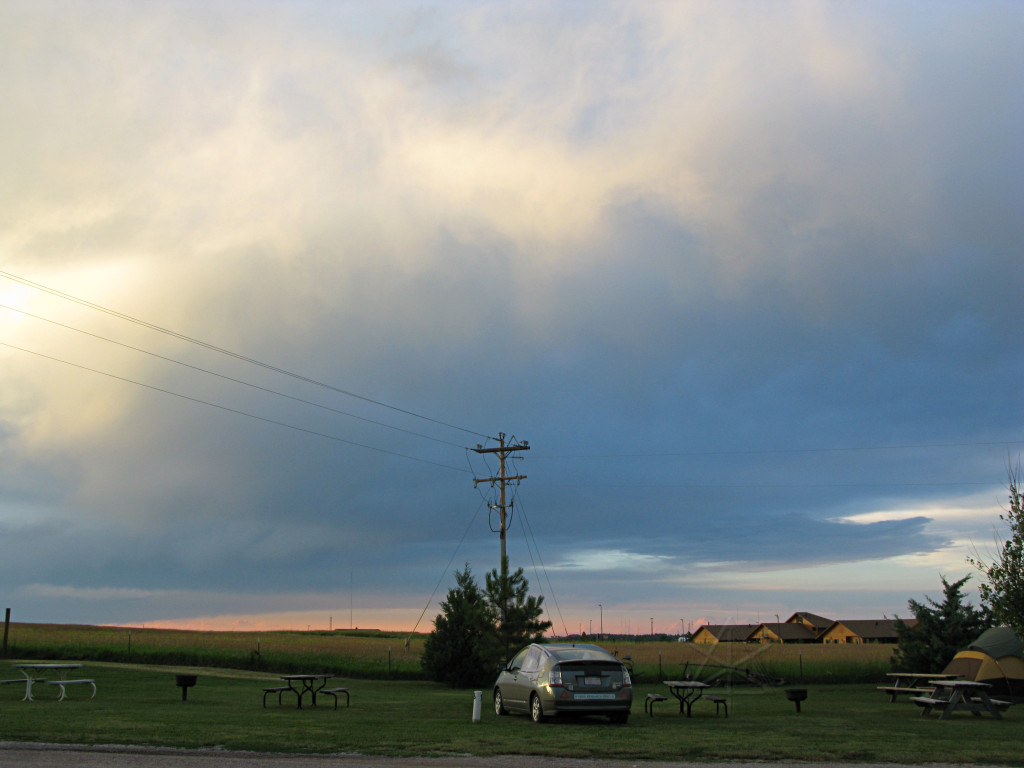
| The next morning I awoke to something scampering around on the roof of the car, but whatever it was dove off and vanished before I could open the door and raise the camera above the roofline. Well, it was time to get up anyway. |
|
|
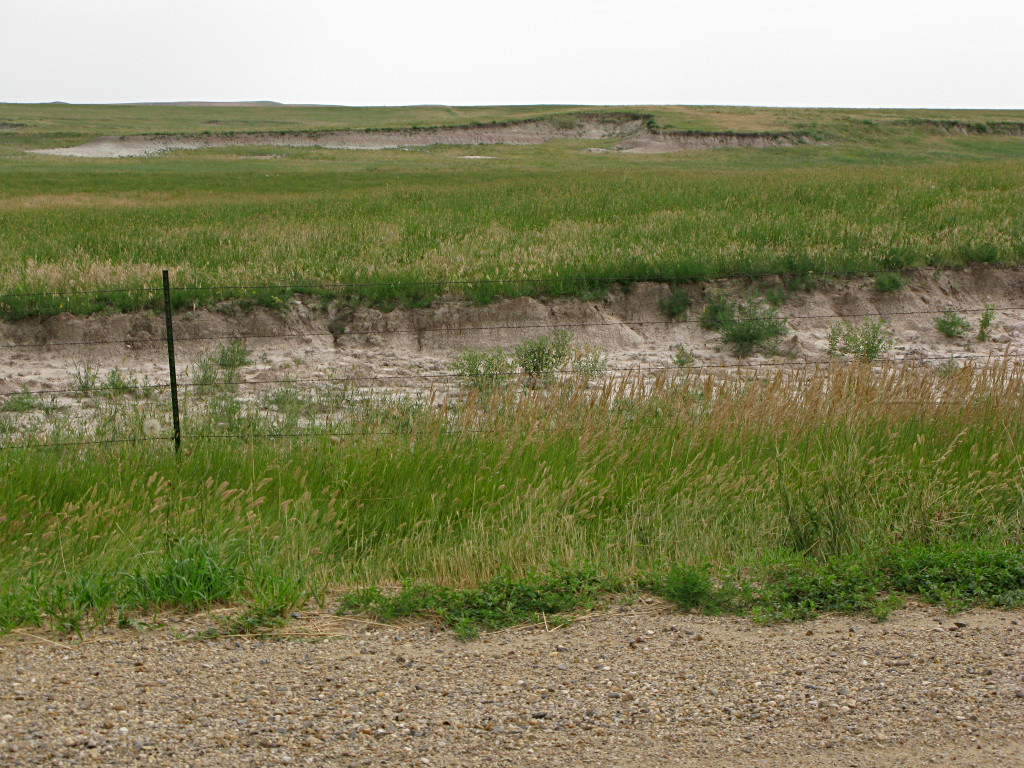
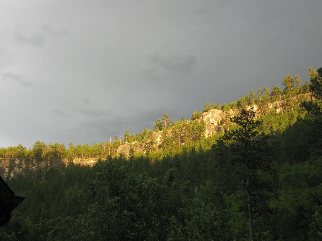
By 0800 I had picked my way out of Presho through a thick blanket of fog that had descended overnight. It continued for quite a few miles that morning. |
|
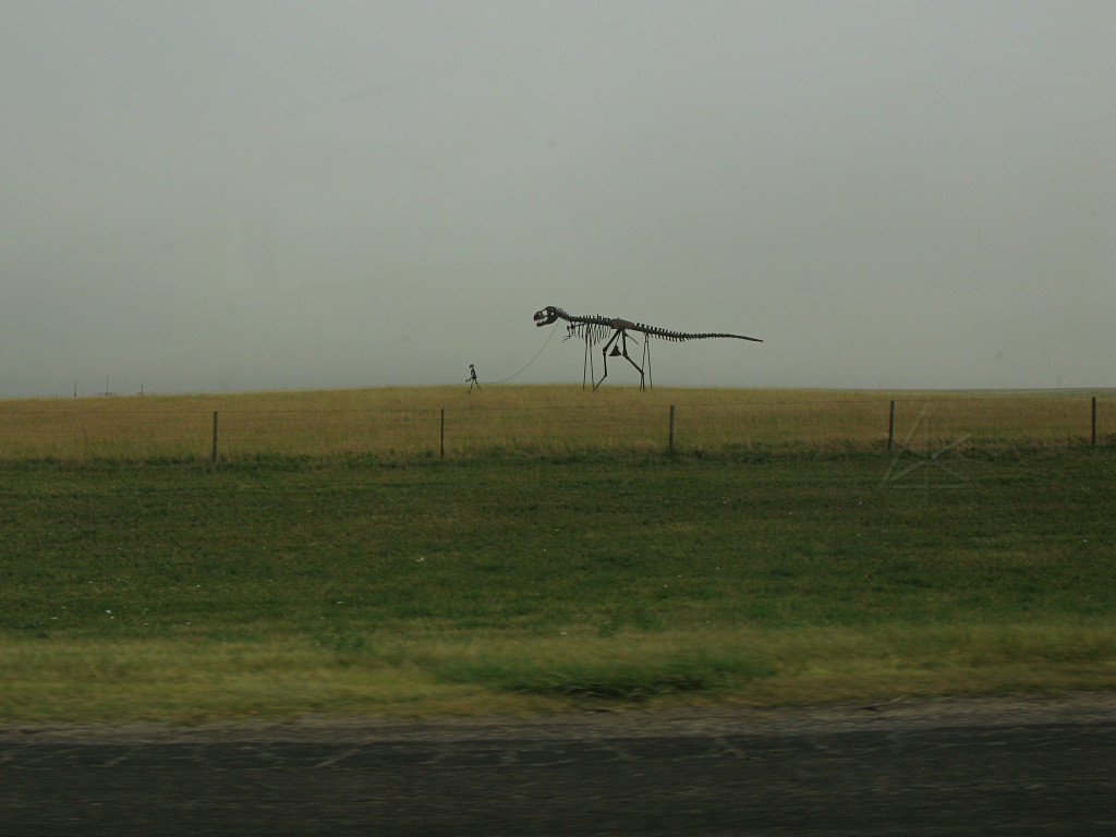
As the fog slowly started to burn off, I spotted more weird lawn art.
While continuing west, I noted that I was still slowly ascending -- about 2000 feet at this point, and probably one factor contributing to the increasingly dismal 55.6 MPG average I was showing. |
|
Eventually the sun began to peek through, and while on a bio and coffee stop
I decided to satisfy a bit of curiosity and took another gravel-road detour
to go look at some of these more closely.
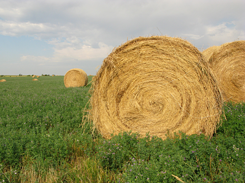
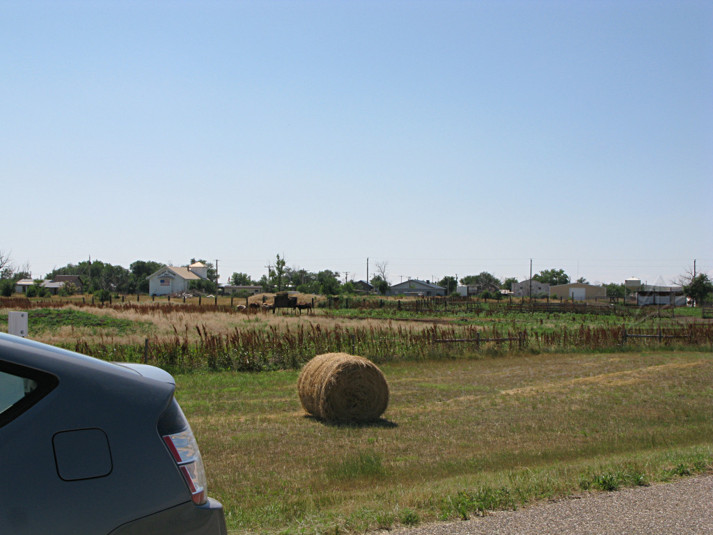
It is astounding that people hay established fields and anywhere else that grass grows, even highway margins and medians, and create *thousands* of these big round bales and then just leave them sitting there. They're everywhere. Sometimes they're collected and stacked up, sometimes they're covered, but some have clearly been sitting out in the weather for a couple of years. The old smaller, human-liftable traditional hay bale seems to be gone, in favor of these half-ton lumps that get lifted with a "bale spear" attached to a front loader. |

|
It is entirely possible to pulse-n-glide on a gravel road, albeit much harder
to hear anything that's going on with the engine. It was sort of scary that
this particular road has a *45* MPH posted speed limit, which seems
awfully high even if it is arrow-straight. I was still raising a good dust
plume behind me at something less than that, but what was more interesting was
the fairly radical wheel speed difference I observed between front and back on
the delta indicator.
Dry pavement shows a little bit of that too because of the torque difference
and a little bit of tire squirm, but apparently when the front wheels are
churning gravel even under light load, they spin quite a bit faster than the
rears that are just along for the ride.
When I stopped out here, it was very quiet. Not even much in the way of cricket or grasshopper noises. |

|
Back on the highway again, and evidently getting into some more weather. |
|
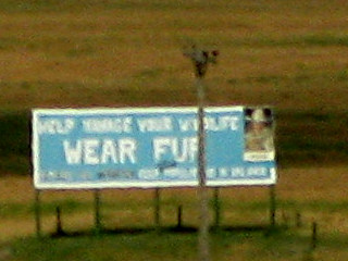
I didn't notice this billboard until much later when processing the previous picture, and could only extract a bad blowup of it but it's readable enough to be pretty amusing. I suspect that most of the wildlife that may need to be "managed", in their estimation, isn't generally sought for its fur in the first place. |
|
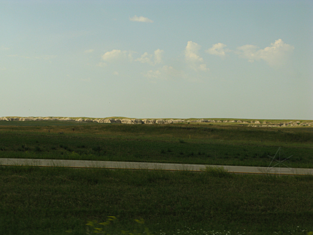
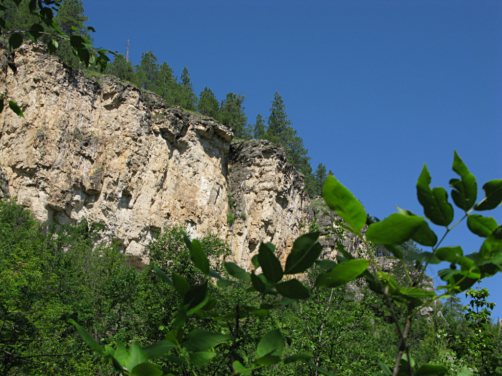
As I was nearing the western end of SD, I kept looking for any evidence of more mountainous or strange terrain since today's main attraction was to be the Badlands. Finally I began seeing some more rugged cliff-like areas off to the south. |
|
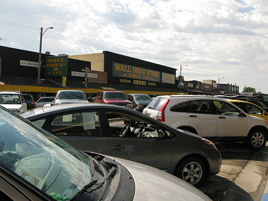
A stop at Wall Drug was obligatory, because they really do have five cent coffee. This is another tourist-trap for which the billboards with cute slogans start showing up about *300* miles out. I was starting to see them before I even got to Mitchell. Inside it's not particularly inspiring; it has a sort of cluttered feel, with little junk-shops and eateries all sort of crammed in under one or two roofs. I had better things to go see! |

|
|
|
I decided to use the "loop road" or highway 240 as a bit of a backtrack, going
toward the southeast a bit and then eventually hooking up with highway 44 below
the Badlands to head back up toward Rapid City. Not a long detour but in
tourist mode, would probably take most of the day.
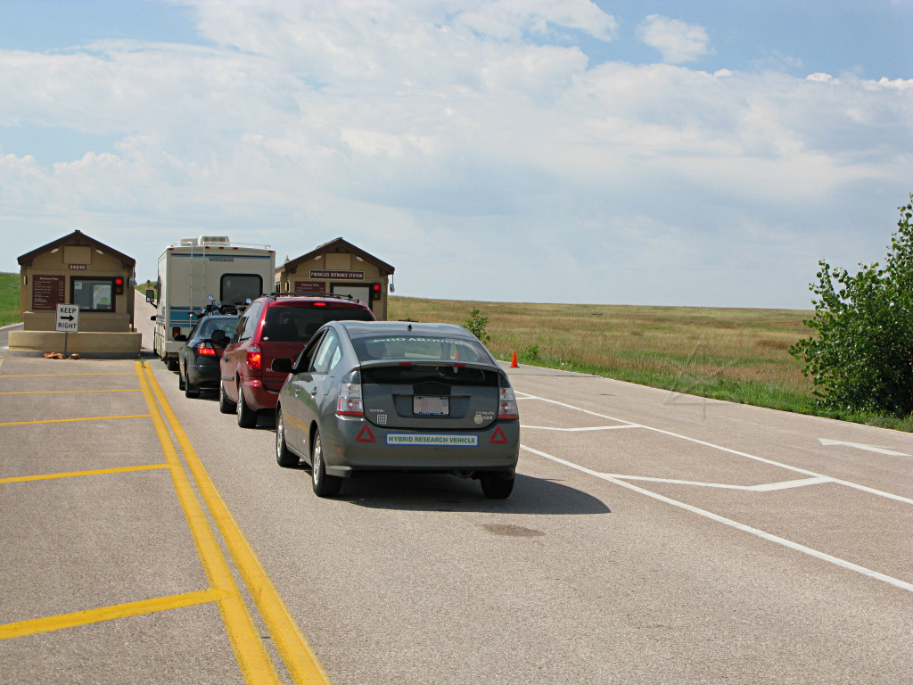
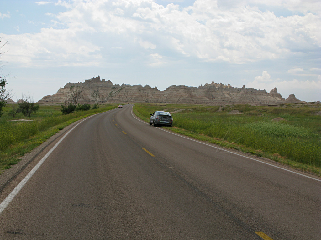
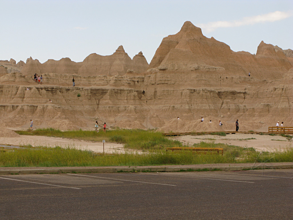
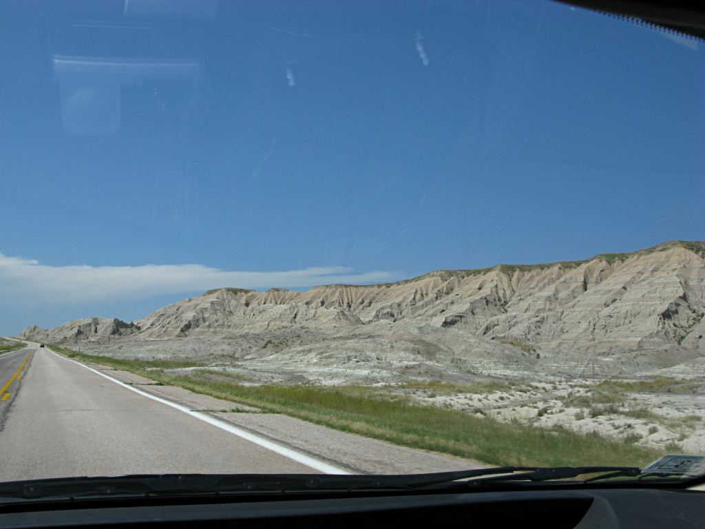
A fairly long stretch southward out of Wall eventually brought me to the Badlands park entrance, where the RV at the gate was taking *so* long to settle its finances or whatever that I had lots of time to get out and take pictures. There's a gentle but visible elevation change up to here, as well. | |

|
This "pinch bug" wandered straight out of the pages of "Tom Sawyer" and into the middle of this road. |
|
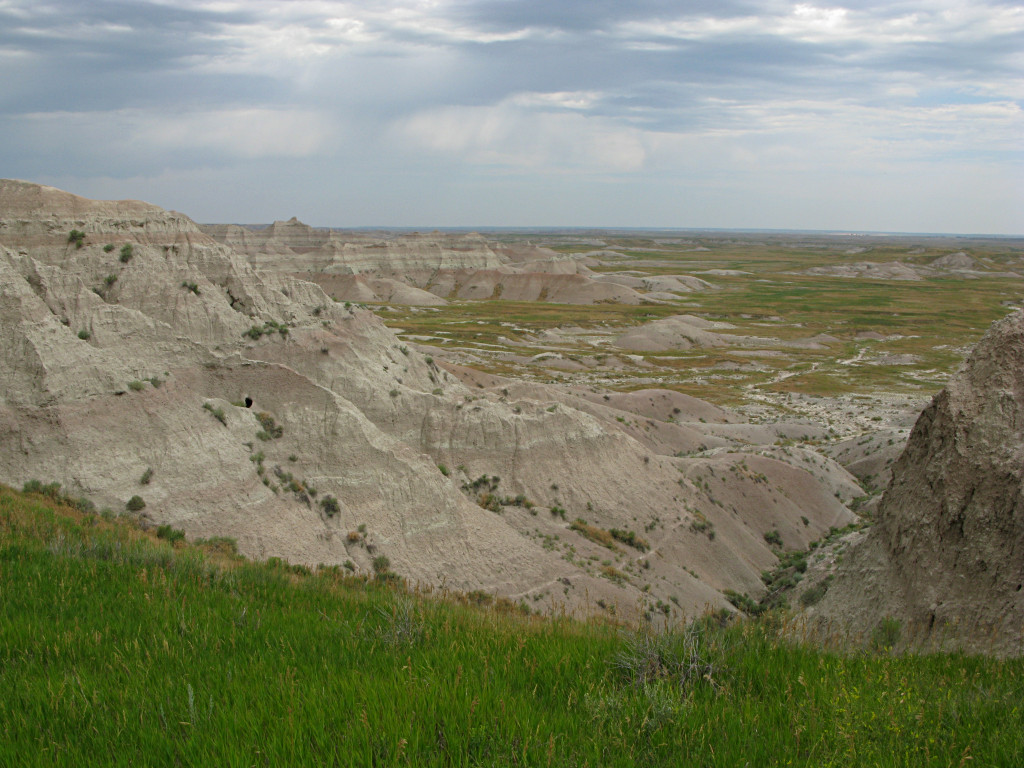
Finally, I made it into the Badlands. |
|
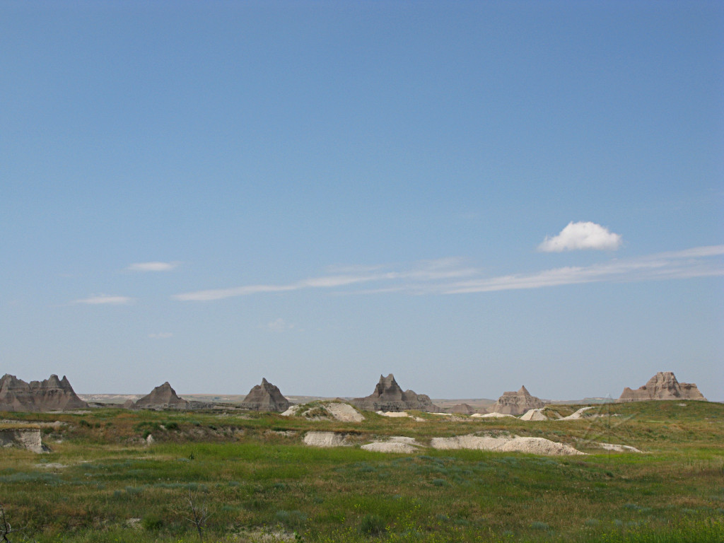
This is an amazing celebration of Weirdly Shaped Dirt, since most of it is the result of erosion. But for some reason it happens a bit differently here. It winds up looking like the most ruggedly mountainous terrain one could imagine, except that it's all within a few hundred feet of elevation as opposed to thousands. |
|
The view back toward the northeast shows how it rises out of the prairie, or more properly is slowly being washed back *into* the prairie. |

|
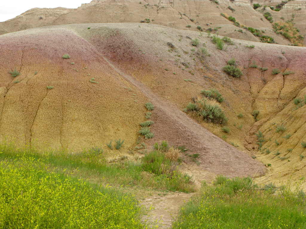
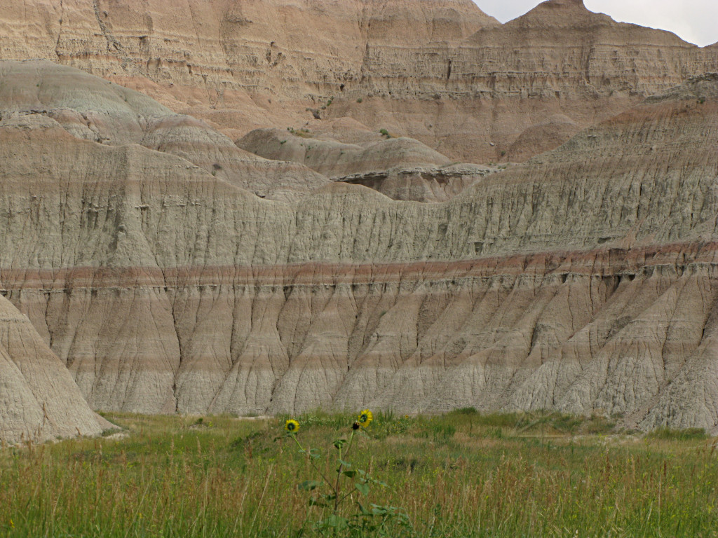
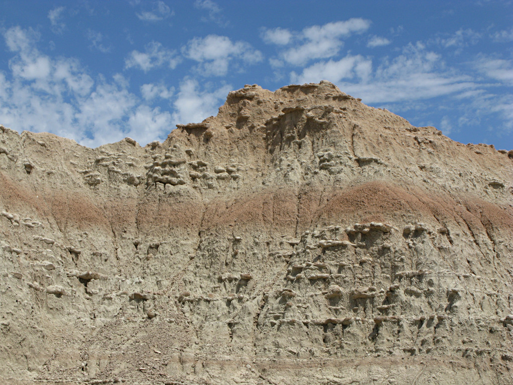
One of the major visual features is the layering, which is consistent across large expanses of the area no matter how the cuts and canyons happen to have formed through it later. Most of the soil and rock is sedimentary, deposited when all of this was either sea-bed or floodplain millions of years ago, and with at least one layer of volcanic ash in between. |
|
The red and yellow mounds reveal some of the oldest layers, and of course newer erosion causes the colors to cross-bleed. |
|
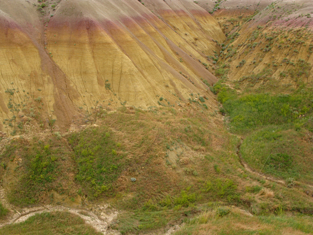
The same effect, but on a larger scale. |
|
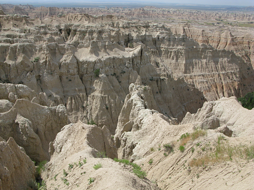
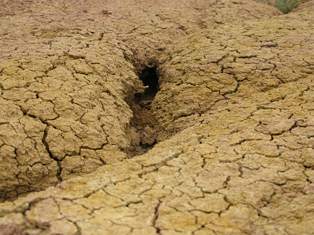
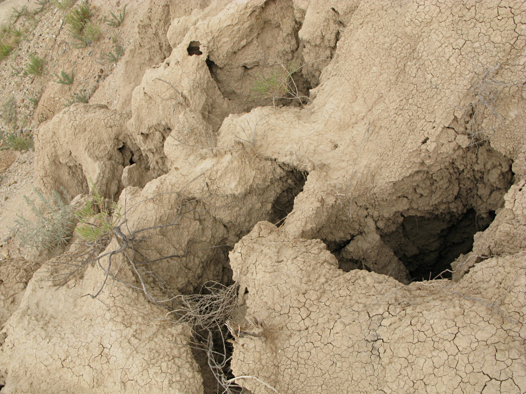
Most of it is not really *rock* per se, more like very hardened soil, and the continuing erosion creates all kinds of channels and holes in the ongoing process of washing the Badlands down into the nearby plains. Conjecture is that in another half-million years, it will all be gone. Here we see the smallest channels ... |
|
... the medium-size ones ... |
|
... and the bigger ones. This is decidedly not something you'd want to climb down into, not only because of the critters that undoubtedly live in there but also that large chunks of this could easily break away and fall under very little stress. |

|
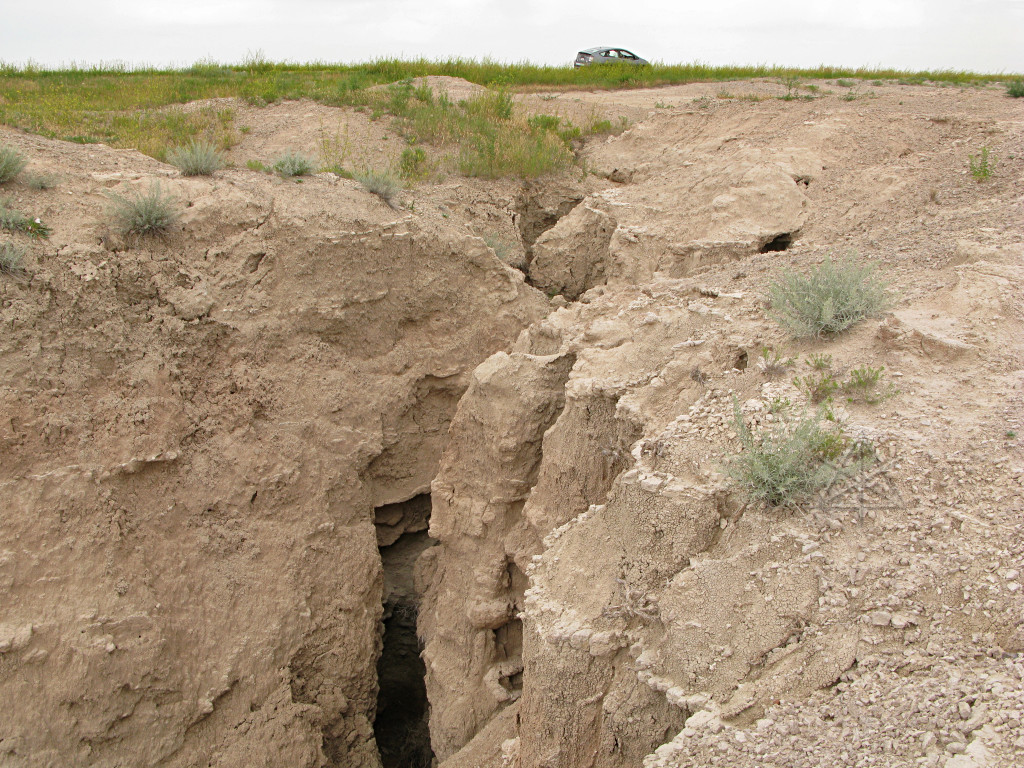
Eventually, the water channels widen out to large gullies and canyons. |
|
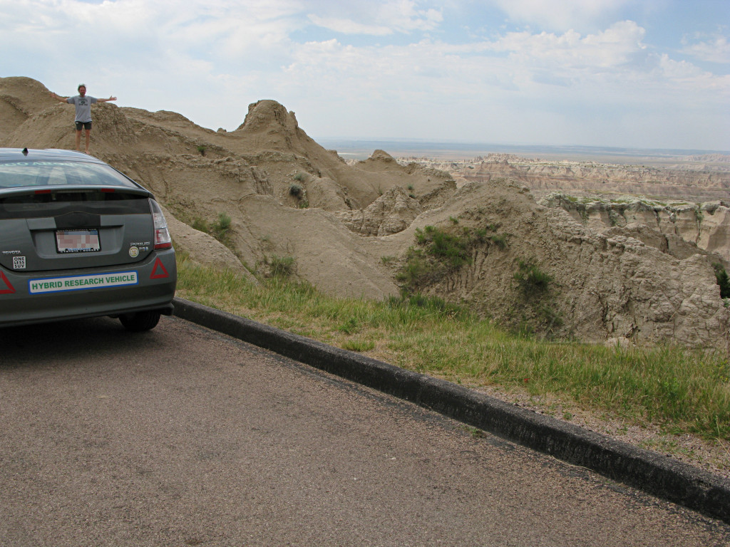
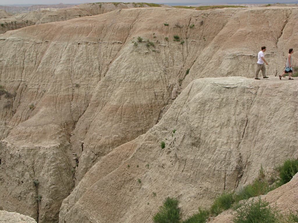
The people give more sense of scale here. |
|
The park road goes across some flatter area before reaching another main group of formations at the eastern end, and there are a few side-roads off of it that seemed worth exploring a little. I spent some of that transit outrunning a thunderstorm, but then it veered off to the northeast. |
|
Most of what I found up the side road was more featureless grassland, but here
and there it's easy to see the same process happening in miniature. Two feet,
twenty, or two hundred -- the water doesn't care.
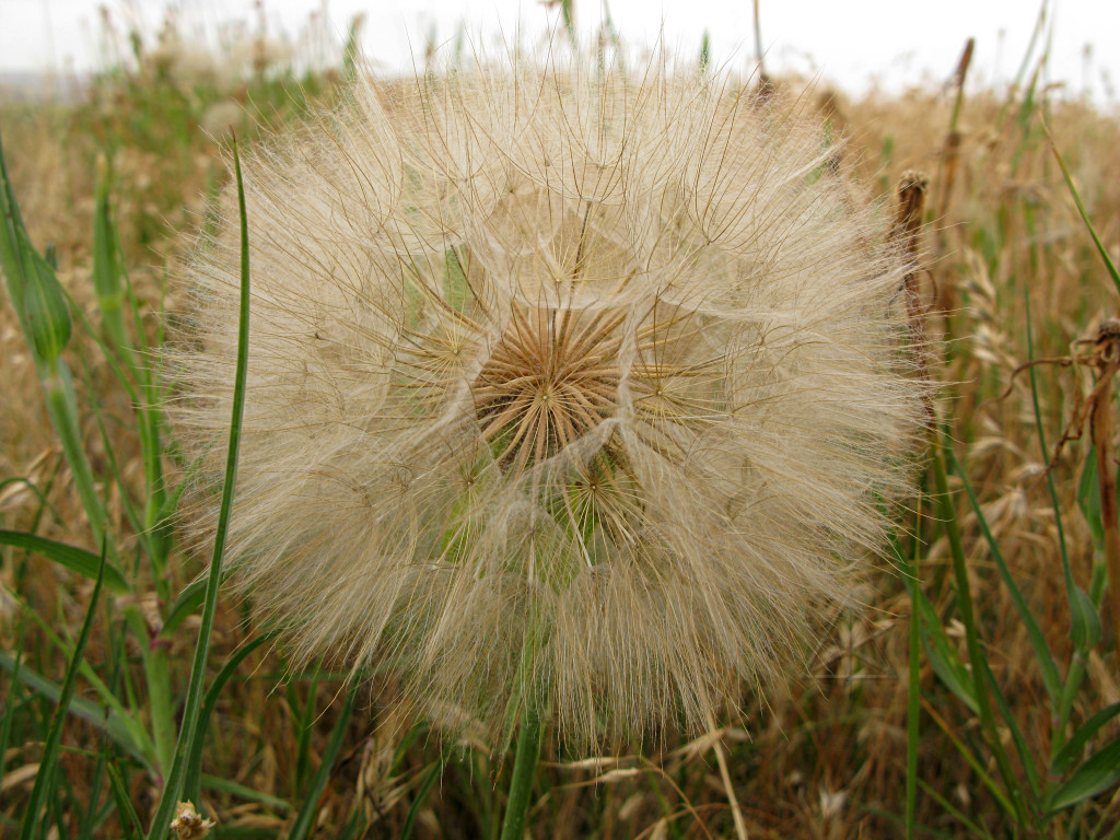
Note the grey ball near the bottom of the fencepost ... |
|
... which is one of these dandelions. They're everywhere around here, and they're HUGE -- like 3 inches across, unlike the inch or so wide ones back east. |

|
The obligatory butt(e) shot. |
|
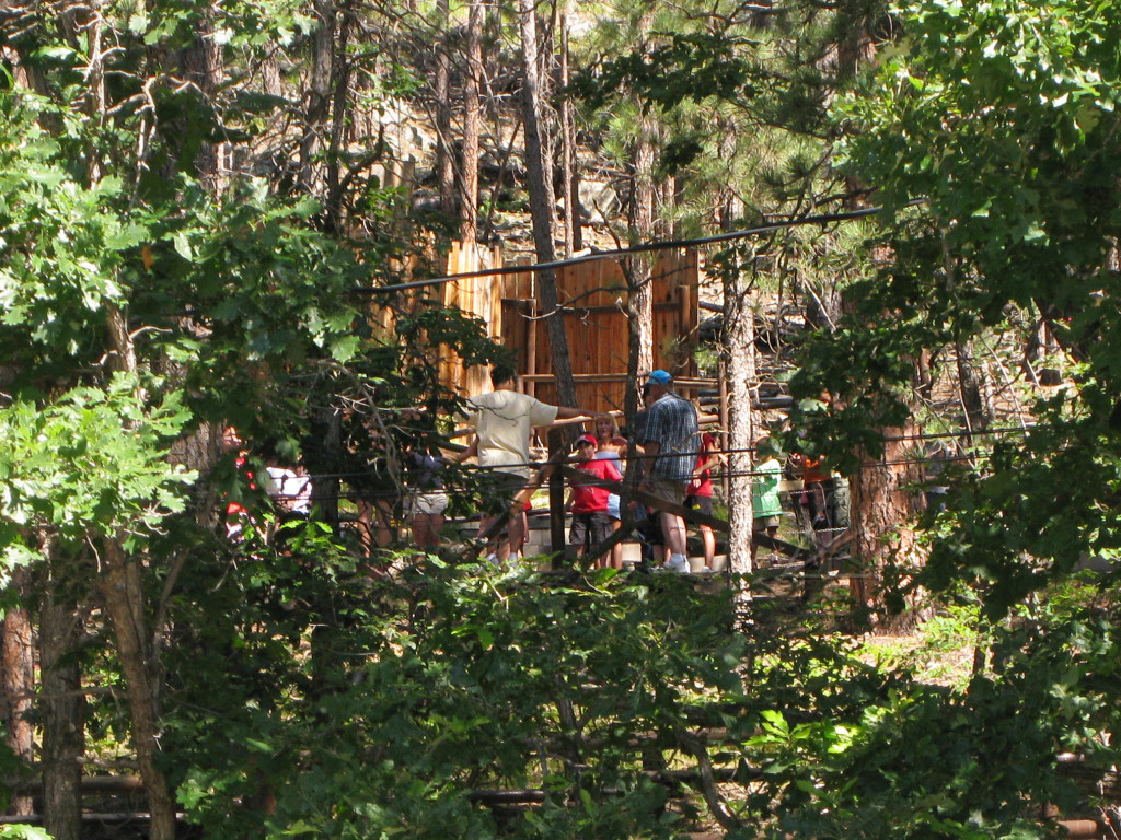
Once I got into the eastern end, I pulled into a large parking area and found little wooden platform walkways going off toward the hills. This area is evidently sort of a "playground" that the kids seem to enjoy crawling all over. |

|
This was taken more for the sky than the hills, but again shows the layering and the fact that some layers are more resistant to eroding forces. |
|
Without some reference, it's hard to get a sense of the size of anything. Here it's maybe a couple hundred feet to the top of the ridge. |
|
So how high would you think this piece is?
It's the top 3 feet or so of a ten-foot wall by the side of the road. But it looks almost the same as the big stuff, lending a very "fractal" feel to all of this. |
|
Some isolated little spikes, either the last melted remnants of larger hills or new ones just beginning to be exposed. |

|
A ridge with a hole eroded through it. |
|
At this point I had reached the eastern end of the park and the thunderstorm
had wandered away a while ago, so I had traveled the past couple of hours with
the windows open and the sun beating down. It was *HOT*. The black Prius
dashboard under that huge expanse of sloped windshield tends to collect a
*lot* of heat which slowly works its way through the entire volume of the
dash. Bringing in outside air with the fan doesn't really help, but today I
made an interesting discovery. Putting the system on *recirculate* mode pulls
air from somewhere inside the dash and blows it out the vents, and that
actually helps push away some of that built-up heat. It even helps to open
both glovebox lids and let air get pulled through there; I found that my owners
manual and stack of maps was acting like a big heat-retaining insulator
after that much solar influx.
I hadn't quite gotten to the point of just caving and using the A/C -- I wanted to keep in closer touch with this whole environment, which meant hearing it, smelling it, and feeling it. Windows open, less of that human isolation that closed cars so easily create. I exited the park and onto 44, passing by the town of Interior which appears to be a few trailers and shacks scattered around -- not much to it. I headed west on 44, sort of doubling back to the south of the main Badlands area. |

|
The Badlands park proper is sort of a long, spidery thing, and 44 bisects it at the middle. So after a while of flat, passing through the "Buffalo Gap National Grassland", I began to see some more dirt hills and table-land come into view. |
|
I passed through a short and relatively uninteresting piece of it, and then back into the flatlands. |
|
I arrived near the town of Scenic, sort of at the other end of the main Badlands from Interior. It doesn't appear to be particularly scenic, but of course it's got its share of those ubiquitous rolls of hay. |
|
I went into the center of town.
View the big picture to get my take on it... |
|
Having seen no actual living people in Scenic, I got back on the road. 44 goes very straight here, and definitely had that "big sky" look going today. |

|
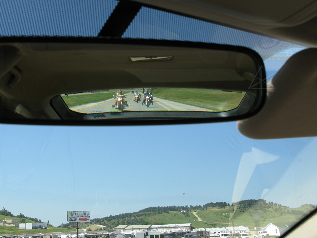
This is about the only thing I passed that entire time; everyone else who came along wanted to fly along much faster and passed me. And I was doing like 45-50 most of the time, a reasonable clip which still allowed a little recovery on that ailing MPG average. But here we see that some hills are coming up. |
|
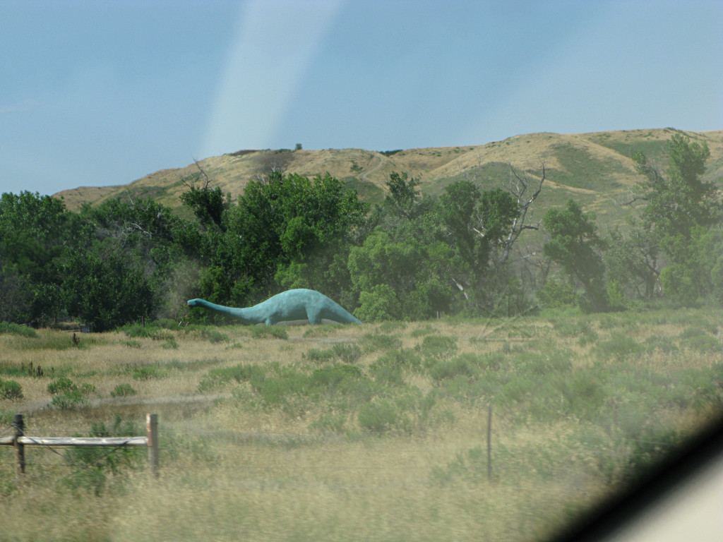
More strange lawn art. I guess in these areas where fossils are a big deal, people often think of dinosaurs. |

|
About ten miles outside of Rapid City I pulled off into the regional airport,
which is up on a little rise and I thought would give a nice view toward the
west where another thunderstorm was clearly building up. I parked near the
edge of the hill and spent a little while in a futile effort trying to capture
some ground strikes, but they weren't happening often enough. At this point
the storm was apparently dumping on Rapid City pretty hard and looming large
and dark over where I was, but even with big threatening clouds boiling over
me I only got a spit or two of rain.
At the airport there was a big "welcome bikers" sign out front. Sturgis is a few miles up the road, and I guess not everyone properly iron-butts their way in for the big bike rally. Such signs were all over town, in fact, and I started thinking that we need Hybridfest to grow to that sort of scale. I often explain Hybridfest to people as "like Sturgis for hybrid owners". But we can probably do without the Budweiser sponsorship. |

|
Once again I managed to evade the storm almost entirely. It wandered off to
the east as I came toward town from the south, and was basically leaving as
I arrived. It left some nice after-effects behind, though.
The upward elevation trend had continued pretty steadily over the day and taken me to around 3500 or 4000 feet, and got my first tankful of *85* octane gas here. The pump didn't say anything about ethanol content, not that means much, but I figured that would be an interesting experiment to see if the 85 would give me more energy content and more MPG. Of course since the higher-altitude terrain was likely to be much more hilly and regularly outside the regen capacity, it could be a zero-sum tradeoff. |
|
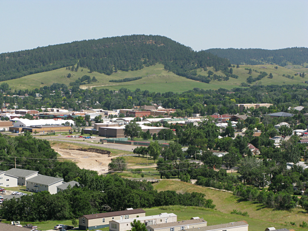
Rapid City is nestled right in where the Black Hills rise up, so parts of
town are flatter and parts have some steep inclines on the roads. I found my
way up to the top of a rise to look around a little; what isn't visible down
in the gully here is a road next to which was a sign reading "prime building
lots". With living-room size rocks randomly dropping off the outcrops?
Sounds great, where do I sign...
It was clear that gas was not nearly expensive enough around Rapid City, because the locals generally drove like it was still 39 cents a gallon, blasting up the hills full-bore like they had to prove something. Phew. |
|
I managed to find a campground along US 16, and did the "homestead Prius"
thing under a colorful sunset. The heat of the day yielded to a delightful
perfect-temperature evening as the last of the day's storm clouds rolled away,
and I was able to use the window screens without worrying about getting wet.
At 3900 feet, I noticed that my Thermarest air-mattress had become very, uh, turgid due to less air pressure outside it, and I had to let some air out before sleeping on it. As a sealed vessel, it was functioning as a primitive pressure-based altimeter. |
|
I also noticed some behavioral changes in the car. At higher
altitudes the vacuum gauge would sink a tick or two lower for the same power
output, and it was clear that the engine was gasping a bit harder for breath.
The vac level was also lower during warp-stealth segments. This was not an
artifact of less dense air around me, because if you think about it that would
have made the gauge go *higher* toward less pressure. Instead I was seeing
generally lower vacuum in operation, meaning more throttle opening commanded
from the ECU.
For some reason the battery state of charge was also generally hanging lower than usual, down around 4 bars in the display instead of 6. Which makes *no* sense at all since the car actually has no barometric sensor, and thus no knowledge of altitude or ambient pressure, and there is no reason the hybrid controller would need to seek any other steady-state level than its usual 60%. I was't forcing the system to use any more battery than usual, even going up hills. Now, sometimes it was nice to have the additional overhead available for regen on the way down, but it's not like the car can possibly anticipate anything about upcoming terrain. [If Toyota's working on topo-GPS-based cruise control efficiency hacks, such a thing is certainly not in this car...] But something was definitely going on in terms of the car's overall operation. The next morning I headed for the next major waypoint, the house of a friend-of-a-friend outside of Rapid City. He lives way up one of the narrow canyons around there, which made for an interestingly wiggly journey up a one-lane gravel/dirt road to find his place. This is one of those roads that hugs the side of a creek all the way up and jumps across a couple of times to find the flattest terrain on either side, and must have been a heck of a lot of work to carve into the side of the valley and build the bridges across. |
|
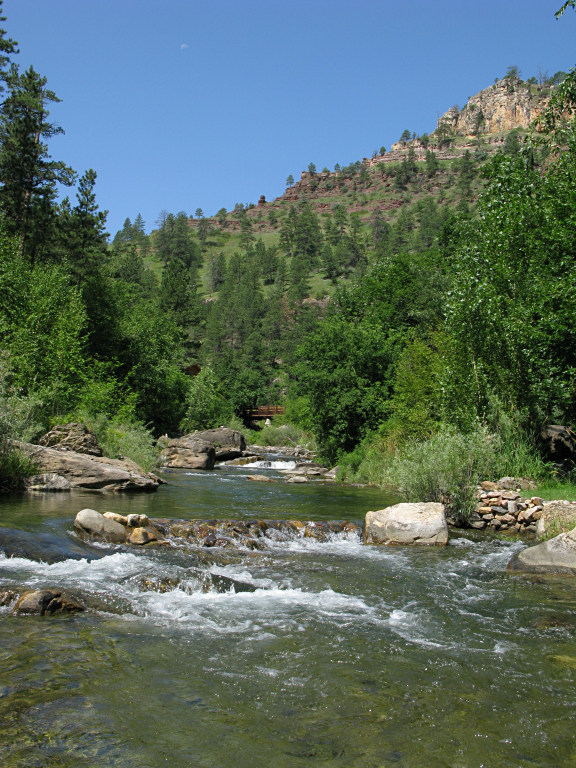
It's a gorgeous setting. The creek runs right through his backyard, and when I got there I just waded right into it and took a picture upstream. This is what he gets to look at all day. |
|
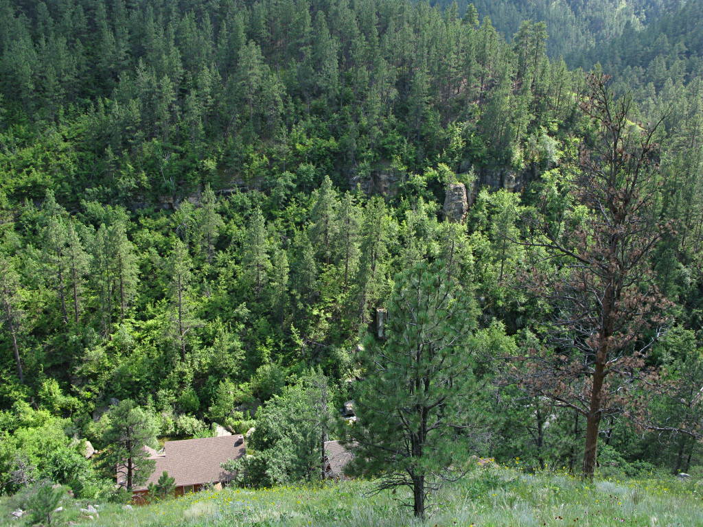
I took a little walk up the side of the canyon, into sort of a very slanted meadow. It was steep and rocky but the main problem was lots of poison ivy and sumac that I was trying to step carefully around. That's difficult when it's everywhere and rocks are shifting under your feet. |
|
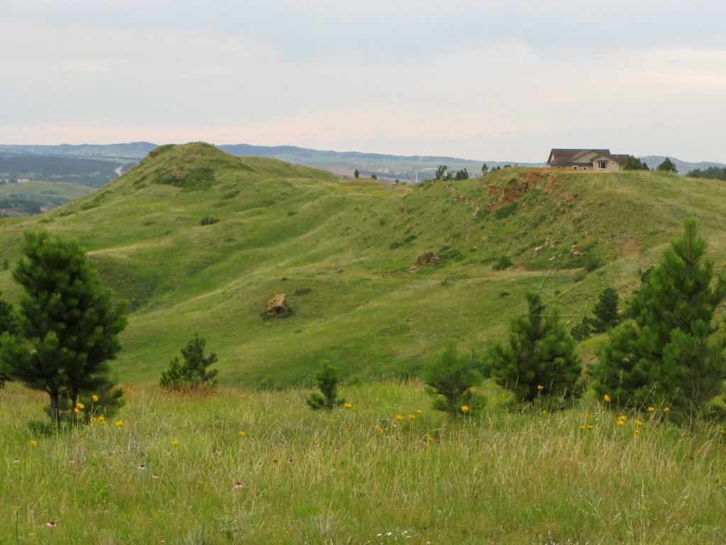
And the last thing I wanted to do was start a rockslide. This is looking down
on my host's roof and across the canyon, and that grassy "prime building lot"
from earlier ain't nothin' compared to how the crags at the top loom over this
whole area.
He takes a somewhat fatalistic view of all this, saying "some of those could come down in the next 3 hours or the next 3000 years and there's no telling". But pieces of cliffs like this are probably more likely to break off during warm/cool seasonal transitions as water gets into little cracks and freezes and thaws. The neighbors have already had to bulldoze a couple of specimens off the road now and again. |
|
One thing my host enjoys is wandering up the streambeds and finding interesting rocks. I picked up one with a freshly broken face that gave a particularly nice sheen in the right angle of sunlight, and spent a while trying to capture that look about it as wallpaper fodder. |
|
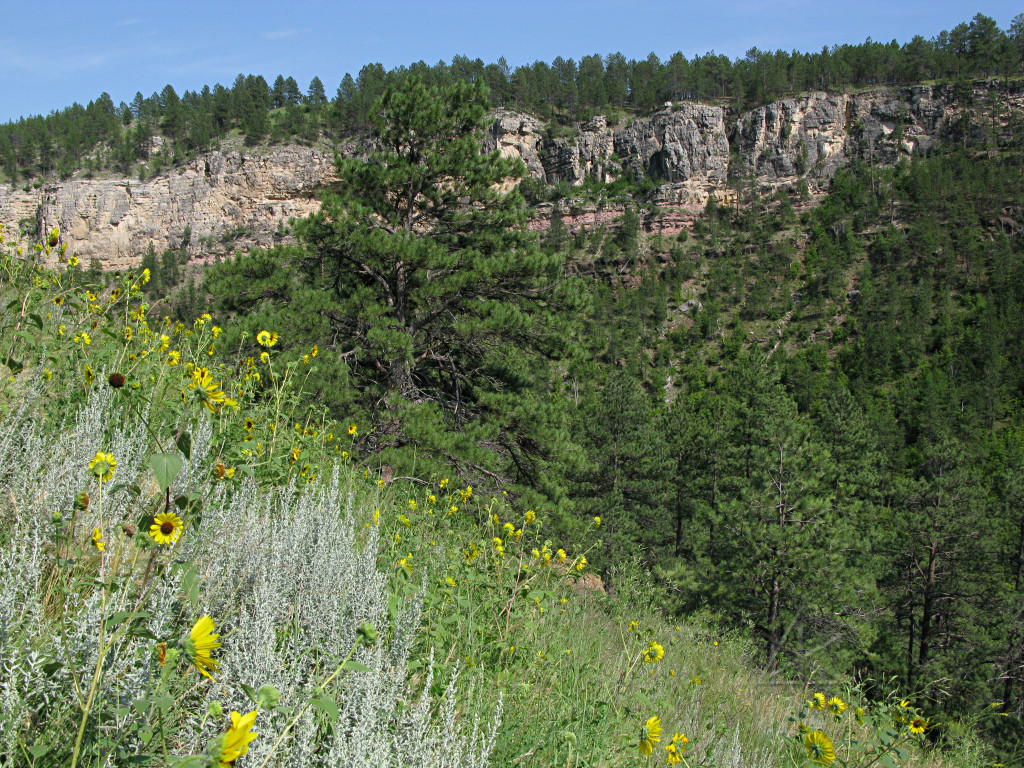
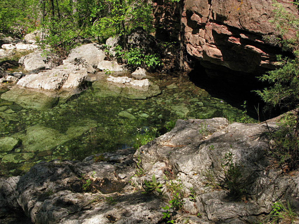
While I was there we took a hike up one of the less-traveled tributary canyons which he hadn't been to in a little while. The Black Hills are quite old, and pieces of rock from many different time periods fall off the canyon walls and then get all jumbled up in the power-mixer that the spring rains turn the streams into. So you never know what you'll find in the streambeds. |

|
From tiny pebbles to huge boulders like this, everything's just randomly tumbled and wherever there are gaps, the water just goes underneath to flow through them. There are some places where a substantial flow just disappears for a hundred feet or more, leaving a dry streambed on top, and then emerges again farther down. |
|
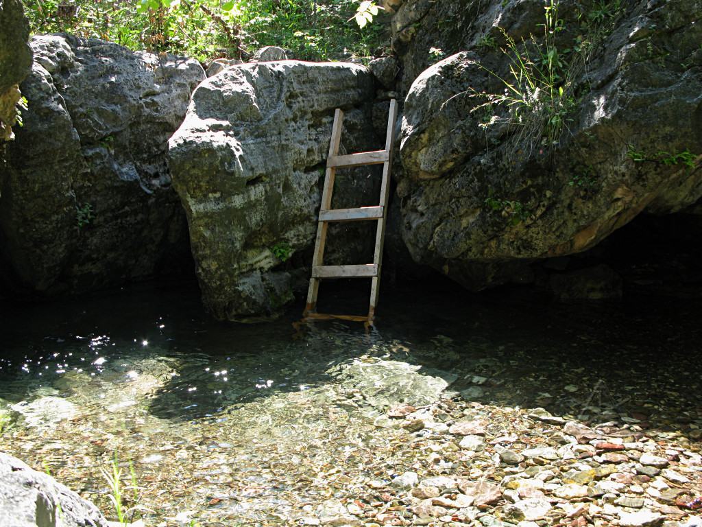
A cute little swimming-hole, whose depth can vary from zero to several feet in the span of a couple of weeks. |
|
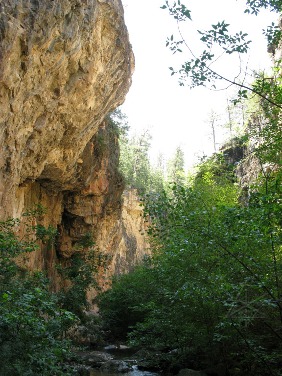
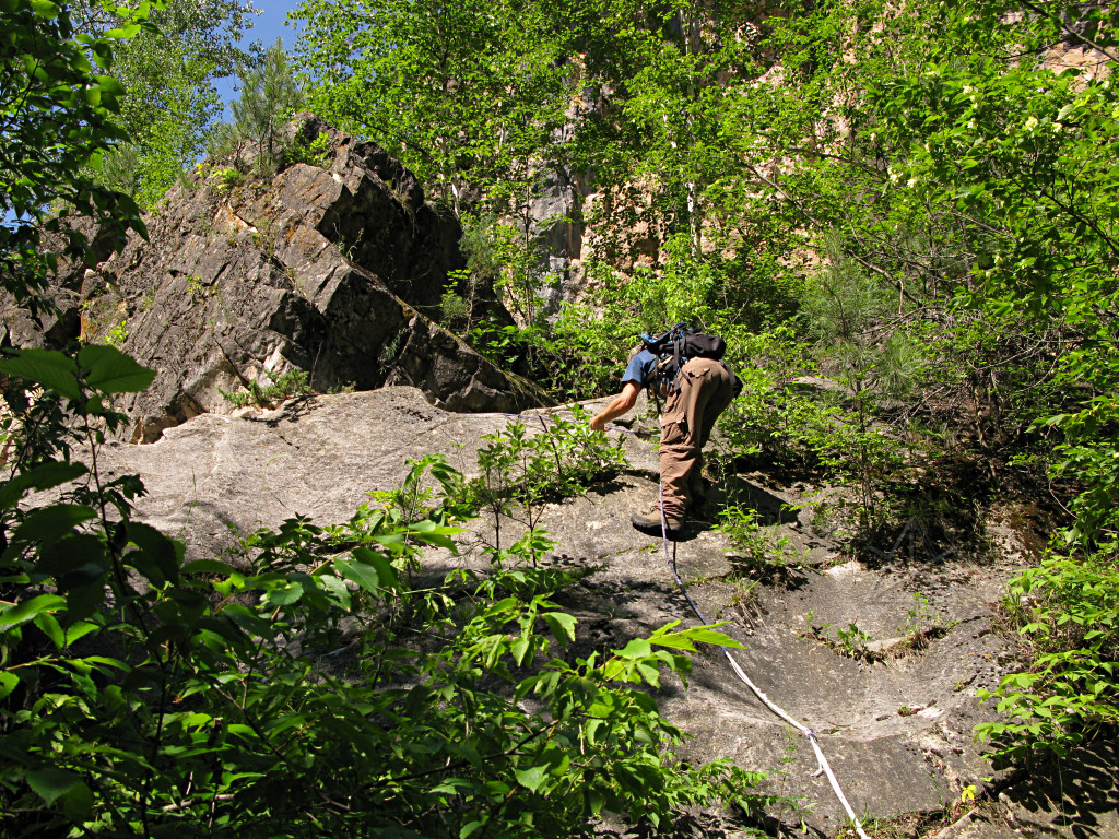
There are many interesting overhangs, and farther up we encountered some climbers who had hiked in a good couple of miles to find and play on more stuff like this. |
|
We clearly weren't the only people to come up here, although this part of the canyon is completely undeveloped and barely has anything like a trail going up it. I'm not sure why someone put this here when there are several other ways around. |
|
This climbing aid looked really old and sketchy to me, but my host said "it's fine, I've used it before" and went right on up. |

|
I think we can see what happened here! Makes me wonder when it will come down the rest of the way, though. The canyon walls are full of little structural-failure vignettes like this and the ancillary rubble underneath. |
|
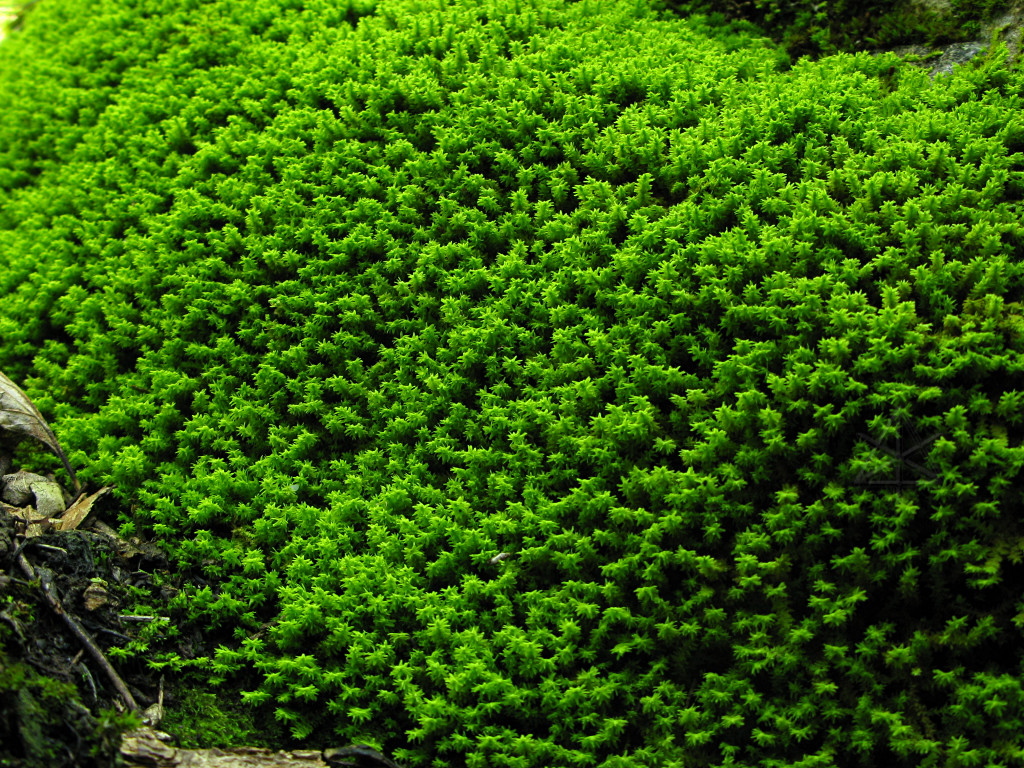
A patch of extraordinarily green moss on a shaded rock. |
|
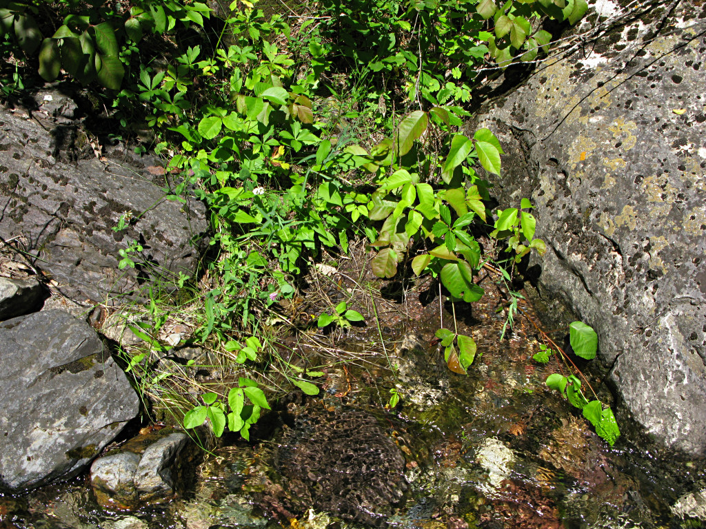
Here too, the poison ivy is everywhere and was the main impediment against
my idea of bushwhacking our way up to the canyon rim. DWI [driving while
itching] is never a good idea.
When we got back to the house we threw *all* our hiking clothes into the laundry and encouraged the dog to jump in the creek and get sort of a bath because she'd been diving headfirst through all the nasty stuff and by that point was likely a walking urushiol bomb. |

|
For dinner, my host aka "Mr. Rotisserie, Sir" prepared a wonderful buffalo roast, from animals locally free-range raised. It was wonderful and yummy, with a slightly stronger and more complex taste than typical beef and helped cast a lot of doubt on the trade in feedlot cattle. |
|
While we were getting ready to eat, the radio started with local emergency warnings of vicious thunderstorms with quarter-size hail and 70 MPH winds. It got cloudy over the canyon and did blow in a rather sinister fashion for a bit, but apparently it mostly missed our area and headed south. Another non-storm for me. After it passed, the sun peeked out in the few moments before going over the horizon, splashing a bright band of that late-day "storm light" that I really like on the opposite canyon wall. |
| I stayed here for two very mellow days, and then got going again with a plan to briefly see some of the other major sights around the area, miss some others, and get myself more westward. At this point I was actually within a day's shot of Denver where my next scheduled event would be, but with a week and some in between I had a good amount of road-trippin' ahead and no need to head that way yet. |
|
The canyon dirt road isn't in the best of shape, and at one point I lurched through some holes and heard something bottom out in the front. Upon later inspection it turned out I'd broken off a couple of bits of nonessential plastic under the nose of the car that were now dragging. No biggie, these pieces had taken their share of hits over time anyway and as far as I can tell contribute nothing to airflow. I stashed them in the back and pushed on. |
|
I had been spotting these signs all through South Dakota, but none of them close enough to read. Since they are often near the omnipresent barbed-wire fences, I figured they had something to do with the wisdom of trespassing on someone else's ranch. Finally here was one I could conveniently stop and examine. They're the equivalent of roadside memorials but officially placed by the state, marking places where a traffic fatality occurred. Sometimes I'd see two of them right next to each other, and even more perplexing is how many of them are off the side of a perfectly straight and open piece of interstate. Evidently there's a big problem with DUI, and I don't mean itching. Here's a trucker's take on them, and a report on what some other states are similarly doing. |
|
I got onto 16 south and went for a little way, but felt obligated to stop here
and let the car pick up a little, uh, energy.
Anyone remember the Mazda ads back in the seventies? The piston engine goes boing, boing, boing, and the hybrid goes "Om...." |
|
Now properly aligned with unseen forces, I also dropped into the parking lot of the Cosmos Mystery Area, and without even getting out of the car I spotted what appeared to be an exercise in mass hypnosis going on up in the woods with a guide having everyone stand in a circle and wave their arms around. I decided to give it a miss and look it up later; it's just one of many such constructions that exploit forced-perspective to make people think that gravity has shifted or things are different sizes depending on where they sit. This picture from someone else's collection sort of says it all about how such places are constructed. |
|
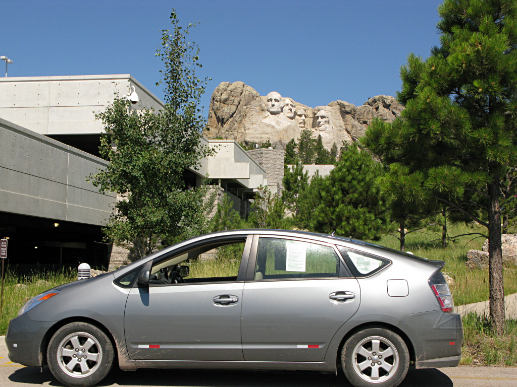
In some bygone golden age, I might have had presidential approval for my
choice of vehicles. These days it seems to be downright anti-american, for
whatever misguided value "american" has taken on.
The set of carvings is actually quite a bit smaller than I expected it to be. I eschewed the ten-dollar charge to park in the deck, found a place along the fairly complex exit road to stop and squeeze this off, and then fled. |
|
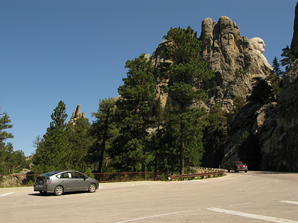
I continued around to the "profile view" lot, which is free.
Now I understand why the Rushmore area was chosen for the statuary. With all the crevices and wrinkles and rounded bits, the rocks around here are VERY suggestive of faces and heads and maybe a few other body parts, so it was a natural step for someone to get the idea of carving in a few more of them. |
|
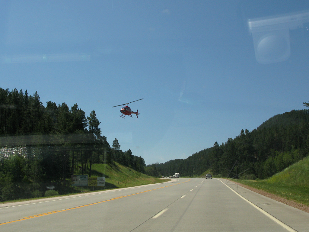
They offer helicopter tours of the monument, and bring them back in right over the road. |
|
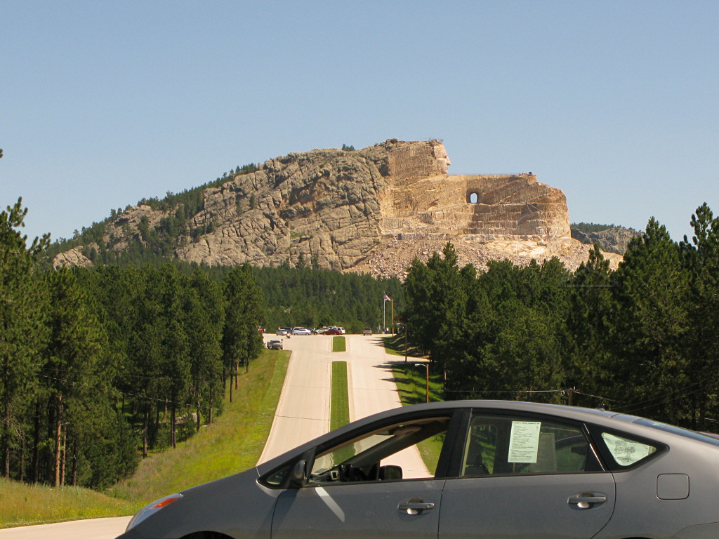
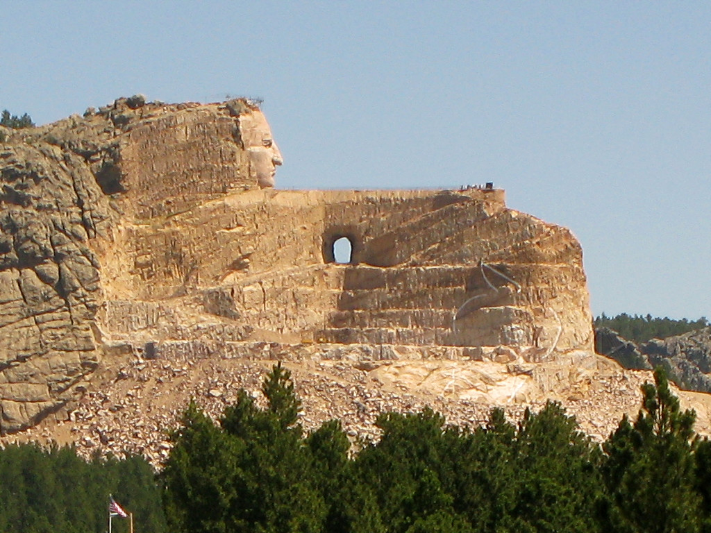
Farther down the road is the Crazy Horse monument, which I also skipped paying to go all the way into but to turn around and leave again, I actually had to go in past the gate house a little way for the U-turn which presented this quick picture opportunity. The story behind this is interesting, and one cannot help but wonder if it will ever be done. |
|
Here's a slightly larger detail, just like numerous other canonical shots of this that people have on their vacation blog sites. The face appears to be pretty much done, and the rest is slowly being blasted out and carved in bits and pieces. There's a pretty visible outline of where the horse head will wind up someday. |
|
I was a bit southwest of Rapid City by now, and needed to get back up toward
I-90. I backtracked a little and wandered up 385 through Hill City and beyond,
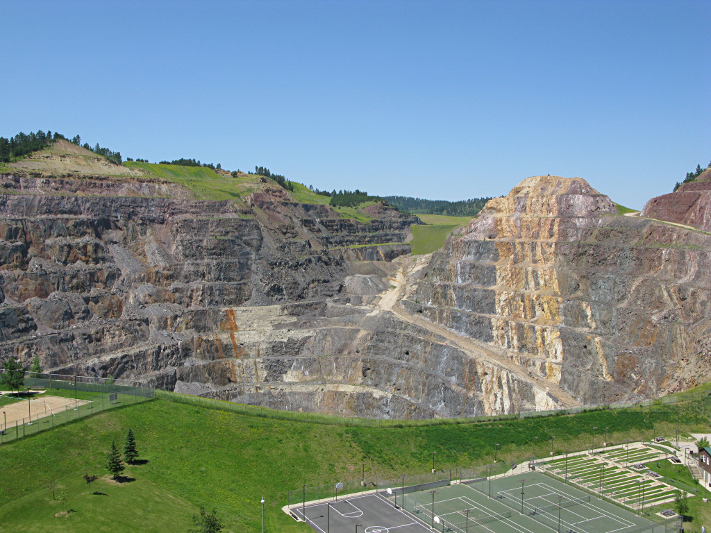
and took a quick left [and then *up*!] into Lead [which I finally found out is
pronounced "leed" like the word used for a good productive vein of ore in a
mine]. The pit is part of the
Homestake
gold mine.
Again, probably plenty of tourist-trap stuff I could have stopped in to see and spend some more hours on, but I made this sort of a flying visit, pausing only to chat with another Priusful of people who pulled in and hand them a flyer. |
|
Turbo Prius |
|
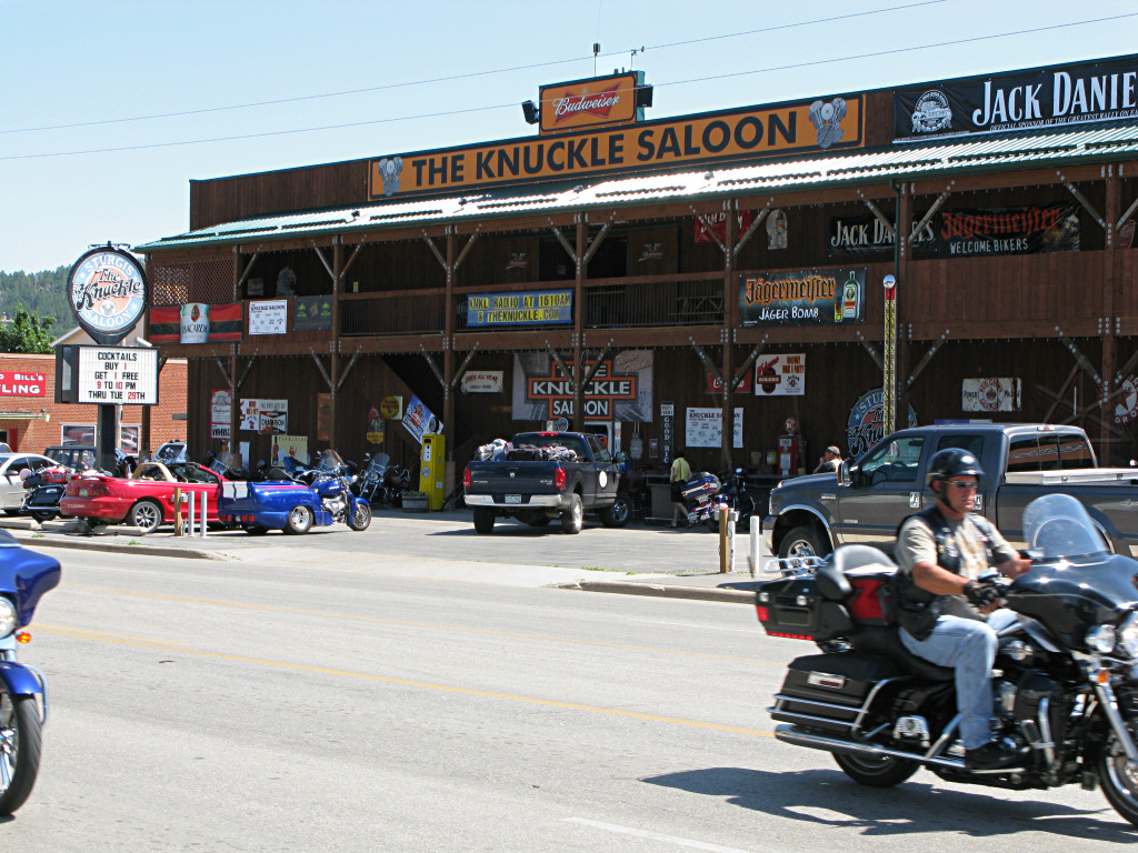
It wasn't hard to notice the large number of motorcycles around the area,
tooling around singly and in groups and clearly enjoying the scenery too
[well, when there wasn't this pesky hybrid-whatzit weird thing in the way
doing the speed limit]. It was about a week out from the big yearly bike fest
in Sturgis, and I was undoubtedly seeing plenty of early arrivals.
I finally understand what Sturgis is really all about. It's not just about the camaraderie and hanging out with all the enthusiasts; it's also about the RIDES. Leisurely day loops of a hundred or two miles around the Black Hills can go through some great roads and surroundings and waypoints. Many of these folks were likely giving themselves a little more time to see the area before the big party kicked in, and from what I've seen bikers love the local tourist attractions. My first thought right after that was -- we need to add a similar piece to Hybridfest, and organize some group runs to local destinations which can combine with MPG driving clinics or just plain sightseeing. I suggested a tour of the Saft battery factory in Milwaukee, for example, if such a thing were offered. |

|
And there were plenty of strange machines in town already -- obviously I wasn't the only one who found this picture-worthy. |
|
Finally I made it into Sturgis myself, just to see the place. I found a little
back street that led up the hill, and had to claw my way up a steep gravel
driveway or road or something -- hard to tell, but it afforded an overview of
the town. [For reference, it's up 9th street past the condos and keep going.]
And already I could see the white peaks of the big party and merchandise tents
popping up here and there.
My own little circuit through the area that morning was around 140 miles by the time I got to Sturgis, and even with the ups and downs I was starting to show some better MPG at 62.5. The local highways afforded some good mid-speed P&G and a few fun warp-neutral runs if I could crest a hill more slowly with nobody behind me first. |

|
Down along the main drag, plenty of preparation was going on. It's interesting to see the entire town gearing up for this event, and they do it every year. I've seen this in Laconia NH too, where once the real festival starts it's ALL about bikes and close to impossible to bring a "cage" anywhere into the area. |

|
Many visitors were already in town ... |
|
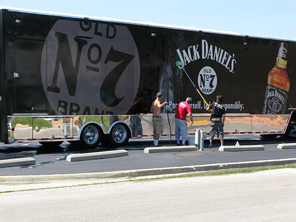
|
| ... and the watering holes and roadhouses already doing plenty of business. I was amused by the guys spiffing up the big rolling advertisement, too. Drink responsibly? Heh... everybody knows that Harleys run on ethanol! | |
|
I finally got back onto I-90 and popped across the border into Wyoming, but had to make a quick picture stop here as a friend back home has a cat by almost the same name. This town was actually inhabited, and I fueled up the coffee cup at the little gas/store/eatery/bar/everything-else building down the hill. Such places are often the main center of activity in these little towns. |
_H* 081020