RoadtripPart 5: meandering east toward Denver |
Part 1:
first leg to Hybridfest
Part 2: local Wisconsin tourism and slightly beyond Part 3: South Dakota, Black Hills Part 4: bangin' around the Northwest Part 5: meandering east toward Denver Part 6: doing tech at Denvention (aka Worldcon) Part 7: the journey home |
|
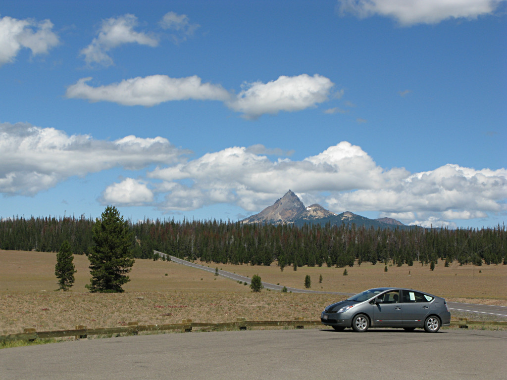
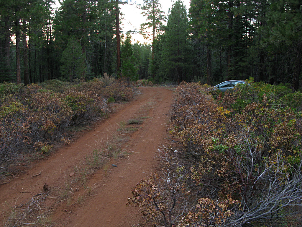
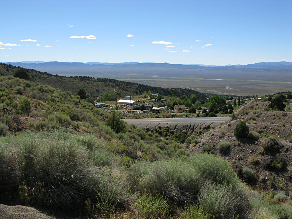
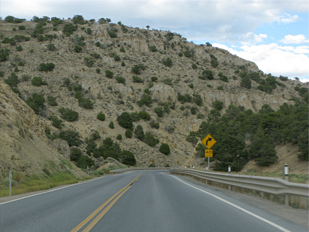
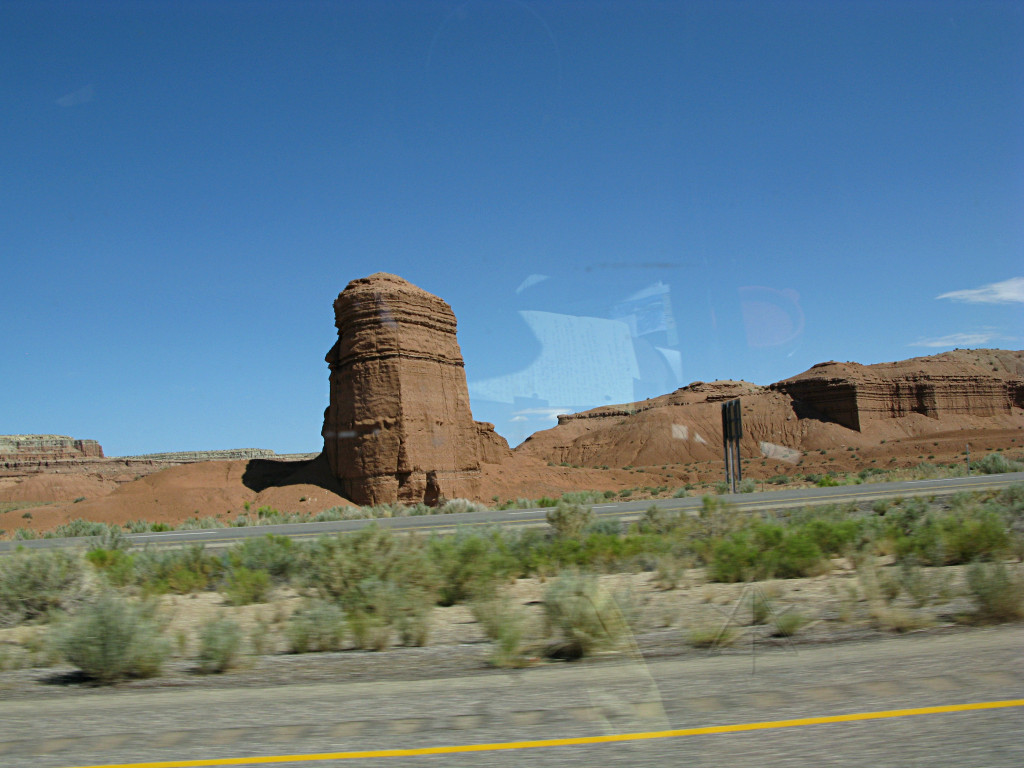
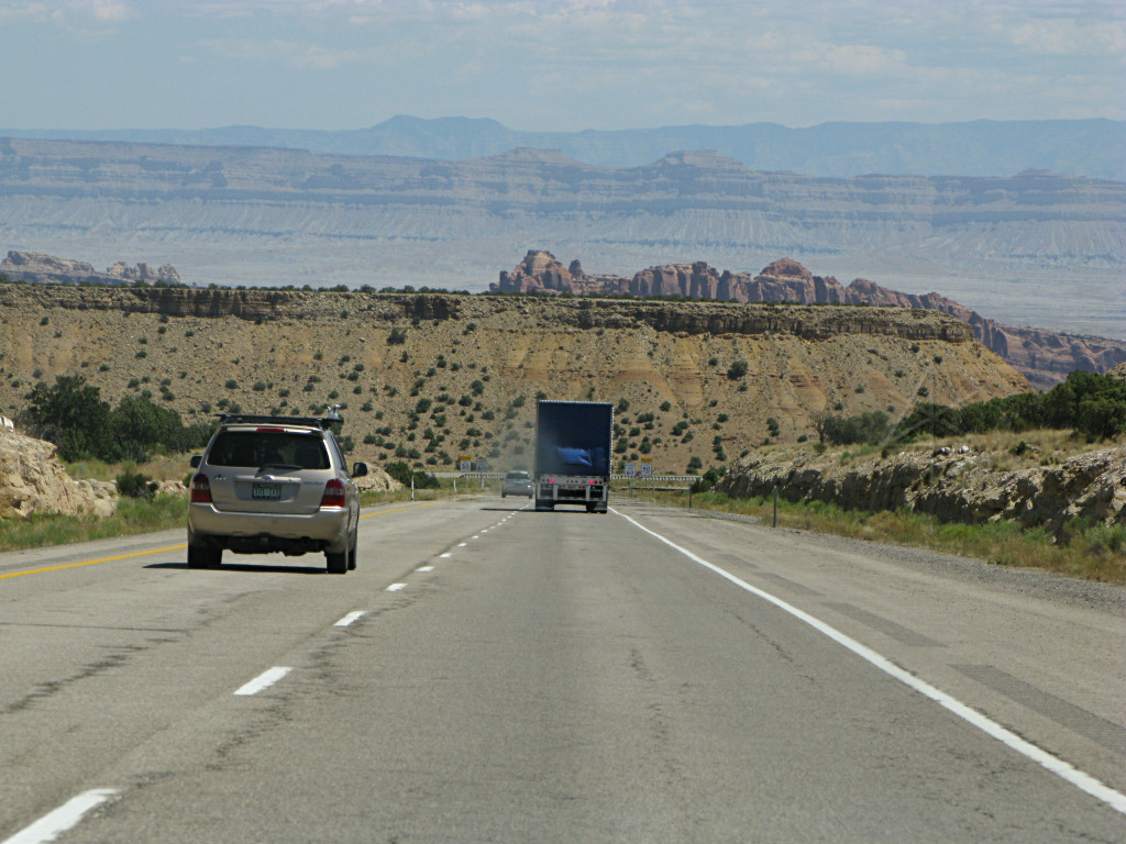
To implement the route change toward Crater Lake, I backtracked about 3
miles and got on Rt. 42 eastward which I figured would be a leisurely
and reasonably scenic run up into the high country again. It winds its way
through pretty farmland and wooded hills over a fairly gentle ascent, and
doesn't really start upward until crossing I-5 onto 138. The first segment
of the run was a nice exercise in some of the low-end engine loading
methodology I'd been playing with recently.
On a road with relatively short straight parts that go into repeated sets of twisties at a 35 or 40 posted safe-speed, I have found that bringing the RPM fairly far down but maintaining torque load allows gentle acceleration at roughly a 40 MPG rate, which a non-instrumented Prius driver can use as a benchmark. It's like being in high gear in a manual -- generally you don't take off nearly fast enough to satisfy a tailgating redneck, so judicious use is recommended, but if the conditions are appropriate and one's foot is locked into that spot, the car will work its way very efficiently up to spanking right along -- by which time, especially on a road like this, the next curve warning sign is visible and it's time to get off the gas and plan the glide down into it. In other words, a much more "damped" rise and fall between slower and faster parts, adapting to terrain as needed, with clear results: 64 MPG showing on a fresh tank for most of that run, getting there in a perfectly adequate timeframe, and stone-cold brakes at the end of it. |
|
|
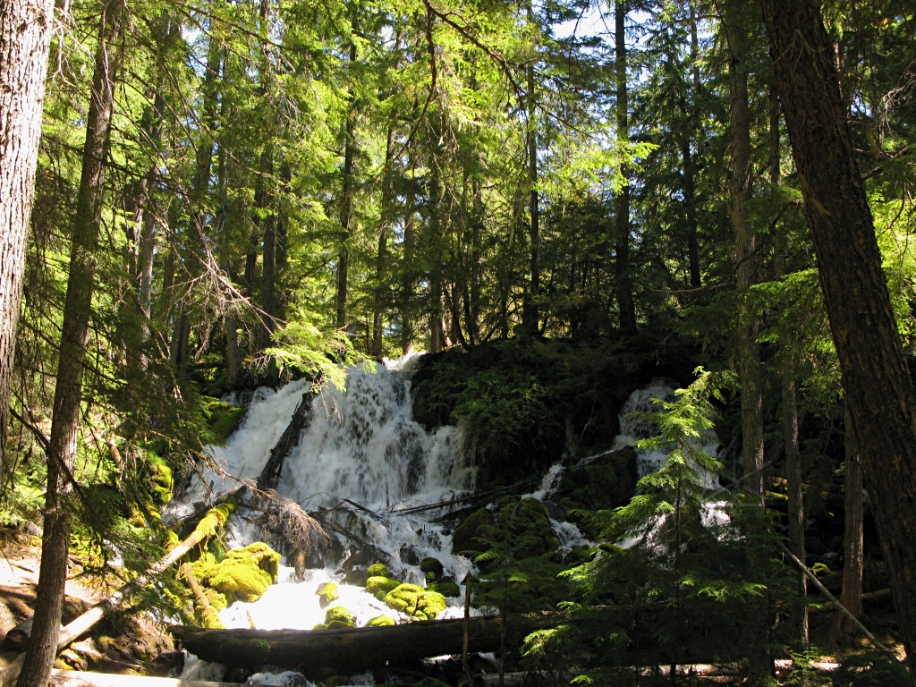
On the way up, around 4000 feet ASL, I pulled into a little deep-woods park containing Clearwater Falls [but different from the river through Idaho]. The pic isn't very good due to the harsh mid-day sun angle, but it was a very lush-green, mostly shaded and peaceful spot. A couple of panel vans supporting mountain-bike tours had also pulled in and the tour groups were having lunch; these are multi-day affairs where people cover a few hundred miles of guided tour over mixed roads and trails. |
|
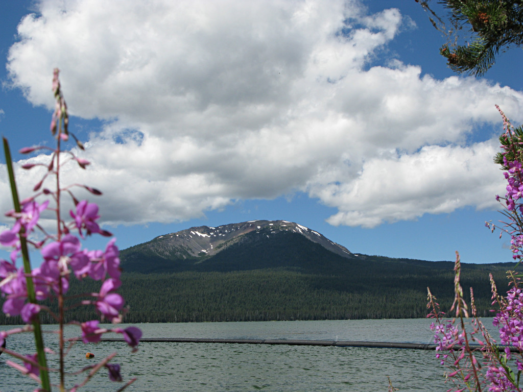
Diamond Lake, north of Crater Lake. Very popular camping and recreation
spot, apparently, given the nearby campgrounds bristling with RVs. The hill
across the way has that certain exploded-volcano look about it, doesn't it...
[I was trying to frame this up nicely but the wind kept whipping the flower stalks back and forth, so I just got what I got.] |
|
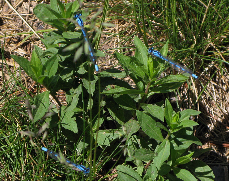
These brilliantly iridescent blue damsel flies were *everywhere* around the wayside store lot I pulled into to see the lake. |
|
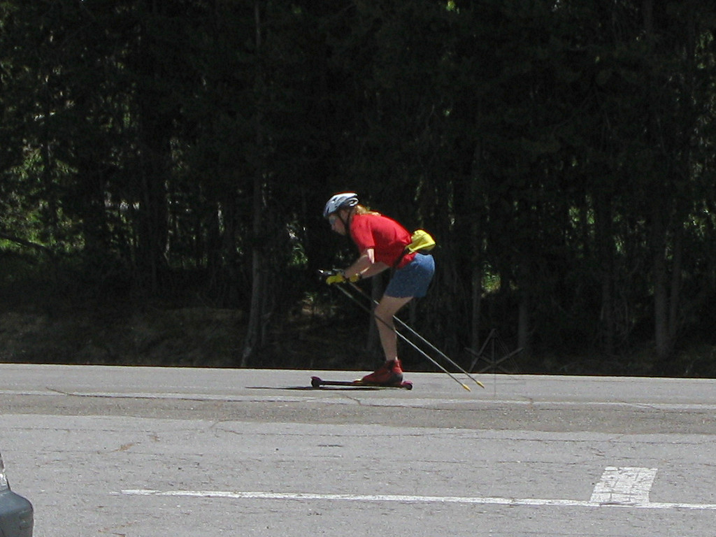
I don't think I had seen rollerskis before, but it's evidently a popular thing to do on the side roads around the camping areas. |
|
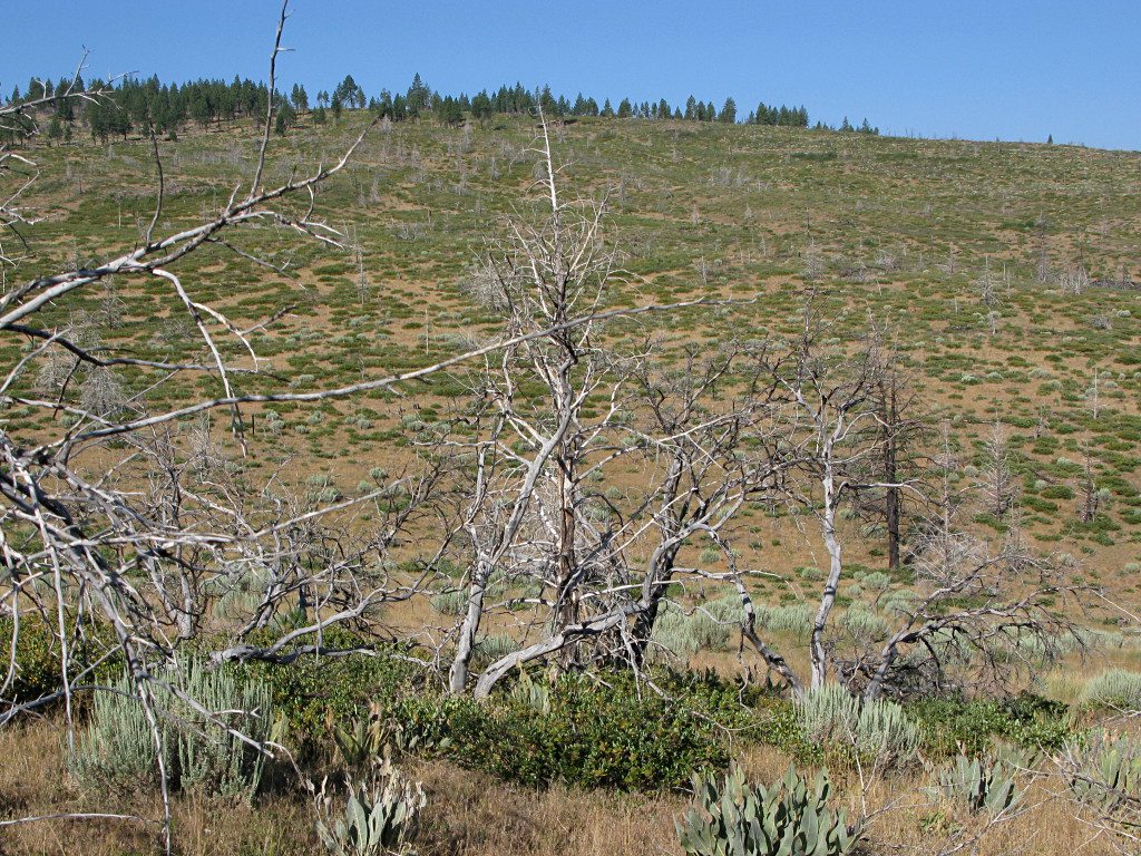
This is the "pumice plain" coming into the Crater Lake area; apparently a thick deposit of volcanic rock that very little has ever managed to successfully take root in. But oddly, it is sandwiched in between two bands of woods, unlike the blasted, barren moonscape below St. Helens. |
|
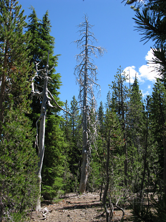
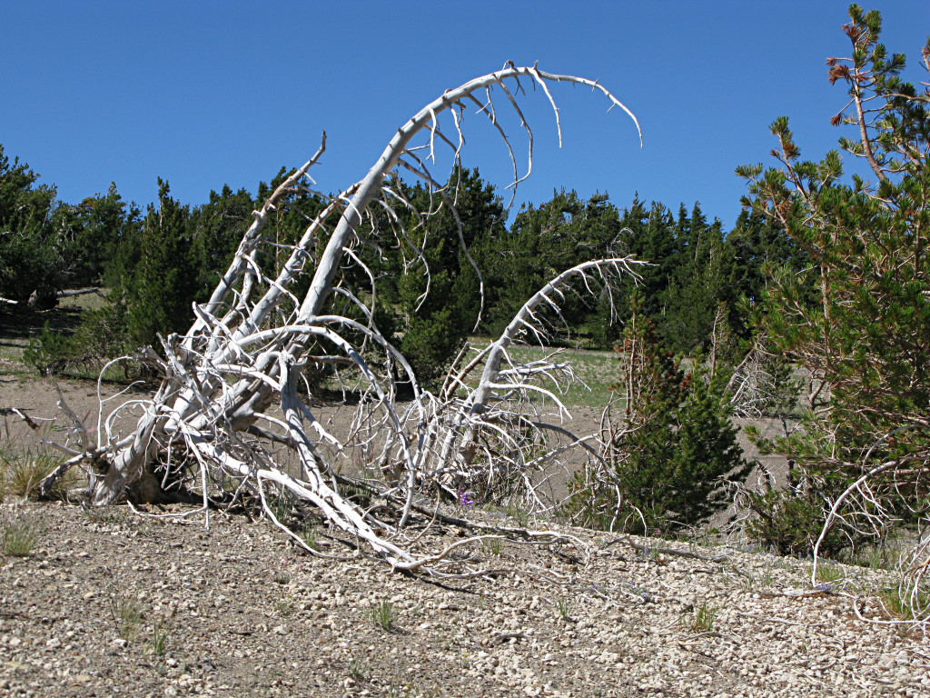
Salted in amongst the live trees, these funky scraggly dead pines are everywhere. Most of the trees around here are a variety called, appropriately enough, whitebark pines. |
|
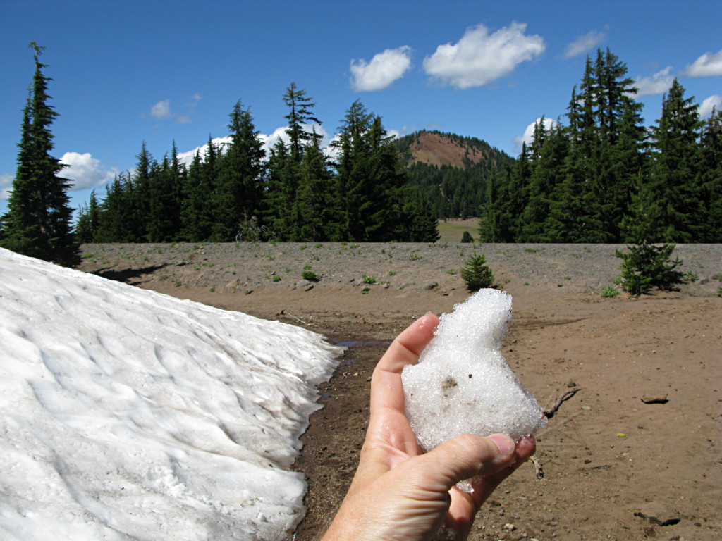
I found big *snow* mounds. In August. I had to stop and play with it. |
|
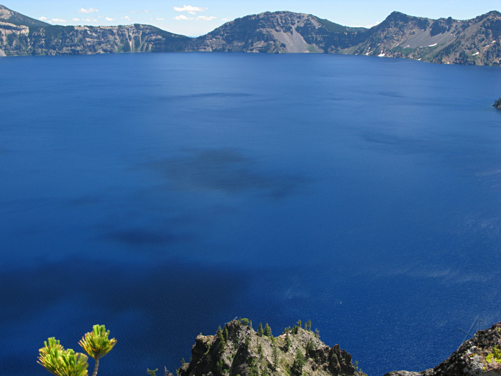
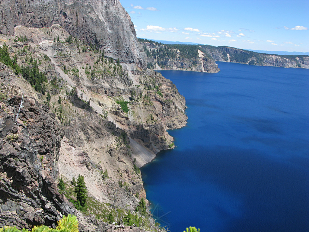
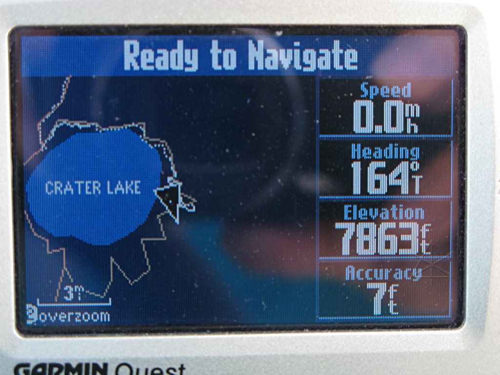
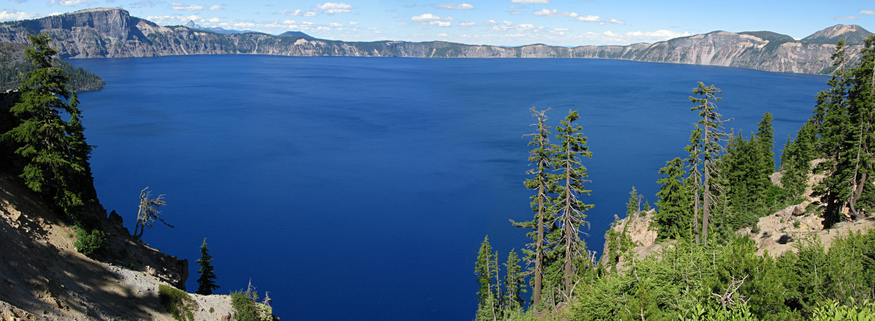
I arrived at the first parking area on the westish side of
Crater Lake,
and walked up to the lip for a looksee.
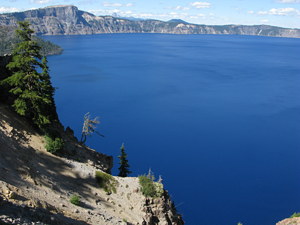
Wow. It's very ... blue. It's also fairly large as is the scale of things around it; note how far down the knob of rock at the bottom is, and the water is a ways below that. For some reason I thought the lake would have a smaller diameter. |
|
Cliffside view from the same place. I had clambered out on a little peak of rock over the main slope, and other people were climbing around various edge features behind me. One of them knocked a piece loose and it went down the slope, with a very hollow, metallic-sounding clinking as it bounced. I guess that's why they're called "clinkers". |
|
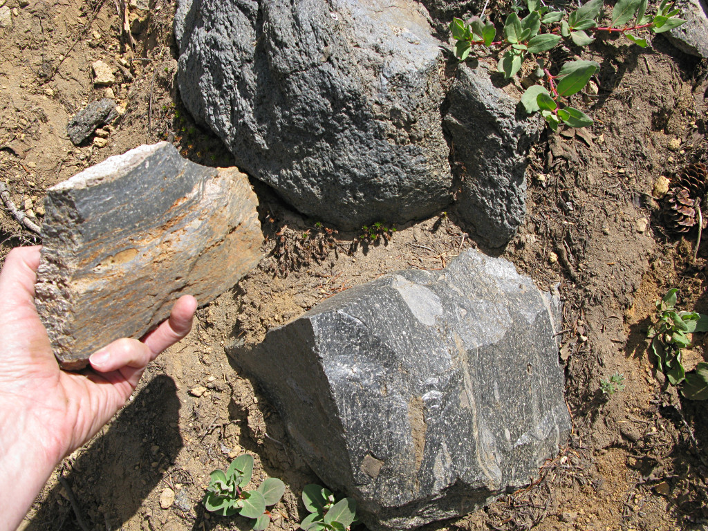
I studied the rocks around me a little. Dense, heavy volcanic glass is
scattered everywhere right next to airy pieces of pumice that weigh nothing,
and some rocks like the one I'm holding exhibit characteristics of both in one.
They say not to collect rocks, but frankly if every man, woman, child, and house pet in the country came here and picked up a few rocks, there would still be *plenty* of rocks left over. |
|
Can you say "thrown up by the force of the blast"? |
|
I continued around the rim road to the north shore, but didn't check out the tour-boat launch ramp that's supposedly down there. In fact I never actually made it down to the water's edge at all. |
|
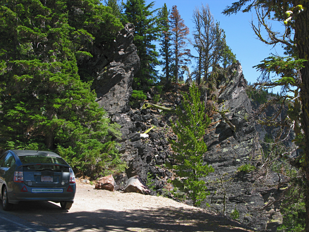
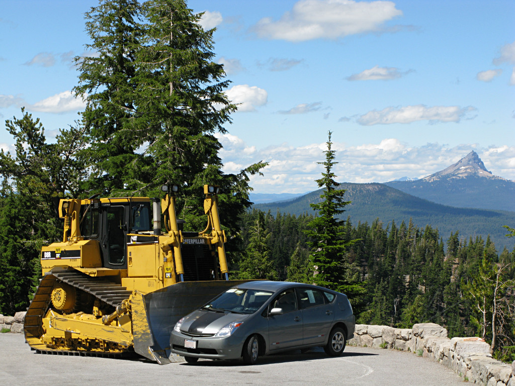
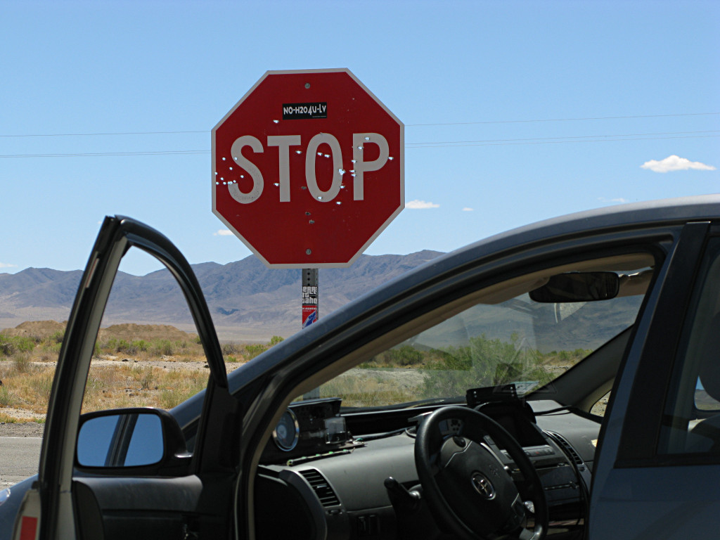
Caption:
I really dig the Prius for these road trips!
Alternate caption, attributed to the numbnuts who feel compelled to try and
prove the hill-climbing prowess of their *minivans* to anyone nearby:
The most sensible explanation for why this was here is that they keep a few bulldozers handy to shove the fairly frequent fallen rocks overboard. |
|
Here the car attained the highest altitude it had ever seen to date. |
|
More of the dead whitebarks near one of the parking areas, which I thought were sort of artsy from a certain view angle. The wind slashes pretty steadily across everything here and it's all at a respectable altitude near the treeline anyway, and many of the trees reflect that in how they grow. |
|

|
|
|
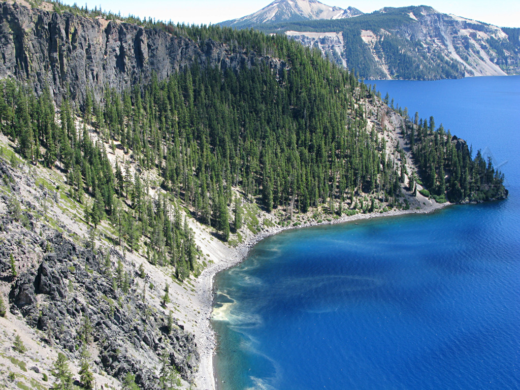
I arrived at the main tourist center on the south shore, where it was fairly
difficult to find parking, and managed to get two mostly-contiguous shots from
the rim path and stitch them together into a reasonably large and seamless
panorama [third pic's big copy], which if re-done in the really fullsize
straight-from-camera version could possibly make a nice print.
This is the only shot that really includes any of the lava-cone "Wizard's Island", and I never managed to snag the "ghost ship" rock formation which here, would be way off to the right but is obscured by the terrain below the visitor center. But again, as with any such major attraction, there are plenty of other pictures of the area only a search query or two away. The real irony is that Hobbit had journeyed all this way to the volcano, but bore no Ring to throw into it. This was arguably a mistake, as the Dark Lord remained in power for six more agonizing, war-torn months after my visit. | ||
|
Reaching the tourist center had brought me most of the way around the lake,
so I'd seen most of what's visible from near the road. It was time to move
along and head south out of the area.
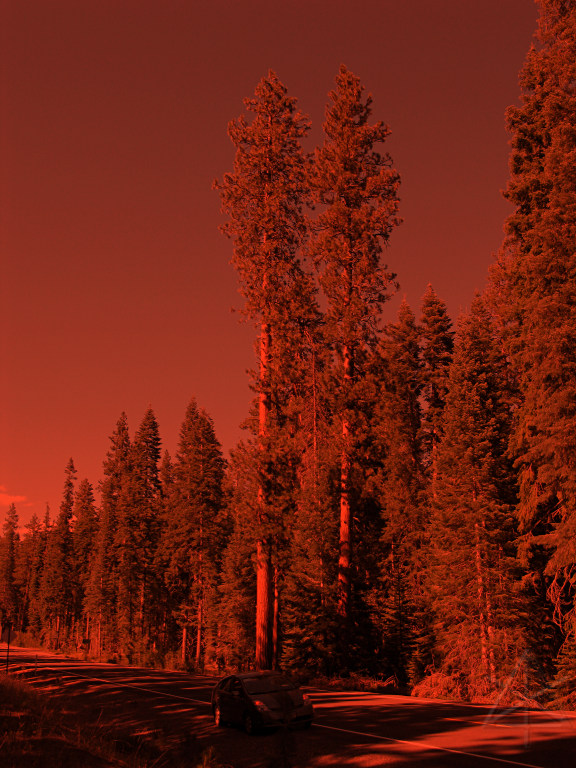
The strangest side effect of Crater Lake was that all the blue pixels in my camera were used up. This is why people so often refer to the *redwood* forests in the surrounding area. |

|
Just kidding. And these big guys are mostly likely Ponderosa pines, not redwoods, even though the bark does have a fairly strong reddish tinge. |
|
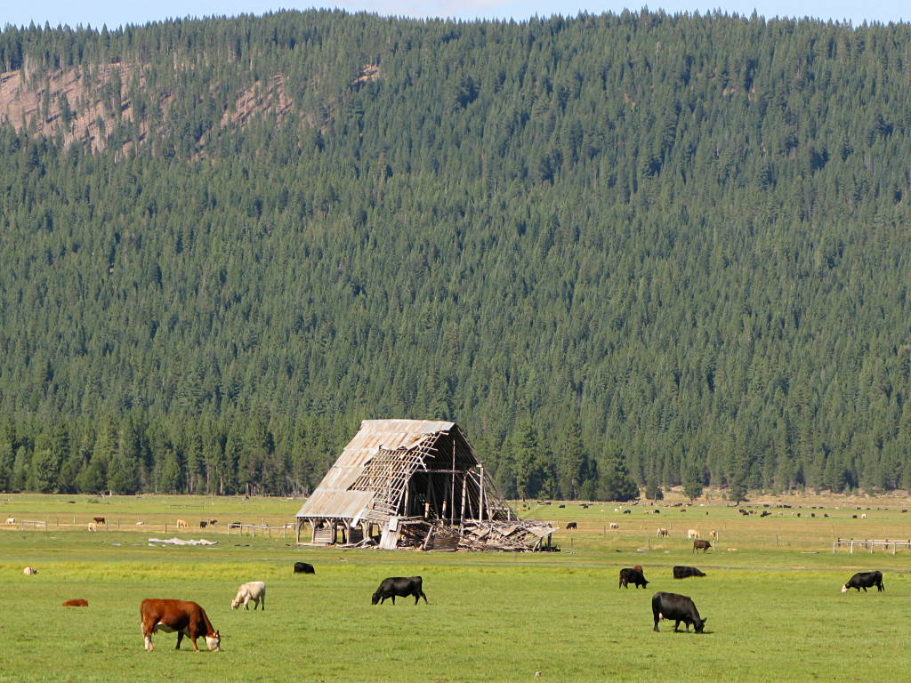
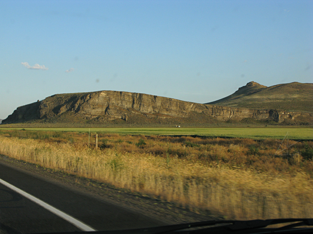
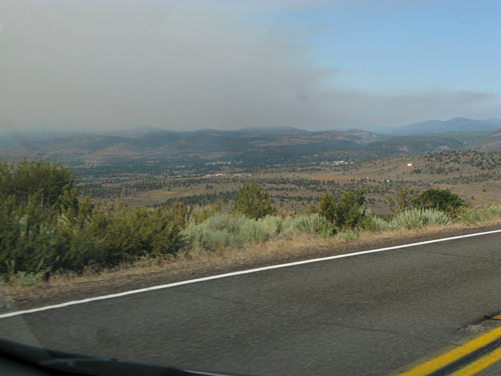
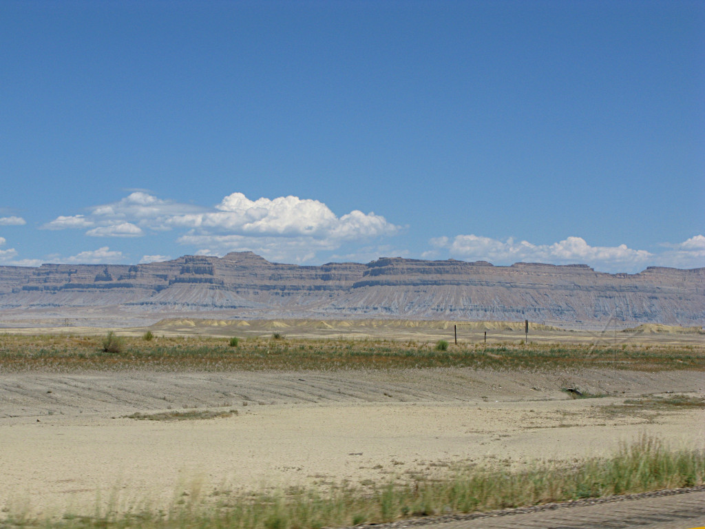
I dropped out of the Crater Lake area into the Klamath plain, which is a long
flat area between various ancient volcanic upheavals. Good for grazing, but
apparently bad for barn longevity.
One little wayside store somewhere along here had *the* most amazing baseball cap collection I'd ever set eyes on, but unfortunately not camera on. More things one can discover by poking into the little off-interstate areas. |
|
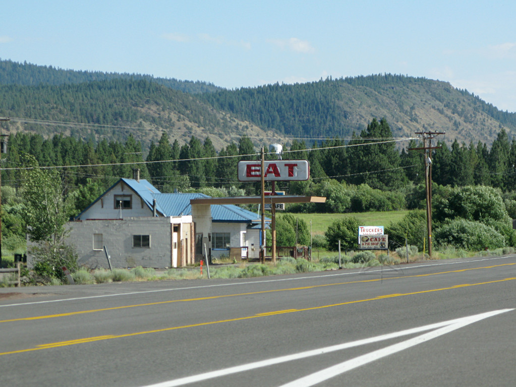
You would think a location where two significant highways intersect would be a good one for business, but what evidently failed as a gas station hasn't done so well as an eatery/truckstop either. It's sort of funny how the Arco sign got reworked. |
|
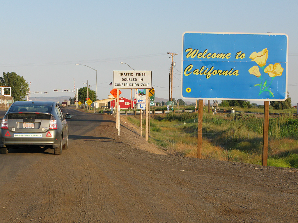
I can finally say I've driven to California, even though I wouldn't get to its coast as I had somewhat hoped. In fact I was only tagging the northeast corner of it. |
|
Signs kept pointing off exits saying "volcanic legacy" and "see the lava flows!", but I think I could see them pretty plainly from the road right here without stopping. |
|
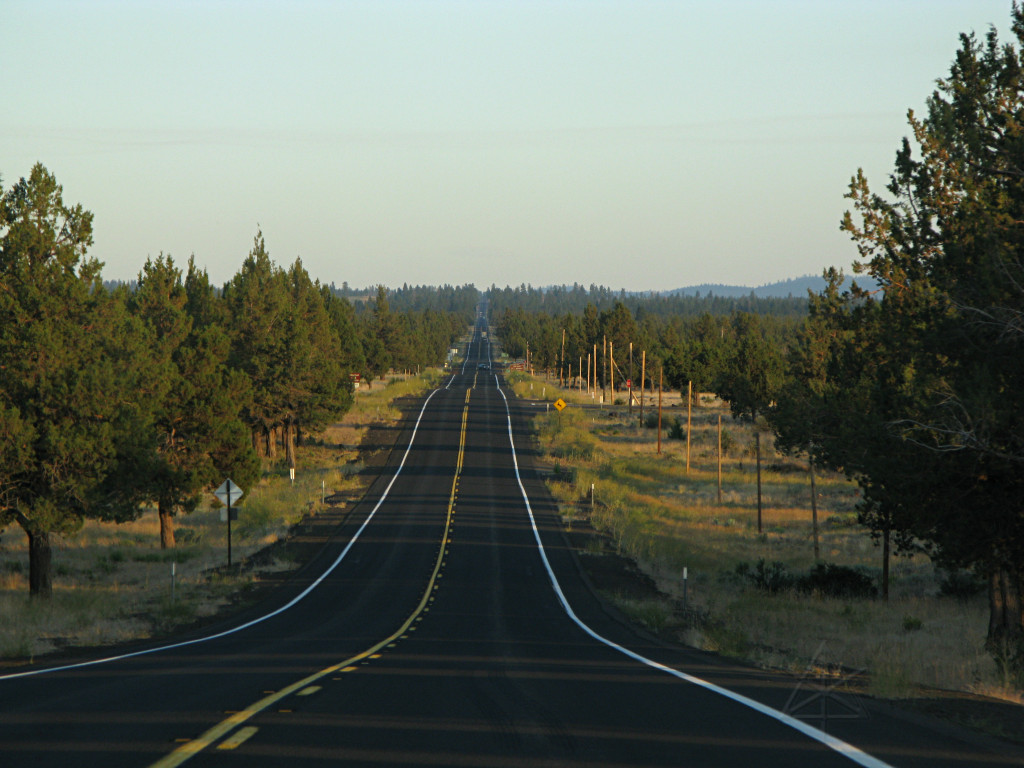
By now I was on Rt. 139 which would take me a fair distance south while angling
toward the Nevada border, and just kept going and going and going through oddly
sparse forest with plenty of those red-barked pines and scraggly grass in
very rocky soil. I was deep in the Modoc national forest at this point, and
the sun was dipping lower and lower as I went on. It was starting to look
like there weren't any towns or rest stops to be had anytime soon, and I began
wondering where I was going to overnight.
Still thinking like a tourist, I branched off onto something called "Bieber Lookout road", thinking maybe it would climb up a rise and have some sort of scenic overlook, possibly a good place to catch a good sunset from. It sort of shortcuts a long curving piece of 139, and I figured it might both shorten the distance a little and be more backwoodsy. |

|
It is certainly backwoodsy, as the number of other cars I encountered dropped to almost nil, but at least this evening had the more interesting feature that local ranchers don't seem to care that a public road goes through their grazing land. In fact there are several cattle guards across the road, presumably between properties, but with the road *not* lined on both sides with the usual barbed wire it's not surprising that the cows were giving me that "huh, what's your problem, we *live* here" look while ambling slowly across. |
|
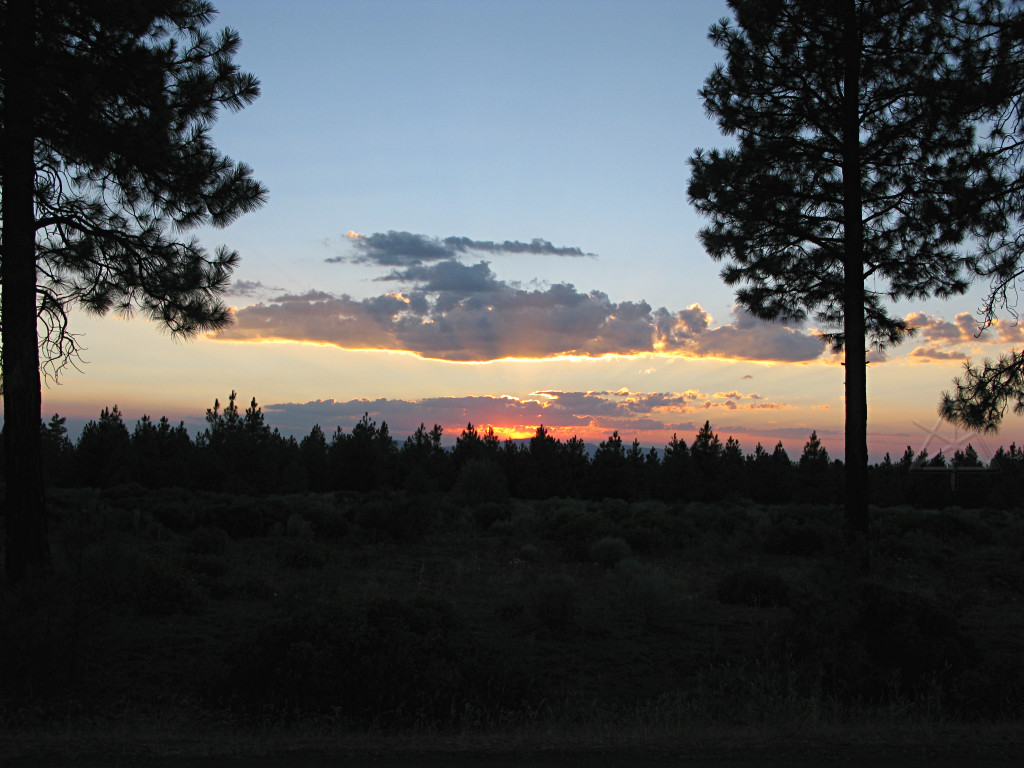
Having found no overlook yet as such, I stopped to see the sunset wherever
I could. Now it was starting to get dark, and I was still miles from anything
resembling civilization.
Besides ranch land, the surrounding forest is also logging land. Many little dirt paths go off from the road into clusters of trees, with little signs at the roadside about how access is only authorized to XYZ lumber company and trespassing carries the death penalty, or something. So simply pulling over into one of those to sleep didn't seem like too great an option. |
|
But as I went on I realized that with so many little offshoots and so little passing traffic, there was no way anyone was going to go poking far enough up each and every one of them and check for interlopers. I had no other choice at this point, and used the last bit of remaining daylight to pick my way far enough up one of these paths to be out of sight from the road, tucked the car in behind some bushes to hide retroreflections and be clear of the path in case a log truck *did* want to come past here in the morning, and called it my home for the night. I still had food in the cooler, so I was all set. |
|
The oddest thing about this place was that it was *dead* quiet. No wind, no
insects, no critters -- *nothing*. Just the lingering ringing in my own ears
from hours of road noise. It was positively eerie, since I'd expect a deep
forest like this to have all kinds of stuff going on at night in the summer.
I even put the windows fairly far up behind the screens in case something came
along and took a notion to try and poke into the car -- there *are* supposedly
bears in these woods, for example! But as hard as I strained to hear anything
around me, I couldn't. Except for a very occasional passing car out on the
road -- tire noise that depending on which way they were going would slowly
grow louder, start to fade, and end with the abrupt *braaap!* of a cattle guard
which must have been just at the top of a rise because the tire noise would
fade quickly to nothing right after. Or I'd hear the cattle guard first and
then the reverse sequence. But I had offroaded my way far enough up the
logging trail past a couple of curves that nobody could possibly know I was
up there. It was just me and millions of very visible stars overhead.
The ground was a very powdery, strange-feeling red dirt that tried to stick to everything and I had to wipe my feet off fairly carefully when getting back into the car to avoid tracking it in. | |
|
I half-expected a logging team to come barging in with trucks in the morning
in the process of getting to work, but nothing disturbed me as dawn broke and
I got going again. And finally I understood what the deal with the road name
is -- this is the town of Lookout that I reached about 20 miles later, which
seemed to have utterly no activity in this early AM. Farther on is the town
of Bieber, where I actually managed to find coffee. So there's no "lookout"
as I was thinking of it, obviously having been totally spoiled by the Oregon
coast and all the mountain roads.
Hard to tell if paganism is alive and well here, or if the star is just left over from last Christmas. |
|
Eagle Lake. In contrast to the specifically defined campgrounds in other locations, it appears to be all public land around here so people pretty much camp wherever they want. |
|
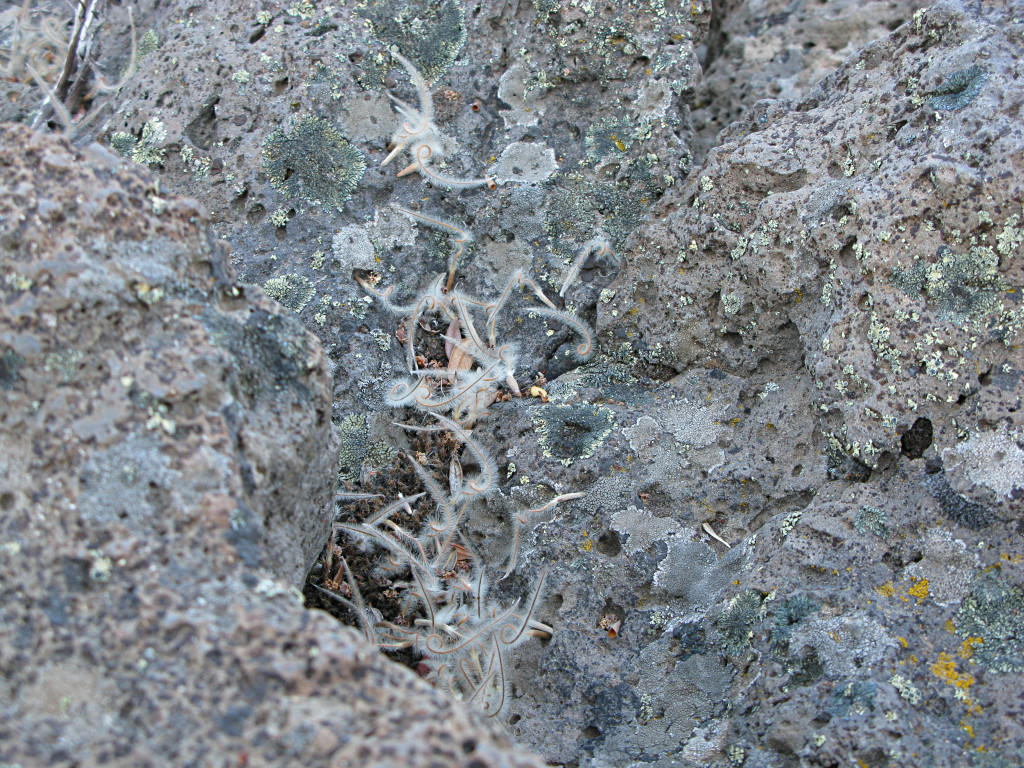
Having walked up into another roadside patch of that "western land" with its ubiquitous sagebrush and prickly flora, I took another look around. There are similar but much larger porous rocks here, with these funny lichens that send off little fuzzy offshoots that always curl to the left. |
|
There are many somewhat mysterious areas of completely dead and bleached-white trees, like this swath all the way up the slope to where the live ones remain. Weird, and slightly unsettling. What killed them all at once? |
|
This is as close as it gets to a feeling of flying in a car, on a long
descent into a town where the road angles sideways down the hill, and then
turns near the bottom to head into the town. Like seeing the target area slide
into view below, and then doing the last turn to final approach and lining up
on a runway. I even had a bit of cloud layer to descend through here, while
dropping out of the hills into Susanville -- which was the first "real
town" I encountered well over 100 miles into California. And all done in
a multi-mile glide without burning any more fuel, of course.
I was getting a little low in that department but at $4.59 !! in Susanville, I only got coffee and figured I could hold out to see if the gas prices would be any lower in Nevada. Reno wasn't that far ahead now. |
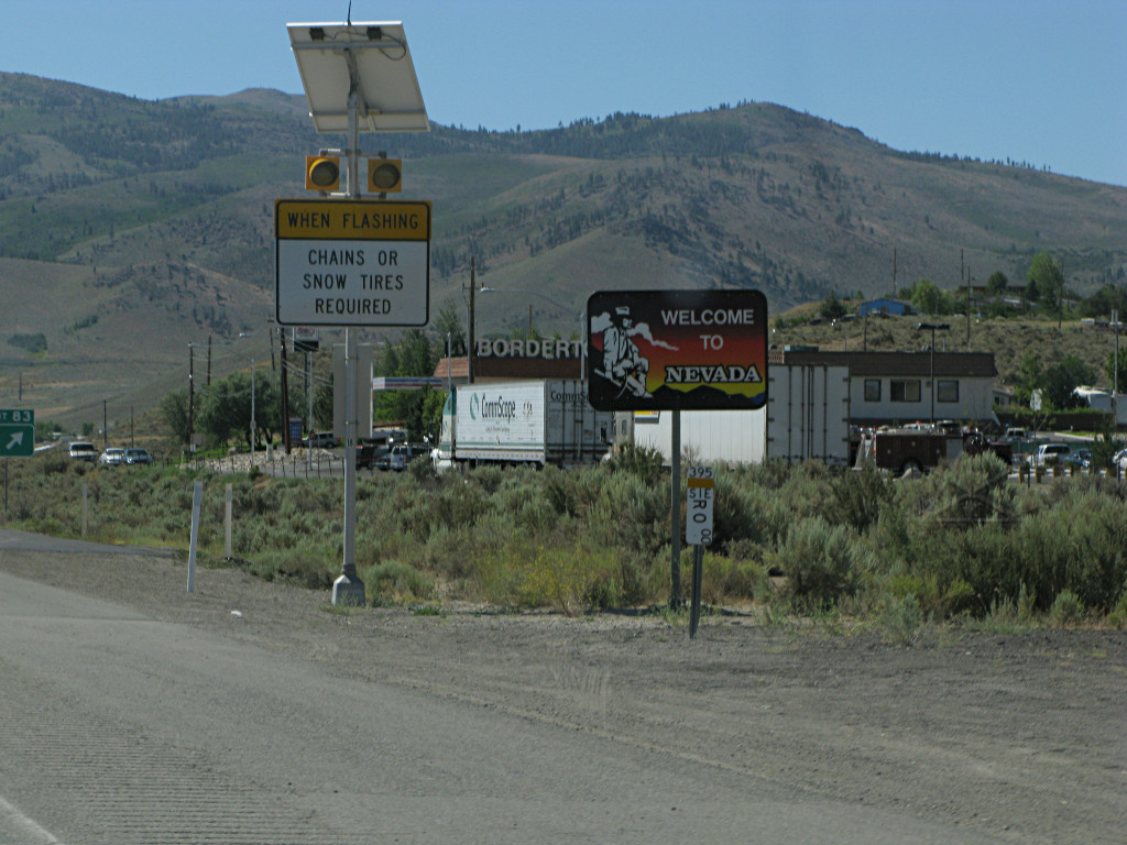
|
That was a good decision. Upon passing the "bordertown" at the Nevada line,
I soon found stations offering $3.93 instead. I continued onward through
Reno, and got onto I-80 for a short stretch.
At one point one of the new Yukon hybrids came past me. Kristin would have been proud -- I guess people really are buying them! I also saw that folks really do wear big cowboy hats while driving around in their pick-em-ups. Yeeehaw. |
|
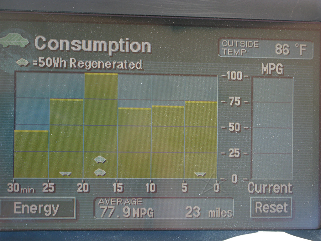
I stopped for gas somewhere along the bit of interstate, after which came
a nice slightly downhill segment before jumping off again in Fernley. This
fairly phenomenal number wouldn't last long, however.
I found my way over toward US 50, which looked like it would go a little straighter across Nevada than I-80. |
|
Besides finding cheaper gas, I was back into omnipresent casino territory. What I left behind somewhere through here was any remaining humidity. |
|
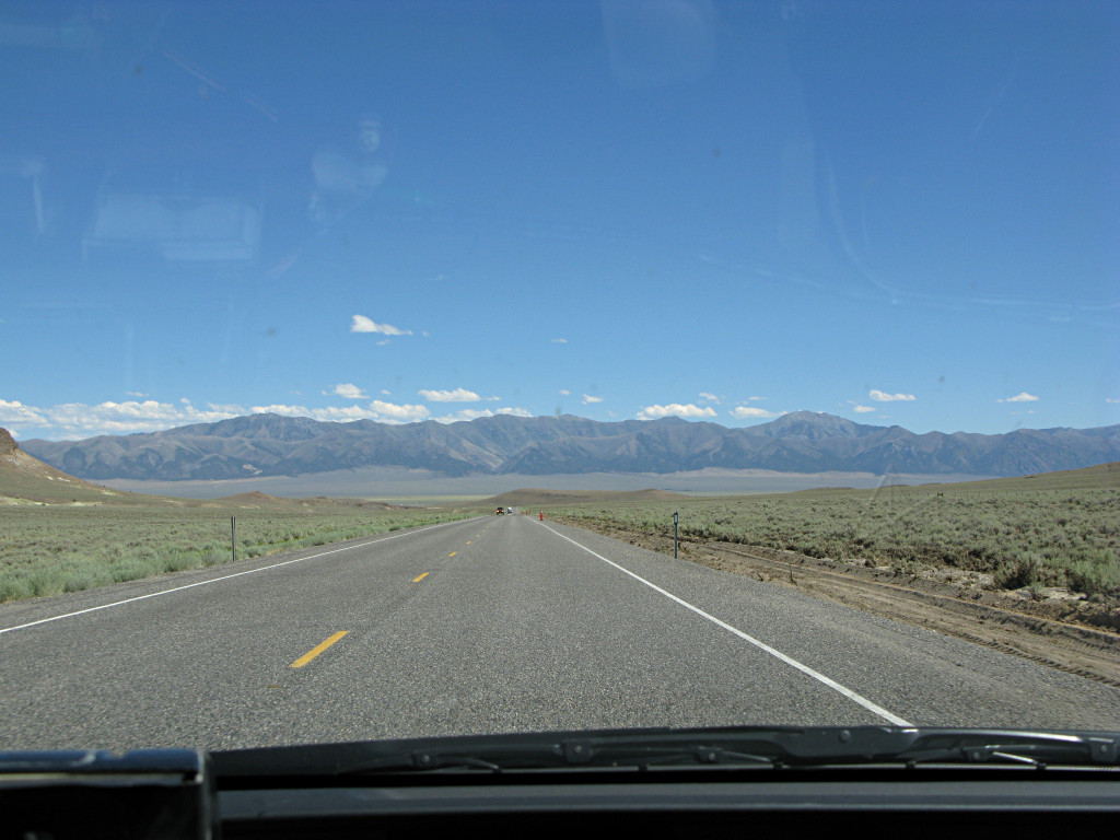
After passing through Fallon, the last major town for a while to come, I settled in for the long run east on Rt. 50. As the sun rose higher and the day became hotter and drier, the fairly infrequent opposing traffic would slowly rise like apparitions out of the indistinct shimmering distance, grow for a while, and then WHOOOSH -- gone behind me in an instant. With a speed limit of 70 on a two-laner, that's a little scary especially when hitting the bow-wave wind blast of a truck. |
|
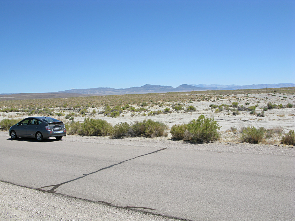
And once again, lost in the middle of freakin' nowhere! I pulled off a little onto a side road to go have a closer look at the land, mostly barren, sandy dirt without much on it except a little scrub. At this point I was about a hundred miles south of where Burning Man takes place, and while it had been tempting to detour up there to see the Black Rock area, I think even here I'd already seen enough sun-baked playa for one summer thankyouverymuch and I wouldn't have time anyway. Interesting Big Art aside, they can have it. |
|
People do seem to entertain themselves in strange ways out here, though.
The road goes along between these alkali salt flats for many miles, and the
locals have developed a tradition of spelling out messages along the low
salt-flat banks with dark rocks. They're not that easy to read while sailing
by, but the tradition has apparently continued for some years. Here's
another article
that touches on it.
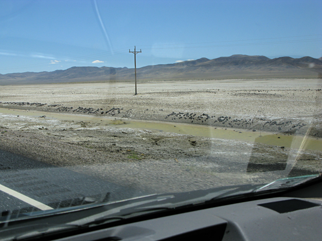
That ooze in the ditch doesn't begin to qualify as water. |
|
|
|
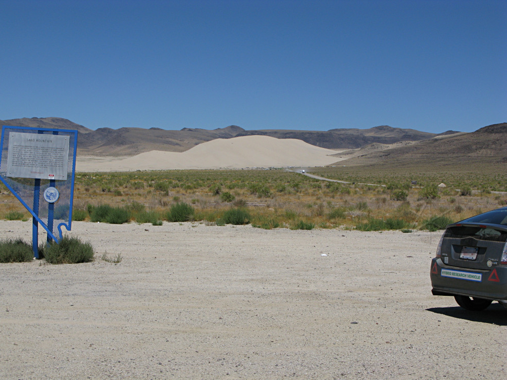
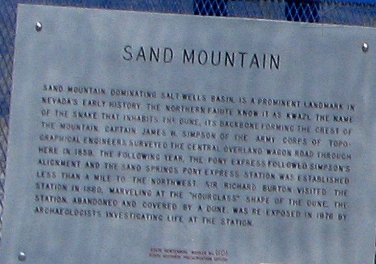
A little while past the salt flats I unexpectedly spotted
Sand Mountain,
sticking out like a sore thumb amid the rolling brown hills. The RVs and
things parked way in there around its base were about the only sign of human
habitation I had seen for about half an hour, so I pulled into a small turnoff
at the head of the sand road, perused the sign, and then decided I had to go
take a closer look.
If you want to get every part of your car bouncing vigorously up and down, try going down a sand road as washboardy as the access road into here was at the time. OMFG. I thought my instrumentation, both built-in and add-on, was going to fly apart into tiny electronic chaff. The mere process of slogging into there and back out knocked a full 2 MPG off my average, 100 miles into the tank. But I pushed on, past the RV that's just starting outward here and through its dust cloud, and finally got closer to the base of the mound. | |
|
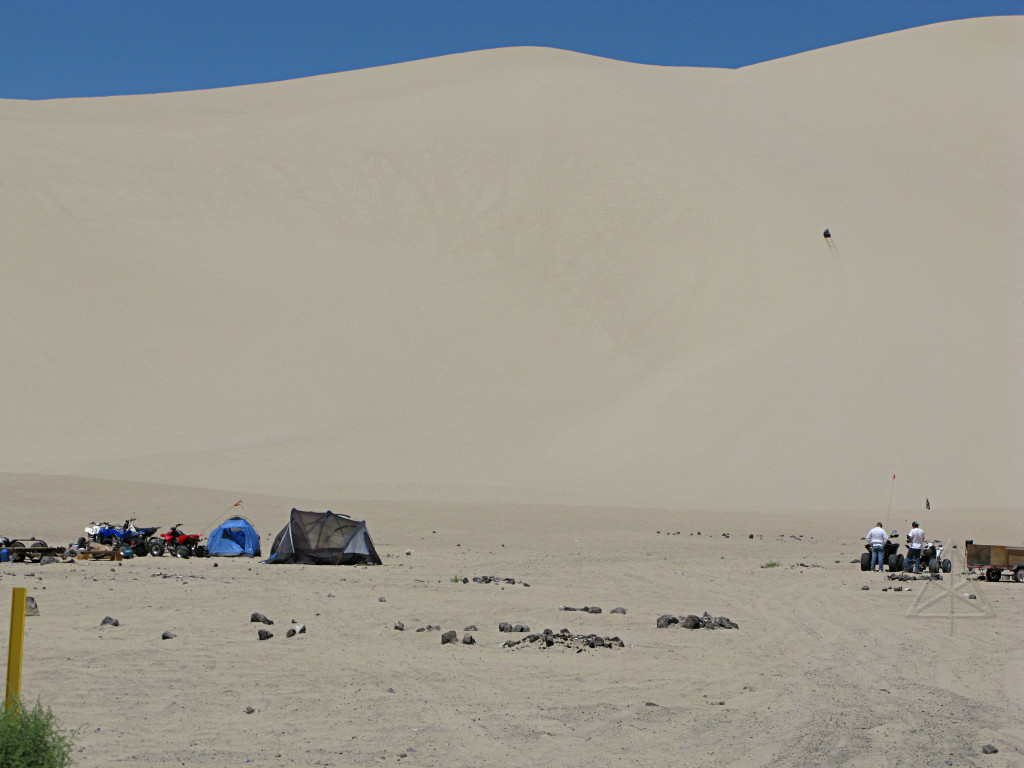
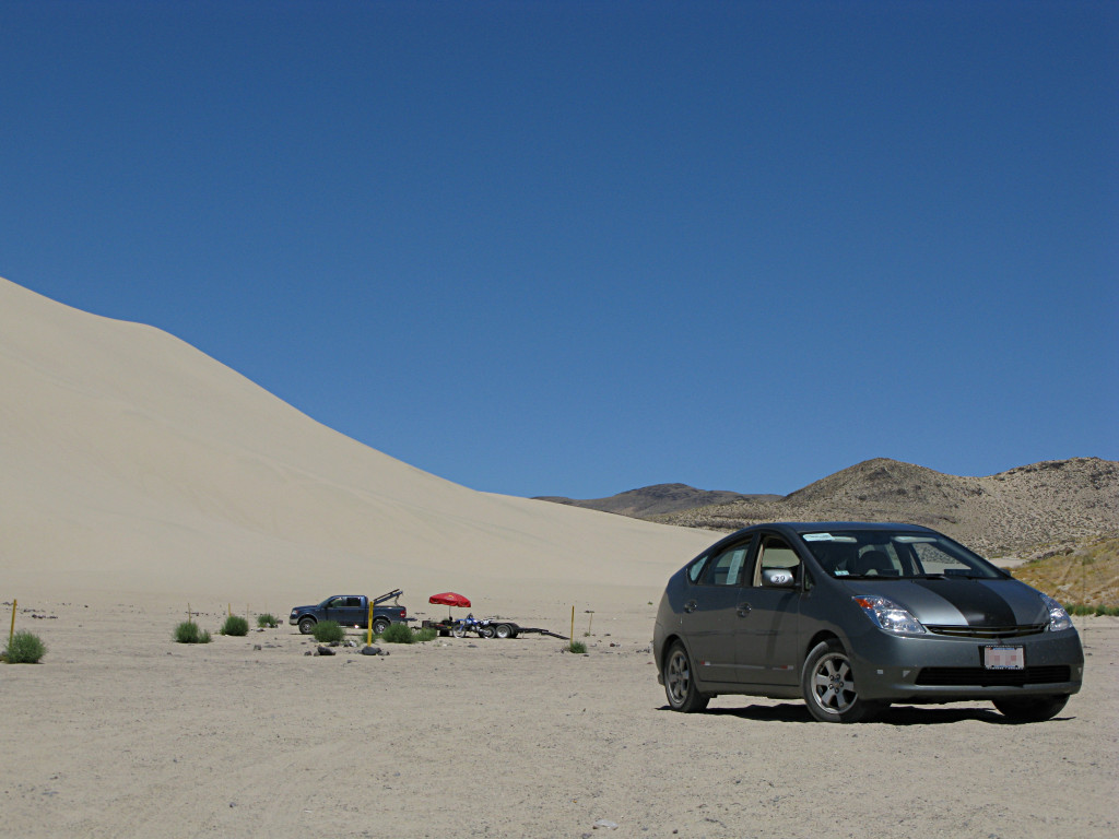
It's just like the Oregon dunes, but taller. The sand comes from the salt flats to the west, deposited here by wind as it curls around in the enclosing hills. The same off-roading enthusiasm is certainly present here, possibly with a slightly more redneck flavor. People camp and ride for days at a stretch. |
|
I tried to go a little farther in toward the hill, possibly up to one of the camps to ask a couple of questions, but soon felt the progress get a little sluggish and the front end start to bog down. Two-wheel drive, nice hard tires, especially in that heat -- not optimal for this terrain with the sand getting softer by the foot, so I decided that this is about as close to being a "sand squirter" as a Prius gets and rather than get stuck, carefully backed out again. |
|
ATVing is apparently not all the visitors do. Clearly, I was already deep
in "firearms as entertainment" country.
I got rolling again and realized that I was already weary of the way Rt. 50 kept staying in the flatlands, despite passing rugged hills on either side. It was time to go find some real mountains again before I went nuts. |
|
I got my wish soon enough. The road began to climb soon thereafter, and soon some high ridges were looming in the distance. A pattern soon emerged for the next several hours -- anywhere from 15 to 50 miles of flat valley, climb over a couple thousand feet of ridge, another flat valley, etc. Rt. 50 basically goes perpendicular to the mountain ridges, but meanders back and forth a little finding the lower passes to cross over. |
|
On the way down off one of the ridges, I decided to play a little. With
nothing on the road ahead of me for several miles, I brought the engine RPM
up to a little over 4000 and held it on the long, straight downhill. Not
the 5500 software-limited redline, but still a fairly high power demand and
gravity was already helping me top 70 or so before starting this test.
The car touched 102 MPH before I spotted some opposing traffic way off in the distance. At that point I went into a long warp-stealth glide, was back down around 70 when the traffic coming the other way zipped by, and continued the glide far out into the valley using no fuel for a good two miles or more. At the ridge summit before starting this, I was showing 56.5 MPG / 191 miles after the climb up. Once I was through fooling around and back down to normal speeds on the flat, the display showed 59.2 at 204 miles. That's 13 miles worth of "experiment", which helps describe just how large the scale of everything is out here. Where else do you get that kind of unimpeded distance to test the parameters of your vehicle? | |
|
|
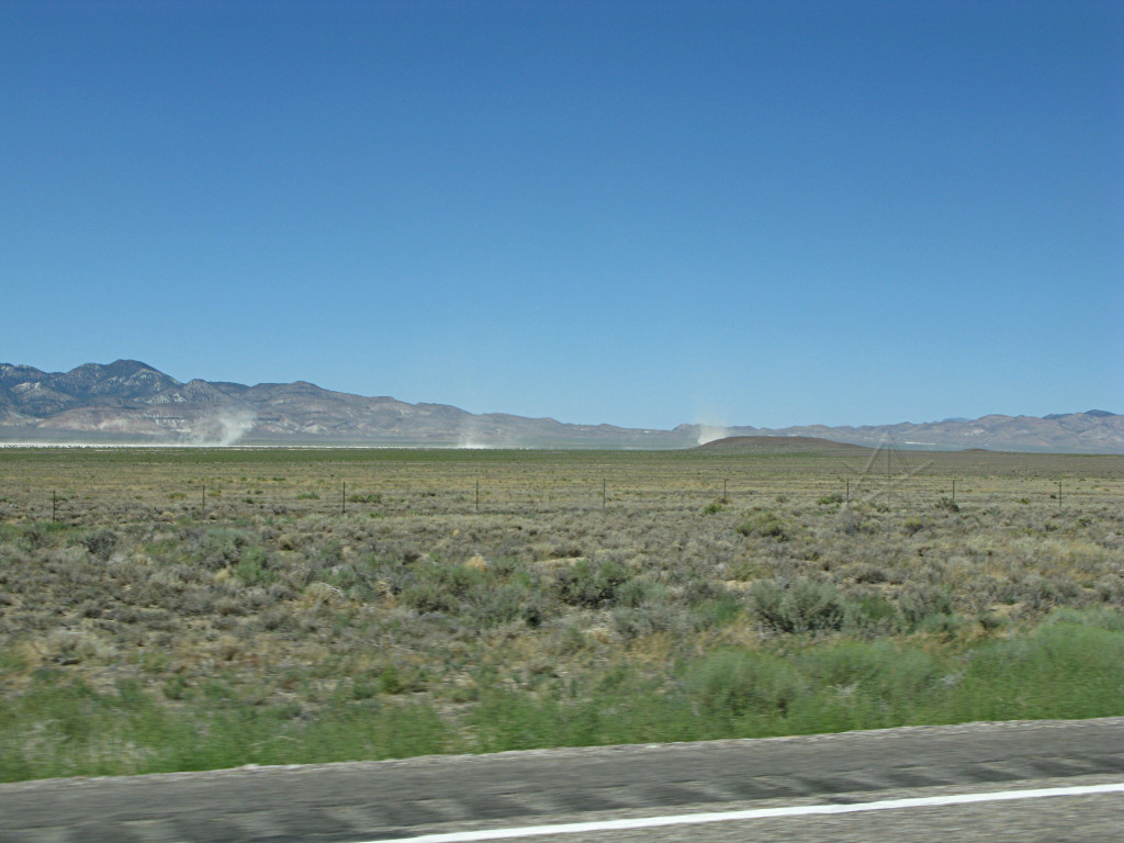
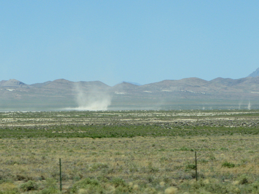
| I finally understand what dust-devils really are. They randomly form on the dry plains where there's no grass, and slowly wander along almost like living things as they build up and spawn off little clones of themselves. They're really sort of creepy, and I was wondering if I'd meet one going across the road. But today, they all seemed to stay a mile or two off to either side. | |
|
I've heard that Austin, TX is a pretty progressive place.
I found all those new wind turbines being constructed near Austin, MN. After another 20 mile run of valley, which you can see stretching way off into the distance here, I arrived in the little burg of Austin, NV which is perched on the western slope of one of the ridges. I pulled into a gas station for coffee I/O, and found interesting, clueful people. Jose' behind the counter seemed really intrigued by the car and hybrid stuff and the fact that I was all the way out here from Boston, and even a couple of random teenage girls hanging around in the place seemed mildly interested. I guess they don't get many Priuses through here, and thought it was neat that I was nowhere close to needing gas yet. I was totally amused at finding another town named Austin with intelligent life in it. |
|
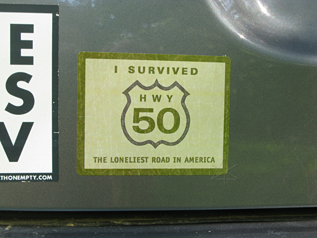
It was here that I first learned of US50's reputation. In exchange for one of my flyers, Jose' gave me this sticker and a couple of other little odds and ends, along with describing how even though there's some nominal level of civilization in Austin itself, it's 100 miles back the way I came to the nearest *real* grocery store, and that very little infrastructure exists toward the east for longer than that. |
|
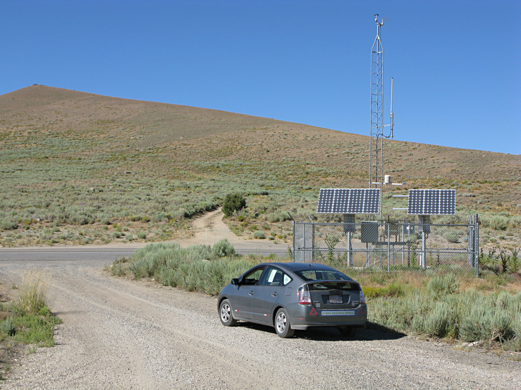
Above Austin the road does a couple of twisties to get up the steeper part, from which the shot back across the valley was taken, and then crests the next summit. Many of the ridge summits have these little self-powered weather stations on them, as do several random locations down in the valleys. No idea what they communicate back to. |
|
I encountered ONE other Prius along the whole Rt. 50 run, and pulled into the
same little turnout they were sitting in to chat with the occupants. They had
been along 50 before but were bemused by the recent addition of the weather
stations since their last visit. They were also fairly impressed at my being
from back east and now coming from the *west* coast. They were pulling 46 MPG,
in contrast to my 59, and I don't think it was just because they were headed
westward into the wind.
At one point a trio of Harleys passed me, and about a hundred miles later, the same group passed me *again*. I caught up with them in Eureka later, the middle of the three notable towns along this whole stretch, and stopped for a quick break and got to chatting. They were headed to Sturgis, and decided to go via the more "adventurous" route and take in a lot of scenery. Obviously their fuel stops would be more frequent... They had a kid along with them, maybe 12, and a tiny dog that came with its own do-rag and leather vest and rode along just fine in a *chest pouch*. All three bikes were also laden to the hilt with camping gear, of course. I *wish* I'd gotten a picture of them and the dog because it was sooo cute, but I think we were all more intent on gittin' on down the road. There were actually quite a few missed photo opportunities of this sort -- either no time, wrong angle, infeasible to stop, too much of a time-sink to drive toward, or flat-out lameness. Sometimes I would substitute by just making a note for later. Trying to catch everything would have doubled the whole trip time and the number of "keeper" pictures, so I didn't mind having to draw the line *somewhere*. Besides, every picture has some amount of story behind it and quite often, that piece of story would already be forming in my mind *as* I went for the picture. That would affect how it was framed and focused, where it was shot from, whether I'd try to put the car in it or not, and if any additional "leadup" shots needed to be captured afterward to help round out the explanation. Again, the numeric filenames gives some hints about how some of this got mixed up and reordered. In other words, I spent a certain amount of time on the roadtrip in "journalist mode", thinking in terms of the final writeup even down to the wording. But plenty of shots were just spur-of-the-moment "hey that's neat" reactions. |
|
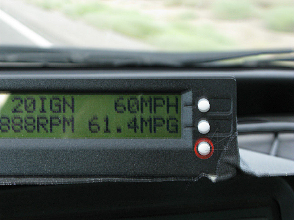
Most of the flatland stretches through the valley yielded numbers like this, pretty much the same "60 @ 60" crossover point. My foot didn't move a whole lot through most of those runs, only to bring the RPM as low as I could and still sustain load and speed. I can't imagine what the other Prius was actually doing to be so far off from this -- probably going a whole lot faster, for starters, because this is simply what the car is capable of especially in the ambient temps of that day. |
|
When it came to each ascent, there was little reason to change my power demand
at first because generally as the road tilted up, it also began to go into some
curves with a lower posted safe-speed, usually 40 or 45. Gravity would pretty
much do the job of slowing me down for getting into these twisties while I
could still stay at optimal efficient load, and then later I'd go into a
higher-power climbing mode as needed but still not pushing particularly hard.
Most of the ridge passes are like this, with plenty of slower-rated curves
working up and down, and then it's back into the straight
rocket-sled
track in the valleys.
In general, a constant-power scenario of letting speed drop a bit on the uphills and getting it back on the downs tends to be more efficient than trying to push hard up the hills and then have to brake more on the backside. Some vehicles have no choice about this, where a lower horsepower-per-ton ratio is accomodated with climbing lanes and "flashers under 40 MPH" signs and the like. On just starting one of these rises somewhere between Eureka and Ely, I noticed a semi quite a ways back from me just before going around the first bend and losing sight of it. I figured it would eventually overtake and pass but probably way after negotiating this ridge. |
|
Does anyone remember that seventies suspense B-movie called
"Duel"?
It was one of Spielberg's earliest efforts, with Dennis Weaver as a traveling
salesman in a somewhat unreliable car being pursued through the desert by a
crazed tanker truck driver who wants to kill him.
Three or four turns into the ascent and nearing the summit, I noticed that the truck behind me had already closed the gap quite a bit and its nose was just peeking around the bend behind me as I reached the end of a straight part. I crested the hill and began a nice controlled glide down, still being mindful of the recommended speeds around curves and frankly, they aren't kidding when they rate those -- you go much over the 40 or 45 that the sign says, you're pushing the cornering traction pretty hard. Then, all hell broke loose. While all of the following happened in quite rapid succession, I can recall almost every detail because it was all so strange and scary at the same time. I rounded another bend and was babying the regen while headed for the next one down, and then saw a small pack of wild horses pop up out of the dip ahead to my right and start diving across the road. Wild horses. Out of nowhere, on the run. The only other livestock I had seen all day was cows, standing perfectly still in flat fields. I still had plenty of distance between me and them, but probably went well over the regen current limit as I braked fairly hard to make sure they'd have room to get across. At the same time, mindful of the truck still gaining behind me, I lit the hazards to warn its driver that something was up and I would be going much slower for a stretch. Then I started scrambling for the camera, because this had to be the most surprising thing I'd seen all day. Most of the group got across the road well ahead of me but as I dropped to about 20 MPH and began to come level with them, there was one mare and her foal remaining to the right side of the road who seemed to hesitate a bit. But rather than stop and wait for me to ease past before crossing, the two of them started RACING me along the shoulder, apparently really wanting to cross and rejoin the herd right now. The mare was wall-eyed, clearly looking at me and her offspring at the same time and launching into a serious gallop. I continued slowing until they had enough room to dash across in front of me, and around this time the camera had finished booting up and I began to swing it over toward the herd that was now all on my left. All of that ensued in the space of about five seconds, and I hadn't unglued my eyeballs from the horses and the road the entire time. Then I checked the rearview, and all I could see was the "big teeth" of the truck's grille completely filling the hatch window. |
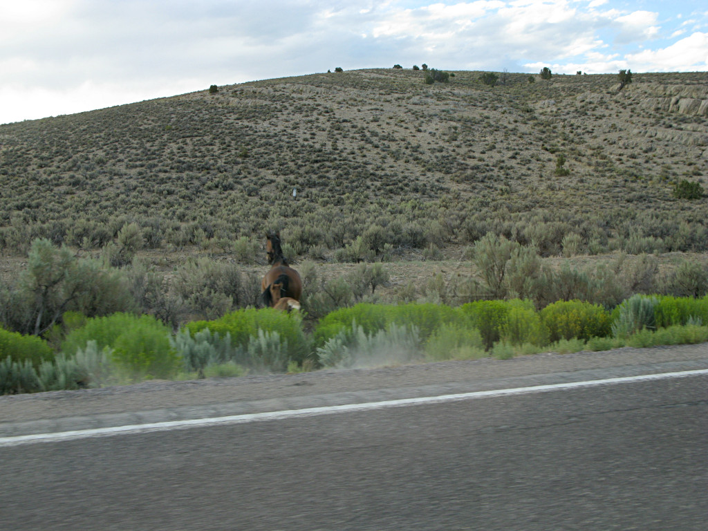
|
I won't say I floored it, because I generally don't do that, but I wasted no
time in applying some vigorous snots to the drive wheels. At the same time I
squeezed off the one bad shot I managed to get of any of the horses, but even
here you can see some of the rapid-fire dynamics of the situation -- mother and
child diving off through the sagebrush, the puff of dust still in the air from
their passing hooves, and me still rolling. I have no idea where the other
five or so horses were; somewhere off to the left of where these two got
momentarily trapped on the wrong side of my car, I imagine.
Time would shortly tell where the real horse's ass was. |
|
I then dropped the camera into the passenger seat and continued reasonable
efforts to get away from the truck, now wondering what the hell was wrong
with this guy. He *had* seen me with plenty of room to spare because he had
slowed to my speed instead of plowing into my back end, but why so close? If
you were a trucker and had just rounded a mountain-road bend, and saw any
kind of wildlife trotting across the road along with the light-show suddenly
exploding off the back of my car ahead, what would you do? Unless I've
completely misunderstood everything I've read about truck driver training,
you would slow down to a crawl and keep your distance from the whole mess
until things settled down, I would hope, especially with another one of those
40 MPH curves coming up on a *downhill*. You might also assume that with an
out-of-state plate, the driver of the car ahead might have gotten a little
rattled by this and would want to take it easy down the remainder, and your
best course of action would be to stay back and give the tourist more room.
This one didn't, but dove up ridiculously close and then continued to chew my ass all the way down out of the pass, around every one of the remaining curves like he wanted me to do 70 around them, and wouldn't back off no matter what I tried with the hazards. I'm talking less than a CAR length between us the whole way, long after the horse situation was over. No discernible reason -- I was back up to speed, and we were still in the curves. There was no excuse for this. He could *see* that I needed to react appropriately to a road hazard and terrain conditions thereafter, and was apparently now holding that against me somehow. | |
|
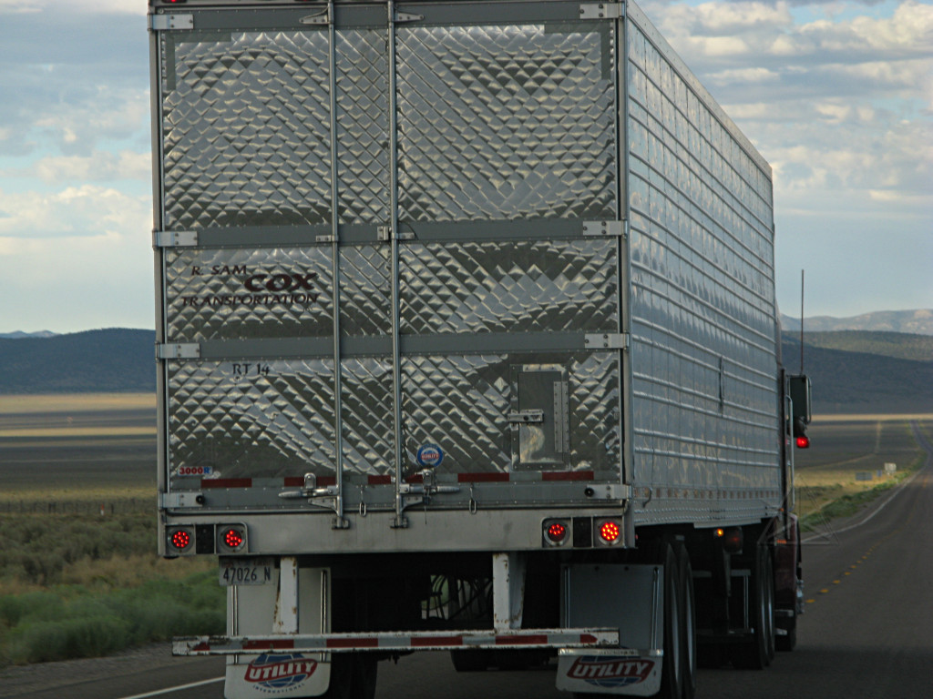
Finally we got clear of the twisties and he was able to pass, and with the camera still alive I tried to get every possible detail of this chump as I could. |
|
I think this was the ONE truck that had come up behind me the whole time on Rt.
50, and for some reason it *had* to turn out to be an asshole. What gives
people like this any right to evoke fight-or-flight reflexes in another fellow
road user, on purpose? As he hauled off into the distance and I gradually
stopped shaking, I began re-thinking the whole incident and wondering what *I*
had done wrong. Followed the safe-speed guidelines through the turns up and
down the hill. Slowed down for the horses. Slowed down even *more* for the
horses. Tried to communicate the unsafe situation as best I could. Got the
guy past me as soon as I thought it was safe for a pass. WHAT THE FUCK was
the PROBLEM?? Couldn't he wait the additional two goddamn minutes it took for
us to get out of the hills? This dipstick had just pretty much ruined my
afternoon's enjoyment of this road in one shot, just by planting his 40 tons
of death within crazy proximity to me. I would have loved to get rid of him
earlier, but there didn't seem to be any opportunity even on the short
straights to manage to slow enough to get him safely past me and it felt like
I had to keep moving just to avoid a blatantly threatened collision. After
railing so much on the forums about the rarity of anyone genuinely needing
to *accelerate* their way out of a hazardous situation, I wondered if this
might be one of them. But even if I tried it I would still be limited by the
curves ahead, and the last thing I was about to pull was any kind of erratic
brake-check on this guy so I kept it as smooth and predictable as I could.
What would have happened if he had been in the lead instead? Would there be shredded horsemeat all over the road? Would he care? Would he derive some sick glee from it, and carve another little notch in the steering wheel? My feelings toward that driver at the time and even still, long after the event, became incredibly vitriolic and harsh and should probably not be read by the emotionally thin-skinned. Fair warning. Let's just say that I did not particularly like the gent right then. Aggressive truckers could get a solid lesson here in how they may be viewed by some of the driving public, however. A little while later I saw that I was approaching the town of Ely, and decided to boot up the cellphone and see if I had any coverage. I did, just barely, even if it was roaming. So what. I called 911. I don't do that lightly or very often, but I couldn't gloss this one over. Police encourage motorists to do that if they think there's a dangerous situation, and this most certainly was one -- not so much to me anymore, but certainly to the next poor traveler he was going to scream up behind. I supplied as much information as I could get from the trailer picture, noting that the truck would be arriving in Ely fairly soon and maybe they could snag it there. It took a little bit to sort out where to send my call, but the Nevada SP that I was forwarded to said they would try. I arrived in Ely a bit sooner than I thought I would, and cruised through its relatively short length looking off to the sides for the truck in question hoping I'd see it pulled over with the rollers going behind it or at least parked somewhere that I could relay to the police. Nothing. At the far end of town the highway took a turn and headed out to the southeast past a few large gas stations with truck parking in the back, and I couldn't see myself trying to go through all of those trying to find this psycho and the one piece of information I couldn't really remember was the color of the cab. I figured he was long since through and out of there before the staties could even walk over to their cars, and that my call was probably all for naught. Highway 50 joins up with US 6 out of Ely, and I got onto that and headed out of town into the gathering dusk. If the truck *had* stopped somewhere in Ely, I didn't want to try overnighting in the same town as this lunatic and I wasn't quite ready to pack it in yet anyway. But about two miles down the road, the phone rang. It was the staties, telling me they had actually found the truck in the big Shell station I had passed on the way out and I had the option of going back and providing more information. You bet I turned around. I drifted into the back gravel lot of the Shell plaza and found the trooper's car parked in front of a familiar-looking truck nose, and stopped at a respectful distance. The officer came over and we talked. I allayed his apprehension of a shouting match by reassuring him that I didn't even necessarily want to talk to the trucker, I just wanted his unsafe practices dealt with. I never even got out of the car. I showed the trooper the picture of the trailer, and he actually took the whole camera with the shot zoomed in on the display and walked off to the back of the trailer to confirm that it was the same one. When he came back he pointed out that if I actually wanted to press any charges I would probably have to come back to Nevada for a court date, but at the same time he knew perfectly well that the truck driver had screwed up and had already given him a bit of a tongue-lashing. He also confirmed that no, I most likely hadn't done anything wrong in the incident and that I did the right thing by calling it in. The truck driver meanwhile was leaning against his cab fender staring into space, looking rather blase' about the whole affair, and I wondered in a mild way if perhaps there was a little prior history involved with this guy. Still, I figured that simply because the police had come after him, the message had been sufficiently passed that he had done bad, and I declared the incident closed for now and thanked the officer for taking the time to follow up on it. What I failed to do right then was nab a picture of the trucker, which would have been good for the archives. It was far too late on a Saturday evening to think about calling the trucking company, and I had no way to look it up. The statie asked where I was headed next and I told him, out US 6 and to continue on 50, and he said that's the same way the trucker intended to go after taking his food break. Great, I thought, this guy was going to be behind me *again*. Well, I wasn't about to wait around to make sure he went out in front of me, so I headed out into what was almost now nightfall with no idea of where or when I was going to sleep. At this point I had suddenly had enough of Rt. 50 and just wanted the hell off of it, and figured I might get most of the way to the other end by continuing as far as I could. But the incident was not totally closed, not in my hindbrain. The officer had also mentioned to look sharp for wildlife as there tended to be even more of it out at night. So now I had the paranoia of that damned truck still behind me someplace, now salted with vengeful intent for landing him in trouble with the cops, as well as some unknown number of ridges still to get over with lots of of extra surprises that could pop up out of the night with glowing eyeballs. I made it as far as the Utah line, where there's another little "bordertown" and I stopped in briefly to try and find some food and do the wet-rag cleanup thing. It was a combination of bar, casino, gas station, tiny and mostly-useless convenience store, and Mexican teen hangout. Their coffee was fairly old and vile, and the most usable food I could find was a package of turkey slices. The bright side was that I still didn't need gas. There were numerous reasons to not stay here overnight, so I kept going into the darkness for several miles. My experience from the redwood forest was telling me that it was going to be another night up some random side road wherever I could find it, although side roads aren't particularly numerous in this desolate flat stretch and of course there are NO trees. A little pulloff like the one at the summit weather-station would have been ideal, except that in the dark I now had no idea how far the next ridge would be or what was at its top. |
|
Finally I spotted a hint of a roadside reflector, and with no headlights
visible for miles behind me, slowed down and poked along so I could actually
*see* where any possible road took off. There it was, a little gravel track.
I didn't care if it was a road, a ranch driveway, or whatever; I bombed fairly
briskly along it for over half a mile until it went over a very slight rise
which I figured might put me out of sight from 6, turned around, and killed
the lights as I squeezed off to the side as far as I dared. Like at the
logging trail, I had no idea what might want to come along here early in the
morning, but it would probably be fine for the night. Worst that could happen
would be kids out on a late-night cruise up the backroads, and since I had no
idea where this road went or who used it or what critters of all types might
be wandering the area, I kept the windows fully up for this one.
Like I said, the truck thing had *completely* ruined my mood and put me in serious paranoid mode. But I was also in a completely unfamiliar environment, so taking a little extra care about all of its denizens was probably justified. |

|
On the bright side, the stars were absolutely *astounding* overhead -- an
entire gorgeous half-sphere of inky sky with no moon and the Milky Way clearly
visible. 15 seconds at wide-open f/2.8 laying on the car roof and as high as
I dared push the ISO on this somewhat noisy sensor was still not quite enough
to capture it. The only light pollution was a tiny bit of glow from the
bordertown which I could actually still see evidence of several miles back.
Despite all of the foregoing, I managed to sleep reasonably well. No disturbances came along to my knowledge. |
|
I was awake again at the first hint of dawn creeping over the hills. The air
was very dry -- I was getting static zaps from my blackout curtains and
styrofoam cooler. Morning dew on the roof? F'geddaboutit, not happening
out here.
[Here's one time I *should* have thought to use exposure bracketing, because the dawn sky was much prettier than this.] It was nice to be able to see the highway and surroundings again as I got rolling. There was still plenty to look at, in a somewhat rugged and bleak manner of speaking. |
|
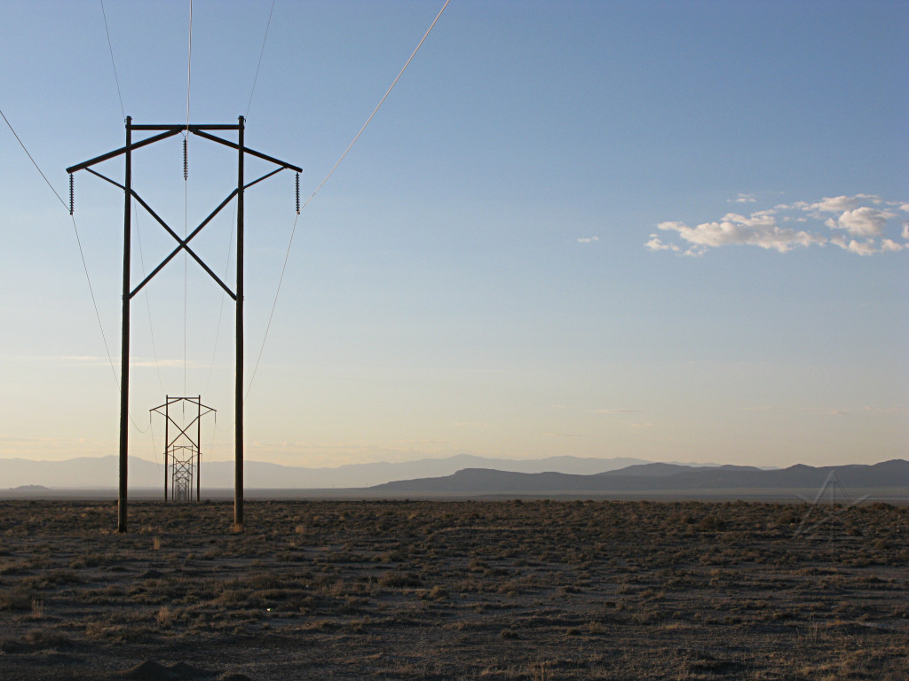
I frequently saw these largish power lines crisscrossing the desert -- I have
no idea from where to where, but it is obviously in someone's interest to
ship electricity over fairly long distances out here. Some of the towers and
poles had clearly involved a lot of work to install, such as the many that
march up over the high ridges and sit on precarious rock outcrops.
This should help lay to rest some of the "it's not worth using long transmission lines" arguments, because out here it's clearly happening and people are spending money and time on it. Maybe they're losing a little in efficiency, but frankly there's enough open, dead, ungrazeable and non-arable and otherwise completely useless land that large-scale photovoltaic and concentrated-radiation boiler plants would completely make sense out here and would provide such an abundance of daytime, peak-load power that a little more loss in conduction over hundreds of miles just wouldn't matter. It's still better than the alternative of burning tons of coal at one end and having to keep going back to that big ugly black hole in the ground for more until there's none left. |

|
The pavement along this stretch was fairly rough, and probably knocked a little
off the MPG average just from increased rolling resistance and tire noise.
At this point I was starting to finally think about fuel, and having that
"which towns are the real ones" problem again. But it looked like Delta, UT
was in fairly easy reach and there might be something in Hinckley before that.
The level of plant life seemed to reach a local minimum as I headed farther into Utah, but then reappeared, possibly helped by extensive irrigation rigs. The entire town of Hinckley smelled strongly of sweet hay, and as far as I could tell that and a few houses amid the vast green fields comprised all of it. No open gas stations. There was gas in Delta, though, which I reached around mid-morning. |
|
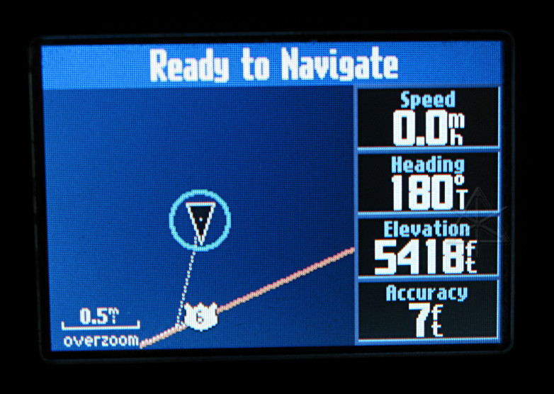
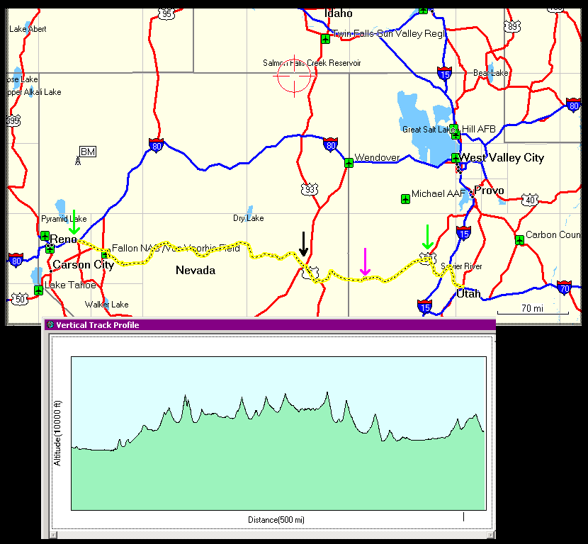
I had survived the Loneliest Road, despite a certain amount of diciness along
the way, and now have pictures to prove it. And did it pretty much on one
tank of gas, with the car showing 62.5 MPG for the run. The green arrows are
where I fueled; the black arrow is Ely where I dealt with the trucker and the
statie, and pink is about where I slept. The height profile more or less
matches the track, and pretty clearly shows the ridges-and-valleys terrain.
With the scale it doesn't *look* like 530 miles, but with all the wiggling
around through the passes and the excursions north and south to find the next
low point, it adds up. Again, an area where one must consider fueling stops
a little more carefully. Getting stranded out here would suck, and I could
see travelers being unwilling to stop and help out due to either real or
perceived risks.
The little "BM" icon [big pic] is somewhere in the Black Rock desert, which I'd already dismissed as 100 miles in the wrong direction for this trip. |
|
I was finally back into slightly more populated areas and denser plant life,
but still plenty of gorgeous wide-open country and nice hills. And access
to interstate highways again! Soon I got onto I-70 for the last big push
toward Denver.
I noticed many little ranch campsites with an RV and a couple of trucks or ATVs in the middle of random fields, presumably as remote sleeping quarters for people out working on something in a given area, and most of the houses have at least one RV parked next to them. Maybe they're lived in year-round? Hard to say, but there are an awful lot of them out here. |
|
As I got farther into Utah, the hills began to change appearance, and over
a relatively short distance. There are also quite a few "ranch access" exit
ramps off the interstate, offering no services or towns and just jumping onto
some random gravel road off into the wilderness.
That was really tempting, but I had to actually make some distance today. |
|
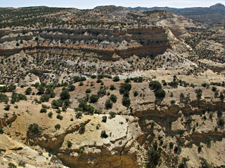
The terrain got even weirder, and a few "scenic overlook" pull-offs began to
come up. I stopped in one and found myself looking out across a fairly
impressive expanse of space and depth.
In a real forehead-smacker of a moment, I realized the one thing I hadn't yet tried when faced with something like this. No, not throw myself off the cliff. [Do you really think I write, or drive, *that* badly? Gimme a break..] No, what spaces like this need is a 3-D view! And with a little creativity I could probably manage to capture that. I think what may have clued me in was standing on a flat concrete sidewalk while looking out at the vista. |
|
|
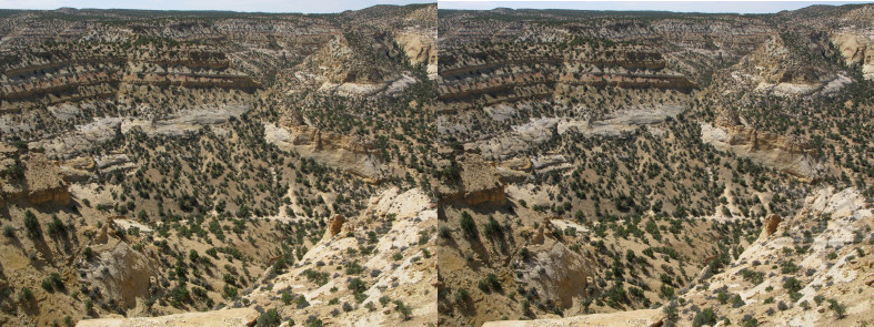
I got out the tripod, and it wasn't too difficult to set up a shot and note
where the center of the picture was, change nothing except to shift the tripod
six inches over, and take another shot. Then I could take these two almost
identical pictures, crop them so everything matches at the same height, and
jam them together as a "divergence" stereogram. To get the effect, the eyes
needs to focus on separate pictures, which isn't easy for everyone and takes
a little getting used to since we normally converge at a single point.
They used to [and maybe still] make stereoscopes for this -- fancy glasses with a little bit of assistive optics to help diverge the vision paths to aid in viewing pairs of pictures. As matter of fact I had something as a kid called a "view-master", a plastic box with two lenses and a bunch of little disks with pairs of slides of various scenery, which you could insert and turn and get eight or ten 3-D views per by looking through the eyepieces. But it's really doable without any external hardware. Here's a smaller pair which may be easier to start with than its corresponding larger one. Pretend you're looking *through* the screen at some very distant object, but allow your lenses to keep focued on the images themselves. Tilting the head very slightly right or left may help with vertical alignment. Try to let the treetrunks drift together into one, and the rest of everything should suddenly jump into place. The perspective in this case winds up a little "deeper" than we'd normally see it, because our eyes are less than six inches apart. |
|
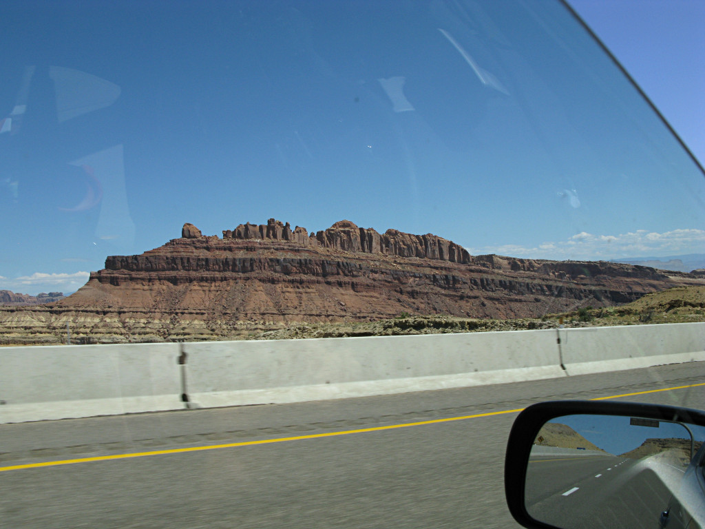
The hills along the highway became even more distinctive, and on quite a grand scale. This stuff has much more *rock* content than the eroded dirt of the Badlands, and goes on over much more area. |
|
Seeing this outcrop gave me an inexplicable desire to carry an anvil up to the top of it. |
|

|
|
I reached a pulloff labeled "Devil's Canyon", shown here in in sort of
pseudo-panorama. One could probably spend an entire day [and go through a
whole lot of water] hiking around in it.
Recognize anyone familiar in the left-hand picture? The mystery of the anvil urge is revealed. | |
|
|
I found a relatively flat place on the rock near the edge and managed to
shoot a well-enough aligned pair of the right-hand scene to build another
stereogram. For this one it helps to let the little corner of rock at the
bottom edge converge, and then the rest of the depth should be visible.
Made me wish I'd thought of trying this back in all that big country in Idaho and Oregon. Oh well, maybe next time. A guy I know has a rig with two identical cameras mounted on it and position-calibrated, that he uses to take whole sets of paired pictures with minimal fiddling around. No tripod needed to keep things aligned; he can hand-hold this setup while walking around at events. |
|
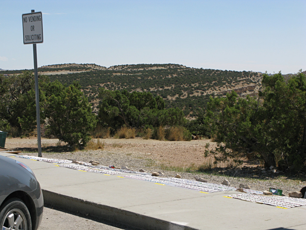
It was amusing that people sell Indian jewelry right in the shadow of the "no soliciting" sign. I asked -- apparently they rarely if ever get hassled for doing it. |
|
Okay, what is tilted here? The near horizon, the far horizon, the road, or my braaaaaaiin? |
|
|
|
In general, what I was spotting from the interstate was just so interesting
and weird and all new to me, that I was tempted to keep blazing away with the
camera for a while [traffic gaps permitting, of course] and try not to go *too*
nuts with it. Just like in the Badlands, but this was all a bit different.
This is hardly an uncommon inclination just about anywhere in this area, as other travelers have also observed and extensively documented. I'm already hankering to return and see more of it. The rest-stop pulloffs are actually not placed at the most interesting-looking areas, so it would probably involve some rough backroads and hiking to find the most bizarre stuff. | |
|
A trio of huge and almost identical buttes. "We three kings" comes to mind as a name for them. |
|
Here's one just for the network security folks. [Think "lockdown script"..]
This town evidently had its own heyday way back when, though. |
|
I eventually crossed into Colorado, and soon made my way through Grand Junction with a short lunch stop. The shapes of the rocks and hills gradually changed again, still remaining quite interesting. |
|
I didn't notice until processing the pictures later that one piece of the above looks like a little castle of some sort. |
|
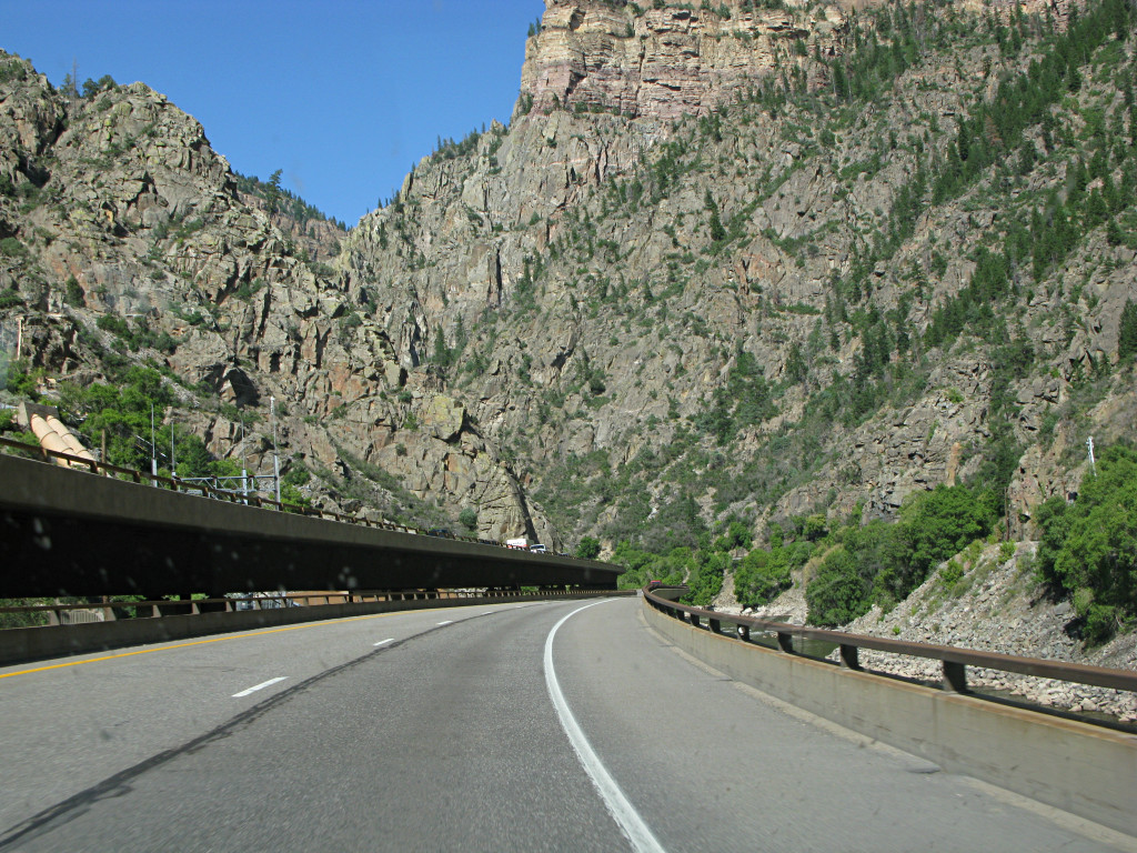
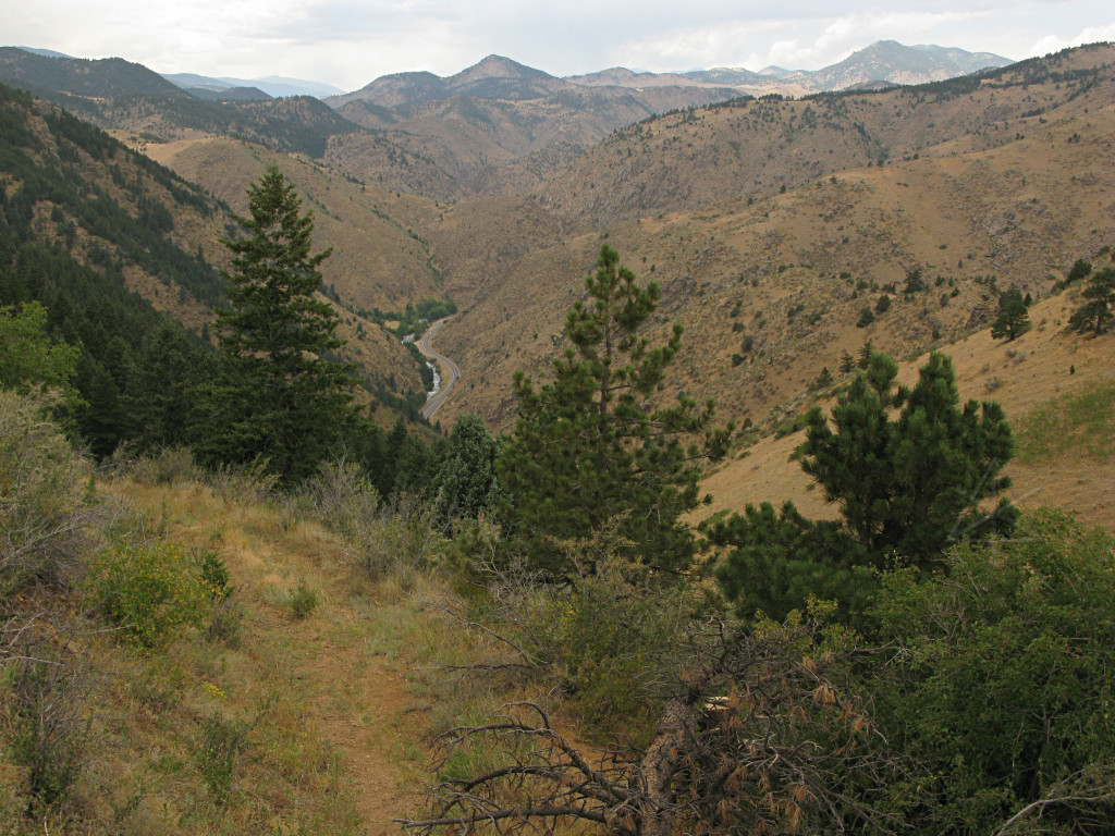
The highway winds its way around the outcrops and deeper and deeper into narrow valleys, following a riverbed and doing its best to avoid impassable mountain slopes as it goes past past the amusingly-named towns of Parachute, Rifle, and Silt. But eventually the cliffs close in too tight and block the way, which made boring a few tunnels through them necessary. It still looks like the big pieces could slide right off this hill any time, bounce over the tunnel arches, and land in the road. |
|
The structure of the hills had almost returned to some concept of "normal"
at this point and were starting to have a few more trees on them, but my
micro-summary of Utah and Colorado is this: I'd like a double helping of
rocks, please, with rock sprinkles and a layer of shaved rock and rock sauce
and a couple of rocks on top.
I was trying to not think about all the astounding scenery I was very likely missing by not jumping off onto the backroads somewhere through here, but at this point I was on a roll with almost perfect timing to make the Denver area by evening. Or so I thought. | |
|
|
[Is this
"highway porn"??] |
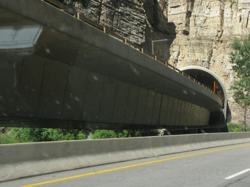
| As the road continues snaking up into the more serious mountains, its builders evidently had a few other tricks up their sleeves. To adapt to the steep side of the river valley, the two sides split into independent bridge structures. At a couple of points when the outcrops intrude too far, the westbound half is put through a tunnel and the eastbound half just hugs its way around the outside of the hill. | ||
|
All of this going through or around hills didn't stop the overall elevation
from slowly but steadily rising, getting up to about 7800 feet at this point.
I also noticed that traffic density was ramping up, and I started to encounter
a few little backups and chokepoints. In a couple of stretches of slower
traffic on slight downhills, I spent so much time drifting along with the
engine off that it started to cool down below 70 degrees C, under which the
system drops back into what's called
stage 3a. Then whenever I'd use
the engine to get moving again it would annoyingly *stay running* afterward,
and traffic flow was just fast enough that I was still above the force-EV
threshold. Fortunately I've now got a workaround in the form of a recently
installed fuel-pump cut switch, so I could just pop into neutral, kill the
pump, and wait for the engine to shudder and die and then coast along in a
happy engine-off state anywhere from 35 to 60 MPH on the next downhill. If
the car's in neutral, the hybrid ECU doesn't care about an engine stall so
it doesn't throw any errors.
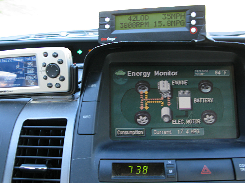
The car was definitely exhibiting all those high-altitude signs again, with the battery charge hanging lower, engine vacuum pretty much pegging at zero on the climbs and unusually low during warp-stealth, and holding the warp-stealth threshold itself continuing to be very tricky. It didn't help that the traffic around me continued becoming increasingly heavy -- what the heck was up with this, I was thinking, still pretty far from Denver and saw no major cities in between, and yet it was almost looking like typical metro-area traffic crush except with much nicer scenery around. And like around a metro area the density of obnoxious drivers was increasing quite a bit, although instead of expensive coupes or urban hoopties or semis, now primarily in the form of big manly diesel pickups, land yachts, and RVs. And all apparently sharing this unreasoning need to prove their worth somehow by completely flooring it up the hills with the boat or ATV trailer in tow, way into "power enrichment" mode. I could easily smell all the unburnt hydrocarbons in their hissing exhausts and the occasional little coolant leaks caused by high heat and pressure. Most of them were doing the left-lane conga line as tight as they could, while over in the right lane my having to watch and deflect many of them off my own butt while keeping battery current just below zero in the glides was beginning to get pretty old pretty fast. Ironically, I was often floating along *faster* than those in the left lane, because they all kept bunching themselves up in traffic waves of their own creation from being too close. I noticed myself leapfrogging the same groups of cars several times over. Then as the map continued drifting past on the GPS, the reason hit me: we were coming up on Vail, the local seat of spoiled stupid-money yuppiedom for all seasons. By the time the flow reached the town itself I just wanted to drop a tac-nuke on the place, as it clearly brings out its denizens' worst in contempt for their fellow humans and road users. What's the point?? The reckless endangerment building up all around me wasn't getting anyone along any faster. |
|
But it wasn't just Vail itself, as the mashup continued past the town and into the serious climb up Vail Pass beyond it. Here's where things started to get really weird. I went into my usual 3000-RPM climbing mode and watched in some amazement as the car sucked what little remained in the battery completely dry -- down to one bar and still pushing current TO the drivetrain. Basically that left me on the engine alone, which at the unusual [for me] levels of horsepower I was now asking of it would lift the weight of the car at a comparatively anemic rate. |
|
Even though I saw the altitude heading north of 9000 feet ASL, way past any
level I had encountered to date, I began to wonder if something was actually
wrong. About the same time I came up behind a convenient flatbed stacked high
with what looked like crates of onions, that was climbing at about 35 MPH. I
lit the 4-ways and matched his rate, and began to re-think what might be going
on. And then I found one thing that was definitely wrong, or at least clearly
under a lot of extra stress -- I reached back and squeezed the Thermarest, and
realized that the low ambient pressure had made that "altimeter" stiffer than
ever and it felt like it was about to balloon and rupture. I pulled over into
one of the many turn-outs up this stretch and stopped, went around back where
its nozzle was and let quite a lot of air out of it. Then I force-charged the
battery a little bit to make sure it was still accepting energy normally -- it
was, so I pushed a little reserve into it before proceeding upward, still sort
of wondering what the heck was going on.
That was gone again by the time I crested the pass, and a few miles and a dip back to 8000 feet later came Loveland Pass that tops 11,000 feet and I had to play the same game all over again. Fortunately I had caught up with my onion-crate-haulin' buddy again and let him lead the charge [or lack thereof in my case] up most of that until I passed him or lost him, I don't remember which, somewhere before the Eisenhower Tunnel at the top. The worst part of it was keeping up the busy rear-guard action. Even the RV drivers with more modest hormonal needs who were content to climb at a slower rate would still get way too *close* while doing it, and most of the time instead of just backing off and maintaining a gap would respond to my entreaties by moving to the left lane and then have to labor hard ahead of the endless oncoming crush of the overpowered and overprivileged to get past me v-e-r-y slowly. Why bother, I thought, the uphill isn't infinite and has to end sometime. Aren't these people supposedly on *vacation* and taking it easy?? | |
I never really solved the battery problem, but I did gather a little more
evidence later on that put it in perspective as a normal operational quirk.
I posted a summary to
Priuschat
in reply to someone who observed similar symptoms:
... when my own '04 was at 4000 or more feet of altitude, I definitely noticed that the SOC stayed much lower than usual. I have no idea why, especially since the car has no barometric sensor in its control systems so how could it know? Nonetheless it would continue giving assist and only level out around 4 bars in the display rather than the normal 6. . When I went over Vail and Loveland passes in CO at 10,000 feet or so, the car used up *all* of the available battery -- I'm talking down to ONE bar in the display and still pushing arrows toward the wheels, even with modest demand at the pedal. Unless I ran the engine up to like 4000+ RPM, I couldn't climb particularly fast since that was the only power source left. I was content to just drop in behind a slow truck and wait it out through the gorgeous scenery, since I'm not one who subscribes to the school of thought where manhood is proven by how fast your smoke-belching Powerstroke blasts uphill with the boat in tow, but it was still somewhat puzzling why the car had gone out of its way to exhaust the battery so soon in the game. The only change was altitude, and things returned to the "new normal" 4 or 5 bars once back down to 5000 feet and then right back to 6 as I returned closer to sea level. No codes, no complaints, just a clearly changed target SOC during much of my westward wandering this summer. . The only guess I can make is with the engine having to pull in more air to match burning enough fuel to get requested power, and definitely keeping the throttle farther open as seen on my vacuum gauge, that enough of a mismatch existed between the power the hybrid system wanted and what it actually got from the engine that it felt it necessary to make more up from the battery. But that really should only be for transient situations, not steady- state on the highway where I also had the low SOC the whole time. . I asked about this on Prius_Technical_Stuff and other people at high altitudes reported NO changes from the normal six-bar 60% SOC level. Different year cars, though, I think, suggesting a possible change in ECU coding to handle this. I don't believe it had anything to do with the occasional tank of 85 octane I was getting in those areas, either. |
|
After the tunnel I was all set for another nice long downhill scream, but it
wasn't long until that whole idea was shot to hell as I came up behind a HUGE
slow-crawling backup, almost a standstill. Oops.
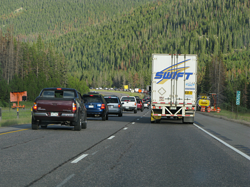
All of that tearing, self-important left-lane hurry to get nowhere, as they landed at most ten or twenty cars ahead in the stalled pack and now had to wait in this mess with everybody else for what would likely be an hour or more. Notice something familiar here? I picked up another unhurried Swiftie, who went through this entire thing with his flashers on even though all the other traffic was drifting down at about four MPH with him. Well, I guess that's technically under 40. |
|
Well, this certainly leveled the playing field. The crowning irony was that
everyone continued to IDLE while creeping along. The road is consistently
downhill for a long way here, and if *half* of these numbnuts had simply shut
down and enjoyed the ride, being mindful that they'd just have to push the
brake a little harder, we could tell the middle east to literally go pound
sand. Even with all that hard climbing I was still showing about 60 MPG on a
tank nearing empty, and now had all this potential energy to use up while the
engine, once again, sat still and slowly cooled off.
A couple of bikers had the right idea, as they killed their engines and coasted along with the only noise being a soft bizzbizzbizzbizz from the drive chains. On the other hand, they don't have power brakes to lose the boost on but if they did, I'm sure they would account for any changing dynamics. Motorcycle riders in general are much more *aware* on the roads, mostly out of self-preservative necessity, although I do get a few death-wish-impatient ones behind me now and again. | |
|
I was about 15 miles shy of Denver at this point, but getting much of anywhere
in this solid and persistent backup was starting to look hopeless. Longish
story shortened somewhat, after backtracking and snooping around a little I
landed at a Super 8 motel in Georgetown for the night. Because so many other
people had also given up trying to reach Denver that evening, I got one of
their last three rooms and everything else around town was full already. The
place definitely has that rough, beat-up ski-lodge feel to it, even in
summer -- no surprise, it's within easy range of several famous ski areas like
Breckenridge and Arapahoe Basin and the town itself is still up at 8500 feet.
Apparently backups of this magnitude are *normal* for a Sunday night as numerous people return from their weekend recreational trips into the mountains, so I just happened to land in it at the worst possible time. I can identify with this, because back east we often get a similar mess on I-93 south coming toward Boston from the White Mountains. I was also low on gas but none of the stations in town had any regular -- because their deliveries usually arrive Sunday evening, but none of the fuel trucks could get to them through the backup! I decided to just wait for the next day. But the important thing was that I finally had a real shower and a place to relax, with an internet hookup and no insane truckers chasing me! I updated the running forum thread and caught up on mail and some contacts, and turned in fairly early. The next morning I had a nice chat with the 40-year industry veteran doing dispatch at R. Sam Cox and asked if he had received any info about incidents involving the Utah highway patrol, and that piqued his curiosity ... I described the whole horror story with the horses and he was all over apologetic about what happened. "That driver should never have done that," he agreed; "that's just bullshit" and by that he didn't mean I was pulling his chain about the incident, he was genuinely concerned about his company's professional image to the public. Case closed, I thought. By the time I got myself coffeed and checked out the gas stations finally had their regular again, and I was soon all set for the next phase of the adventure. I basically had the morning to kill before hooking up with my first contact in the Denver area, so I could be a bit leisurely. I spent a little while in the motel parking lot fooling with some more Xgauge setups on the Scangauge, including one that passively reads hybrid battery voltage very fast off the CANbus. It's interesting to watch that go up and down, which it does over a fairly large range. The nominal "201.6" volt battery is rarely at that level; real life no-load voltage is more like 225 and under various charge and discharge conditions can go as high as 260 or down to 190 or less. No wonder most state-of-charge calculations are based on coulomb-counting via the current sensor and integrating over time -- trying to determine anything from pack voltage alone would be futile, especially if there's a possible ambient-pressure dependency going on. |
|
I had a tentative quick touristy destination in mind already. When
road-tripping around mountains I tend to look for the "wiggly roads", the
smaller ones that are likely to go over the most interesting terrain and
curve around the best scenic routes. The more squiggly the better. And
when studying the Denver map I had snagged from AAA, I found this park road
that definitely looked like it would qualify and was dotted "scenic" all
the way along. So off I went to find it.
It was a weird mix of cloudy and clear that morning, with various little rain-spitting storm cells already drifting around between blue patches. As I was starting down that final stretch of I-70 and just beginning to catch glimpses of the valley to the east, this HUGE 3-pronged lighting flash suddenly rent the sky ahead of me and I figured Denver itself must be having some fun storms right about then. |
|
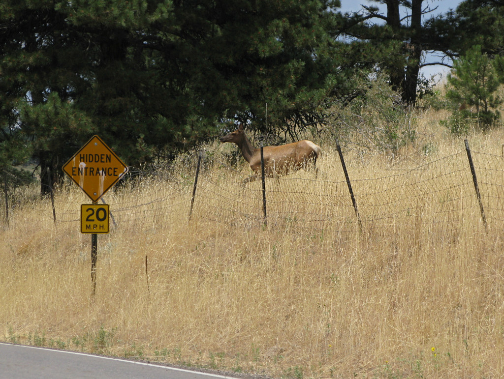
I found the south end of the park road and started in, soon passing an "elk crossing" sign. And only a few yards farther on, a small herd of elk popped out of the woods and insisted on jumping over this fence and crossing the road right then! Clearly, elk can read! I came to a stop to watch them, but behind me some hulking SUV apparently couldn't wait [or read, evidently] and yanked it around me to dive through the middle of where the elk were trying to cross. Trying to stay out of that dork's way and pull aside a bit prevented getting a nicer front-on picture of the critters, so I only managed to get this one over my shoulder out the left window. |
|
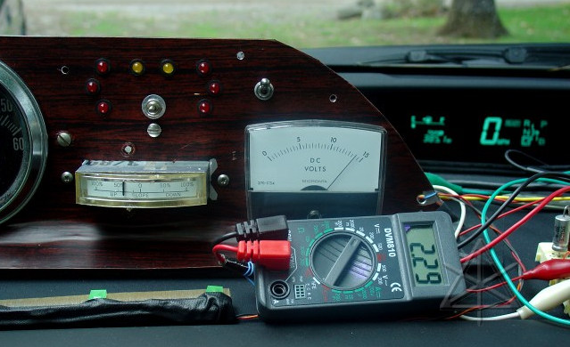
As I neared the site of
Buffalo Bill's grave, my battery
current meter started to wig out, sporadically indicating a strong charge
current.
[Yes, this is an old picture, but that's what charging looks like.]
Without the engine running or the car going downhill or braking. Around the same time, I began to smell a delicate hint of smoke. |
|
Oh crap. This was mighty weird, so I pulled into the little lot near the
museum building to try and debug things. With the car in neutral it was
still going nuts, swinging randomly downward, so I figured there was nothing
wrong with the battery or inverter itself. Next idea was that the little block
of electronics behind my meter panel had finally succumbed to thousands of
miles of pounding and some connection was starting to loosen up -- possibly
the little connector that brings in the signal and reference from the sensor
donut. Or my components were starting to fry... I worked my finger in to
where the board is and started wiggling things, but the little downward blips
that the meter kept doing seemed unrelated to what I was touching. Nothing
was inordinately hot, and the smell wasn't localized to anything specific I
could find.
Now, I had only just started monitoring battery voltage and such on the Scangauge that morning, which was the only recent change to any of this stuff. But how the heck could screwing around with something on the CANbus, the digital side of the car's world, possibly affect my *analog* instrumentation?? The new info I was reading off the network wasn't even coming from an active query that could have been malformed, just passively listening to bus data. One reason for going the analog route is to avoid being lied to by a computer, but it's a different story when the analog stuff itself goes awry. Having determined that nothing was actively on fire and this wasn't the place to try and do a full analysis, I kept going along the park road. The meter's wackiness got even worse as I started into the first twisties, basically making it impossible to monitor regen current -- this was going to be a really annoying run, then; I'd have to do it by feel and maybe listening to the gentle whine out of the inverter and keeping an eye on brake pressure as a limiter. Dammit, why did it pick NOW to fail somehow, when I was still this far up... But then as I went down the hill a little farther, the meter started to blip a little less and stabilize. And I realized that I was heading *down* quite a ways, and was already past the highest part of the park right at the beginning. Oops! I wanted to try and get some pictures from wherever the peak height was. I pulled into an overlook and turned around to head back up a short way, and the meter promptly went nuts again. | |
|
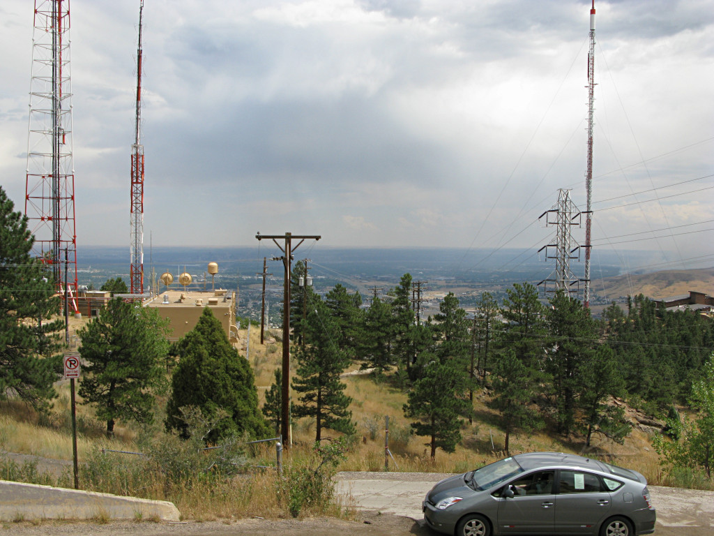
As I got back up to about the only opportunity to pull over and still see
the valley vista below, I suddenly realized that the answer was staring me
right in the face.
The meter driver was picking up the loud chorus of electromagnetic hash from this huge nest of microwave links, cell towers, broadcast transmitters, power lines, and whatever else they've got going on up here on the hilltop. Well, duh. And the smoke smell, totally unrelated, is also explained here -- look way off toward the right in the big picture, although I didn't actually realize the significance of that at the time. But the smell definitely seemed to more or less be all around, not coming from the car. |
| Way back when I was car-shopping and test-driving a Prius, one of my tests involved the immunity of the car's wiring and electronics to strong RFI nearby. The car had withstood those tests, but that didn't mean that *my* electronics were anywhere near as well shielded. So some signal from this complex was blasting right into my panel circuitry and creating some DC offset that made the meter zero-point reference go all wacko, moreso as I got closer to it and fading again as I went past and around the first bend or two. I wonder what the field strength up there really is; either way it probably wasn't doing my body much good to hang around in it either. | |
|
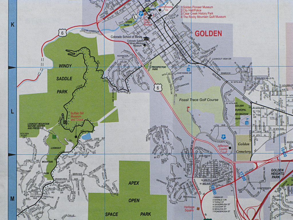
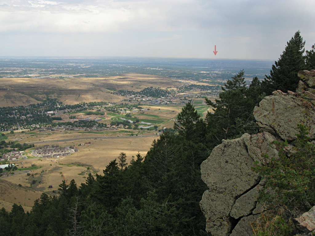
Much relieved, I ignored the meter for a while and continued on my mission to get some decent pictures. The next pull-off was around the north side a bit, but still giving a nice overview of Golden and waaay off in the distance barely visible under the floating arrow, downtown Denver itself. |
|
The view to the west, back toward the Continental Divide.
The errant meter was completely back to normal by now. |
|
|
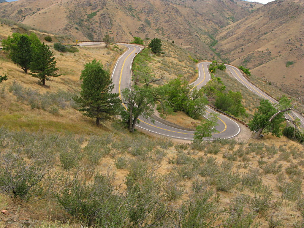
| I certainly got my fill of twisties and hairpins that morning. Cedar Point's got nothin' on this for sheer height! How much of a thrill ride any of it can become is up to the user. | |

|
I got down near the Golden end of the road and now had a good view across the
valley, and it *finally* hit me why I'd been smelling all the smoke.
That huge lightning flash earlier had ignited a grass fire that had gotten a bit out of hand in the meantime, while I was mucking about on the mountain. |
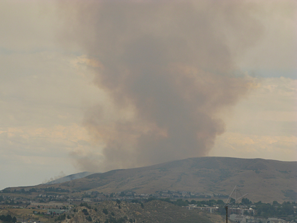
|
I pulled over into a turnout where I could still see this, and spent about 15
or 20 minutes on the phone working out logistics with the person I was on the
way to connect up with. In that short time I sat there talking, the fire
clearly grew even more. And at least one fire engine went wailing up the
highway in the valley below me; evidently more resources were being called on
to fight this sucker.
While the Denver area had already suffered several wildfires over that very dry summer, this turned out to be one of the larger ones and was all over the news later that afternoon. Here's another story. Apparently it had crept up the backside of Green Mountain and closely threatened several residences before it was brought under control. I guess my "source of RFI" shot was also one of the earliest distant pictures of the fire that morning, purely by chance. |
|
I finally dropped onto the flatter area, which is nonetheless still in "mile
high" territory, and headed up toward Boulder which is near where my next host
works. Wow, finally done with mountains for a little while, other than just
being a constant backdrop in the distance.
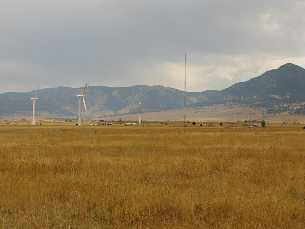
I stopped by the NREL research complex that's up that way, but they don't let people in for tours. [Not even if they're driving Priuses, which I suggested to the guard in the hutch...] They do have an odd assortment of test windmills out in the middle of the field, though. I think this is the only two-blader I had seen on the whole trip. None of these were actually spinning, though. |
|
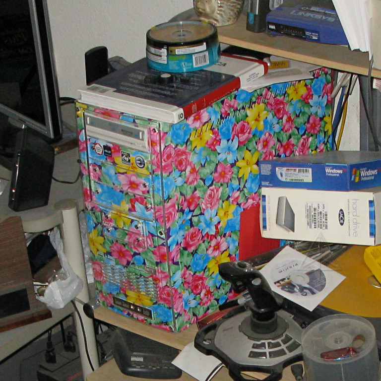
I finally hooked up with my Denver acquaintance, toured his workplace, and
also met his co-worker
Nate who
owns a RAV4-EV and we got to go play around with that a little bit. Then my
host and I headed back to his apartment for a nice comfort-foody type of
dinner. He's a wonderfully silly person in many ways; this is his desktop
computer.
Tomorrow I would enter a totally different phase of the trip -- the second big event on the summer's schedule, which would involve no driving at all for a few days. |
Go to Part 6: doing tech at Denvention (aka Worldcon)
_H* 081123