With no commitments lined up in late March, I decided to take a little
roadtrip up into Maine for a few days. Having found the "mile zero" end
of US 1 down in Key West over the prior holidays, one goal was to go find
the *other* end in Fort Kent ME. It had also been years since I'd been in
Acadia, so that was worth another look. And I recently learned that some
friends were moving to Tenants Harbor, a little farther down the coast,
so that area was maybe worth poking into as well.
As I started off in the morning, there was rain and even a little soggy snow through most of southern Maine and I started thinking the trip might be on the sloppy side in general, but it began to clear as I got past Portland. [Small images are linked to larger versions.] |
I kept going along Rt. 1 to Thomaston, where 131 would then take me
down through St. George to Tenants Harbor.
Saint George, huh? Here's what one finds when rolling into the town center. Cute. |
After crossing, I spotted a guy by the side of the road with a camera on a tripod and swung my head around just in time to see what he was shooting for, turned around and went back to get my own version of it. It was getting late in the day, enough for the sun to sink behind the pylons. I thought it odd that one has windows in the top and the other doesn't, but a little research reveals that the far one is an observation tower over [the other!] Fort Knox. |
In fact by this time I was sort of waiting for sunset, as it was said that shortly thereafter a perigee full "supermoon" was going to rise. It had turned into a beautiful, crisp and absolutely cloudless evening that would be perfect for spotting it. As I got into Ellsworth and turned onto 3 to head for Acadia, it was close to sundown so I mucked around trying to find a piece of high ground to shoot from. I found one open area except that there was a Wal-Mart planted right in the middle of the shot, and every other place was either too low or had too many trees. And as dusk fell there was no sign of a moon yet, so I thought "bugger it" and kept going southeast. Figured I could keep an eye out for the first hint of moonrise and pull over someplace later. |
Nonetheless, it was a beautiful [albeit chilly] night and a tranquil scene over Bar Harbor, where I was still headed. |
What do they say about getting to Acadia? "Drive north until your ass
falls off, and then turn right." Well, that's about what I'd just done,
so it was time to find accomodations for the night. I had the car rigged
in sleeper mode but it was pretty cold,
plus I was still shivering from having squatted next to an icy guardrail
for 15 minutes, so my intent was to wimp out and find a motel. I wandered
rather randomly through Bar Harbor ['scuse, that's "Bah Hahbah"] and down
to the public pier at the waterfront. The taxi driver had mentioned that
about 75% of the lodging places were closed for the season but a few are
open year-round. In the process of getting a little
confused as to which way to drive out of the pier area I went along a narrow
little road that happened to dump me in the front parking lot of the Bar
Harbor Inn next door. Which was open for business. So I stayed there.
It was comfy, but I could not get their internet hookup to work at all even after talking to the provider's support line for some time while they tried to debug things. That was pretty ridiculous; my usual impediments with lodging-service networking have to do with incompatibility in browsers vs. content and can be worked around, but in this case I did everything they suggested and the damn hijacker-box router *still* wouldn't let me out of the walled garden. So I gave up and read the various in-room info about Acadia to plan for the next day. [It turned out later that the ISP actually didn't even know the place was open, and may have invalidated all the preallocated guest passwords in their own database. What a useless amount of overhead and complexity, anyway -- trying to give each guest a separate "lemme out" password and manage all that muck. The right way to do it, as increasingly discovered across the lodging business as a whole but not nearly soon enough, is to just provide a vanilla DHCP-enabled router, block TCP 25 to prevent drive-by spamming, and otherwise don't get in the way at all.] |
Funny bumper sticker spotted in the lot as I packed up to head out. |
Scuttlebutt had indicated that a lot of the
Acadia National Park
loop roads were closed at this time of year, so I opted to head down
Schooner Head road [closer to the shoreline anyway] and see if that
would eventually connect to the park road. It does, and it turned out
that not only was enough of the park loop open to connect out at the
other end and keep going around the island, there are no entrance fees
at this time of year. Double bonus.
[Here's a direct link to the Acadia map PDF at the NPS site, as it's otherwise buried behind dumb javascript-based links that don't help an increasing proportion of website visitors.] |
Off Schooner Head and across a swamp, the east side of Champlain Mountain. The infamous Precipice Trail wanders up this somewhere. |
Sandy Beach, one of the few places that actually *does* have some sand. And very very cold water, of course, pretty much year-round. |
The day was a little above freezing and with bright sun, so plenty of
snow-melt runoff was happening. This tends to create all kinds of
interesting little landscapes near where water drips, trickles, or
rushes. Much of the rock here was armored in ice sheets but with
water sneaking in behind; I've also included a short
video [8.5 Mb]
of what that looked like.
But the day was wearing on -- enough with the artsy stuff for now, time to get off the island and head for my next stop which I had actually scheduled up the previous afternoon. This took me back through Ellsworth proper and about ten more miles up 3 to a bucolic little country road locally called "the Winkumpaugh". |
The primary fellow who runs
this place
was kind enough to let me visit outside
of their usual July-to-September season. I think I successfully let him
understand that I had a longtime interest in phone systems, and wouldn't
mind a bit of construction/restoration detritus and chaos kicking around.
I happened to suggest a day when he needed to go do some stuff around the
museum anyway, so it was relatively convenient for him.
How did I find out about this? The couple who started Galley Lighting are also some of the Museum's lifetime board members, and when I was up at Galley helping with a pickup the shop guy handed me a card for the museum. It became one more reason to roadtrip into Maine. |
It was already late afternoon by the time I got on the road again, and I only had a vague idea of where to head next as long as it was basically northward. While I generally like traveling during the day so I can see stuff, with days still on the shorter side I figured it was okay to do parts of the trip at night and miss some of the passing landscape. So I'd keep going as long as seemed reasonable. Eastern Maine isn't really where the serious hills are anyway, and by dark I'd probably be a little more inland and away from the scenic parts of the coast. |
Entertaining house colors, somewhere near Millbridge. |
9 is a faster road with its share of ups and downs and curves, so it's
likely that people routinely overdrive their headlights. Maybe if they
slowed down a little at night?? ... Nah, unthinkable. That wouldn't
be American, where the posted 50 or 55 seems to be regarded as a
*minimum* speed under almost all conditions.
Oops, is my snark showing? |
9 eventually brought me back to US 1, and I was decidedly in the boonies
now with very little in the way of local resources that weren't shuttered
for winter. Longish story short, I had to head up about another 80+ miles
of US 1 to find the next "knot of civilization" with reasonable accomodations,
landing me in Houlton where I-95 comes from inland to intersect US 1 again.
That intervening stretch of 1 is *very* desolate, with clusters of a couple
of houses maybe every ten miles and nothing else around -- well, not that I
could really tell, as it was dark and I wasn't there to sightsee at this
point. My eyes were glued forward as far as the high-beams could penetrate
watching for the next batch of inevitable deer. The signs don't lie, but
at least the deer I encountered tended to stand around watching me go by
instead of actively jumping out in front of oncoming vehicles.
It was down into the low twenties by the time I made Houlton, so I once again opted to spend money on a room with real heat [and working internet this time]. Of course it would be cold, I was 250 more miles north from home. The guy at the desk mentioned something I hadn't known previously -- the eyes of moose don't reflect car headlights like those of deer do, so they're harder to see at night. And bigger and darker and taller, frequently leading to messy driver fatalities as their thousand-pound bodies fall in through windshields. But I wasn't likely to see any until getting farther inland around this time of year anyway. Leave it to a local Mainer to pass on all the good moose lore, of course... That night I learned that another largish storm was rolling out of the midwest toward the northeast, promising to bring at least some snow, slated to arrive the next evening. Hrmm, I thought; this might become problematic, but certainly wasn't enough to make me 180 on the spot and head home. |
Morning outside the motel was quite cold, and a thin skin of ice crystals had condensed onto everything so that I needed to scrape all the windows before rolling out. |
US 1 is a little less desolate up here, tracking through miles of gently
rolling farmland. As I passed through Blaine -- yes, that's really Blaine,
Maine -- I noted a hill that seemed taller than everything else, and as I
got closer I realized "hey, there's a windfarm on top!"
This is Mars Hill, and helped explain why I had seen a couple of model planets mounted up on posts along the highway. The Aroostook County locals have constructed a distance-scale model of the solar system along a stretch of US 1, which unfortunately doesn't actually place Mars in Mars Hill but the idea of a model on that scale [1:93 million!] is fun. Here's a little more info on it.
|
I was a half-mile from the Canadian border to the east. The terrain didn't
look particularly different over there.
Even with a certain amount of the snow melted away at this point, it was clear that snowmobiles are a major transportation method up here. Not only are the fields running alongside the roads obviously tracked up, in fact all of northeastern Maine is criscrossed with official "recreation trails" with their own traffic signs, and they probably become major thoroughfares in the winter. With their own set of OUI problems, given some of the warning signs I spotted here and there. But even this obscure part of the road had eventually gotten plowed, and the snow alongside it had gone through interesting melt patterns as the sun and dirt hit it at particular angles. A different shot of it became a potential wallpaper, albeit maybe a little ugly. |
Which is how it happened that I visited Canada after all, sans passport, even if the car couldn't get there. |
And there was another dead barn conveniently located right there. |
On the way around the rest of the hill there was an obvious access road up to
the turbines; unfortunately gated off or I would have headed right up it for
a tour. The end of the hill tapers off here but they installed several of
the units lower down on it; with the wind mostly from the south that day and
rather light I'm not sure if these were producing much power. Some of the
units had furled their blades and weren't turning at all. But as I noted
in the '08 trip,
there's likely a slipstream effect that yields advantageous wind speeds
slightly *behind* the crest of a gentle hill.
The site is run by First Wind, which has several installations around the country. This installation is sized at 42 MW. |
Back through the town of Mars Hill; not sure what's up with this building but it looked entertainingly ramshackle. Click. |
I kept going north, through Presque Isle which seems to be all about convention facilities, and out into another long stretch of rolling farm country. The same sorts of facilities and equipment one sees all the way across the midwest were visible, along with the occasional stores selling tractors and seeders and such. As such, it wasn't particularly interesting as scenery goes, especially when cloaked in in the dull grey of winter's frozen grip. |
Soon I reached the St. John river and began following it along the border, shortly thereafter spotting another example of the flexibility of wooden construction: largish shed, in Van Buren. |
The bridge across to Canada; not taken as I didn't have any of the appropriate documentation with me. |
Small bits of rail history spotted in Frenchville. |
Double your pleasure! Two, *two* ratty barns for the price of one! |
So, major milestone of the trip duly reached! Now I had a choice: to go down Rt. 11 through about the middle of Maine, or try to head down 161 and follow the river some more to Allagash. Problem was, Allagash would likely be a 30-mile dead end, as the roads continuing on out of there not only make no sense on any maps, they're pretty clearly dirt in all the sat views. Or more likely mud and snow right now. I bagged on the idea of trying to offroad a Prius fifty miles from the nearest civilization, topped up the coffee in the diner across the street and went to find 11 south. |
Route 11 is pretty much all about logging. Log and pulp trucks barrel up and down it all day, and there are quite a few side clearings stacked high with cut trees. |
One of the saw / pulp mills sort of straddles the highway, so its operations were visible by simply stopping on the side to watch. Interesting specialized handling gear in use. |
The log trucks were for the most part courteous on the road. They are often somewhat underpowered day-cabs, so they'll slow down a bit pulling an uphill. I tracked this one for several miles, whose speed changes seemed perfectly matched to my own fifteen-kilowatt routine and I started wondering why in some *other* highway circumstances the trucks seem to possess more usable momentum than cars, or at the very least often bunch up behind other traffic when beginning an uphill. Galileo says that can't be possible, of course, and this log-truck's apparent power to weight ratio was making much more kinematic sense to me. Thus, I can only conclude that many of the big trucks on the mainstream interstates just lay into the go-pedal hard in the valley *regardless* of whether there's traffic ahead of them or not, yielding the highly unsafe and unprofessional results I so often see. Well, screw that. If they can't handle the dynamics of surrounding traffic in stride, they shouldn't drive, and I'll be one of the first to make their safety managers aware of that. |
11 dropped me onto I-95, and after a short stretch on that I was in Bangor.
["You bang 'er, you brought 'er!"]
Now I had another choice. I could just bug out of here and
do the 4 hours home on the interstate, or try to press on farther west on
US 2. The snow hadn't really picked up yet and wasn't sticking to the roads,
so I figured I could make the 120 miles or so and reach the New Hampshire
border before things got too bad.
I was also feeling sort of a moral obligation and experimental urge. Having wimped out and spent coin on two nights of motel, and with overnight temps now predicted to stay slightly north of 30, I figured I *had* to spend at least one night in the "sleeper berth". I still needed to find the low-side threshold of what ambient temps I could tolerate, given sufficient bedding, without running the car for heat overnight. So I wanted to keep going until it was late enough to make sense for going to sleep, and see how it would go. Taking a very indirect route toward home would provide an appropriate timeframe. |
Most dead-barn pictures are shot on warm-weather runs and include plenty of greenery, so obviously more winter scenes are needed for seasonal balance. This one just screams grey, silent, and dead. |
The snow kept thickening, to the point where I had to go along alternating between high beams to see farther up an approaching hill, and low to cut off the total whiteout coming at the windshield. At times I was down well under 30 mph and it became clear that this was going to be a long, slow run. Every so often I'd test the surface by stabbing the e-brake pedal and seeing how easily the back end would break loose. It was steadily getting more slippery, but the Prius soldiered on through it just fine, not even kicking in the traction-limiting on the uphills. While the Energy Savers aren't specifically snow tires, they seem to perform well in this stuff. |
That whole run along 2 was a very interesting, in the Chinese sense, bit
of driving. Fortunately, the farther-west municipalities have larger road
maintenance budgets or something because there were fewer potholes to
dodge -- not that I would have been able to see many of them by now.
For the latter half of the run there was just about nobody out on the
roads anymore except me, plow trucks, and a few police. A while
later I swung into a small rest area with 3 - 4 inches of unplowed
stuff and had a minor struggle proceeding out of that again, but the quick
GPS check done there indicated that the next "real town" was Gorham NH.
So I'd made the state line, it was somewhere around 9pm, and I figured that
if I found a good spot to do so it was time to tuck in for the night.
There's always the little question of where to park when car-camping. Rest stops sometimes say "no overnight", although trucks seen idling there all night often belie that. Wal-mart lots are often handy because of their "RV-friendly" policy, except in towns where local ordinance prohibits it, and larger shopping centers in general always seem to have a few stray cars in the lots at all hours of the night which one can just blend in with. Larger motel lots are usually fair game, as cars go in and out of those all the time and few are going to notice if a car arrives and parks and then nobody ever gets out of it. Further discussion of the finer points of being homeless in a car can be found by searching for "boondocking" and related terms. Between that and campgrounds, it's a practical way to travel and sleep on the cheap. Well, except possibly less comfortably in colder weather. However, down to freezing or a little lower seems to be the working limit, at least with the bedding I had with me, and with a better sub-zero rated sleeping bag, I could probably do even better. After all, people go winter camping all the time without external heat sources, and a car provides the luxury of having a heater anyway. While I slowly wandered around the few blocks of Gorham, I ran the heat high to warm up the whole interior of the car more than it had been, and took note of potential spots to slot into for the night. Obviously out-of-season closed motels wouldn't do because nobody would expect cars to be there. A couple of church lots and service stations were noted as candidates. But as I passed by the police station and toward the town's central park, I noted a couple of cars simply parked on the side of the bordering road and casually slipped in to join them. Many small towns, particularly out west, actually allow RVs and travelers with other self-contained "dry camping" facilities to overnight in or near their municipal parks as long as they're tidy about it. I figured that if my presence was going to be a problem, I was within sight of the police station and they'd spot all the conspicuity tape from their own front door and come over to investigate. My excuse, if needed, would be that it's far safer to stop and sleep than keep going in clearly hazardous conditions while getting more and more tired, right? And if parking here was a problem, suggestions on a more legal one? While the answer in summertime might be "get a room", I don't think the locals' primary aim this far out of season would be centered on increased lodging revenue. While at least one of the other nearby cars fired up and departed over the course of the night, nobody bothered me and I got a perfectly good night's sleep. The key discovery here was that *not* running the circulation fan hack continually did much to help retain my body's own warmth inside the car, and a few hours later when it began feeling more humid I ran the fan just a little and at a very low level which nicely pushed the moisture out but didn't intolerably lower the temperature. One go-round of that was good enough for the night. Plenty of people snooze in cars for various reasons and don't even worry about air 
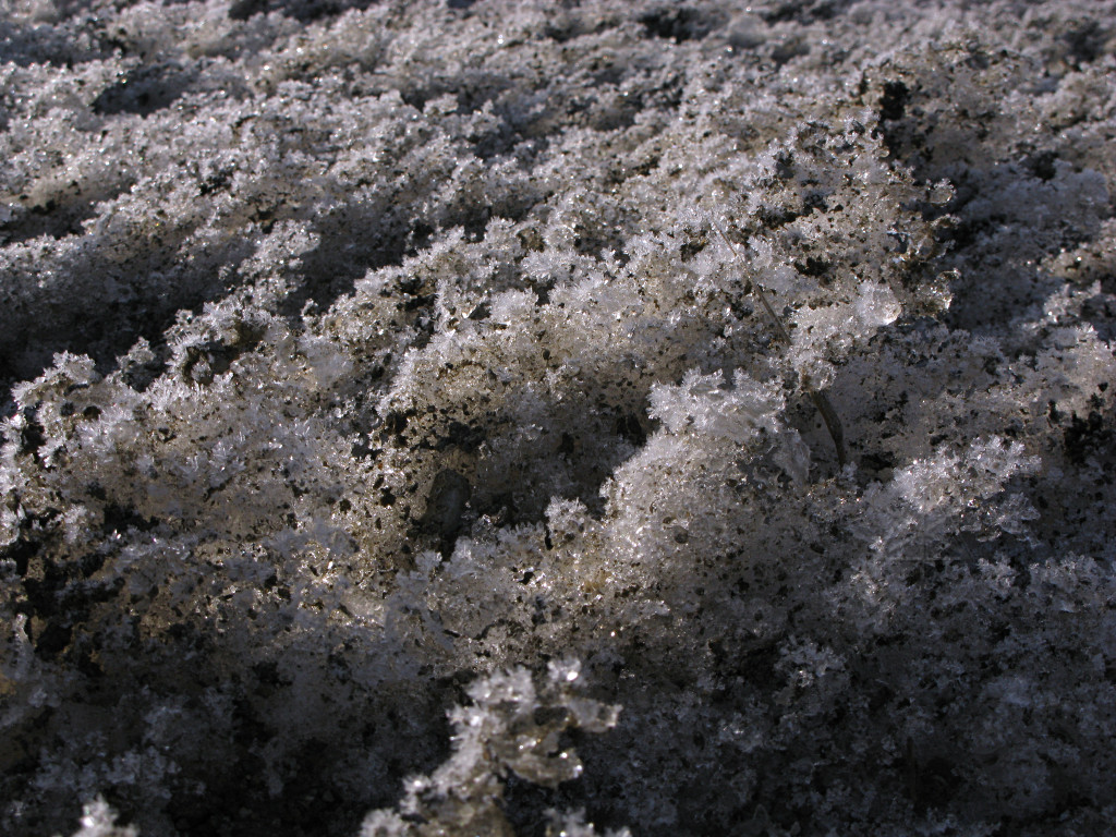
exchange, and just live with the fact that their windows might fog up. There were a few ice crystals on the insides of my windows by morning, hinting that it was somewhere below freezing outside and because I was still cozy, I'd proven more about my little methodology's cold-weather capability. |
None of that means that the car didn't get fairly chilly inside by morning
anyway, and before really crawling out of the sack I reached forward
to fire up the system and run a bit of heat to make my "emergence" step
more tolerable and start de-icing the windows. Sometimes ya just have to
burn fuel for heat energy instead of propulsion, and take the mild MPG hit.
Coffee was available at the Cumby's across the park and then I went back
over to snag some shots of the train-history setup they have along one
side of the park.
They're still in the process of turning the old locos and cars into a little museum, as detailed in this big picture which if viewed 1:1 can be scrolled around to read the items on the plaque in front. |