Some shots from the long road back north.
As usual, each pic is a link to its real full-size version.
Use your BACK control to navigate.
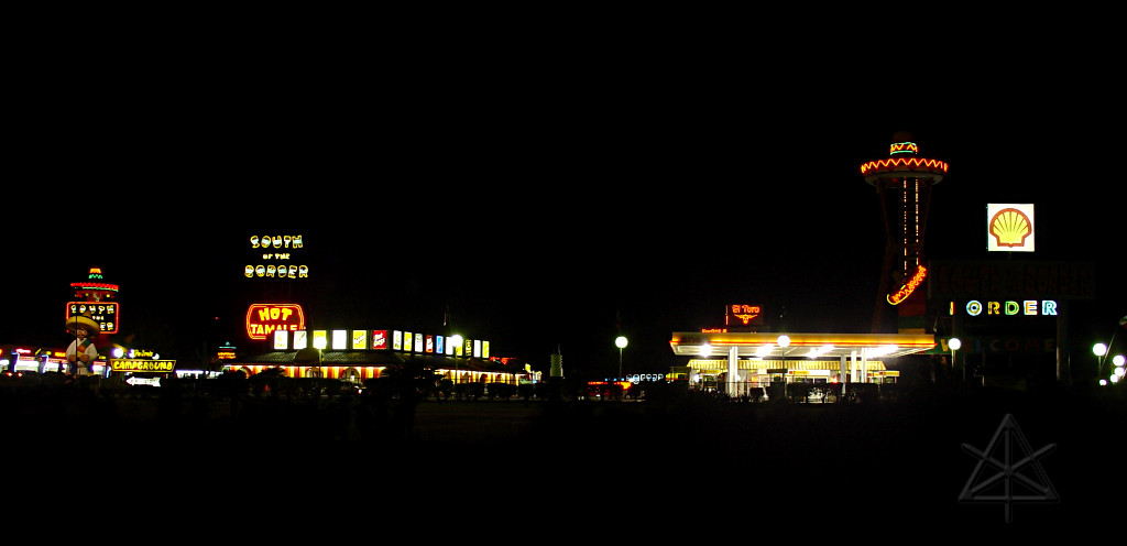
The first day got me as far as the NC/SC border, where there's this amusing
themed rest stop.  A few years ago, one would start seeing billboards for
this place 300 miles out on I-95 in either direction, but nowadays I only
spotted one about 150 miles out and they didn't begin for real until more
like 45 miles away.  Guess they had to cut back a little.
I put a little more distance behind me and then found one of those little
"knots of civilization" off the highway, where another highway crosses and
a bunch of fast-food places and gas stations and truck stops tend to be.
This one included the wal-mart in whose parking lot I spotted many trucks
and RVs, and figured that sleeping there would be fine.
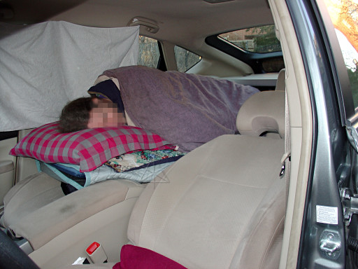
Building this little nest in the car, aka "Motel Prius" just like the other
guy had as his demo at Hybridfest last summer, saved me a ton of money on
accomodations.  I spent three nights total this way on the trip.  Truckers
do this all the time, so why not a little hybrid with an equivalent sleeper
berth?  At highway rest stops or major crossroads there are always available
bathrooms, and that's all one needs when pulling in for the night.
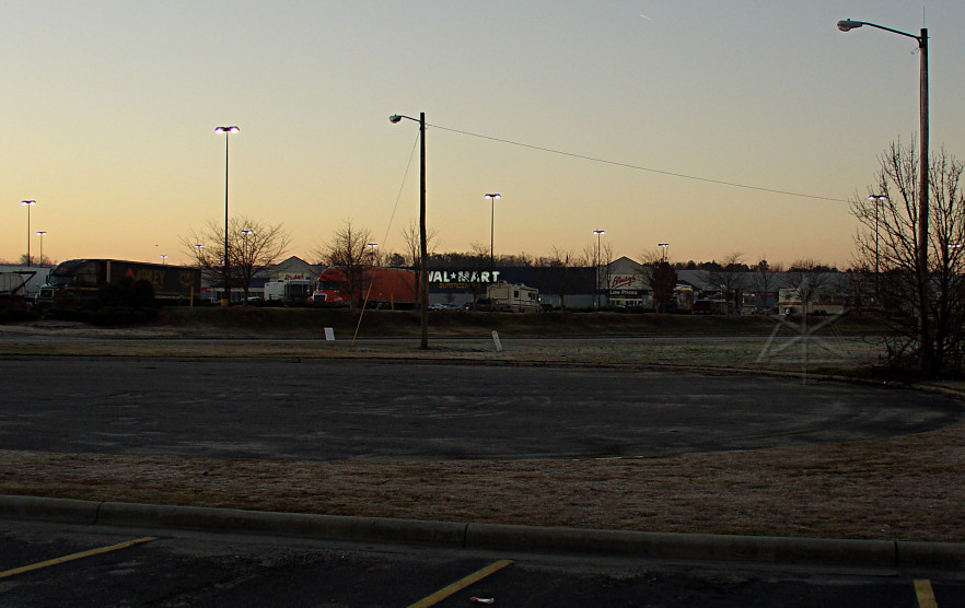
The wal-mart parking lot in the morning, clearly showing its overnight
guests.  This is one thing they're good for, I suppose.  While it's apparently
not official stated company policy, an unwritten tradition seems to have
come into being that wal-mart is "RV friendly".  I did't kow about this
until later when the fellows I later had dinner with in Virginia Beach
confirmed it.  Googling on the subject later confirms that wal-mart and
some other large store lots are thought of as free overnight campgrounds,
subject to local ordinances in some towns that prohibit it.

Most of this day was spent on secondary roads, meeting up with various people
including a long-lost cousin in the [well-named] burg of Southern Pines, and
later on [albeit very briefly] Galaxee and her Dear Husband.  Then onward
along routes 158 and 58 to dinner in Virginia Beach.  At the fuel stop in
West Podunk, NC early that morning, I had to really wonder about the guys
buying 12-packs of beer at 08:30 AM.  Rough job ahead, huh?

One notable feature of the countryside I hadn't seen before was endless cotton
fields.  Yeah, I'm a Yankee boy so this was new to me.  Alongside one stretch
of road it looked like a cotton truck had slowly lost some of its cargo,
because there were little puffs of it stuck in the roadside grass for several
miles.  I stopped and picked up some to bring north.  I can see why people
wanted machines to help clean this stuff and straighten it out...
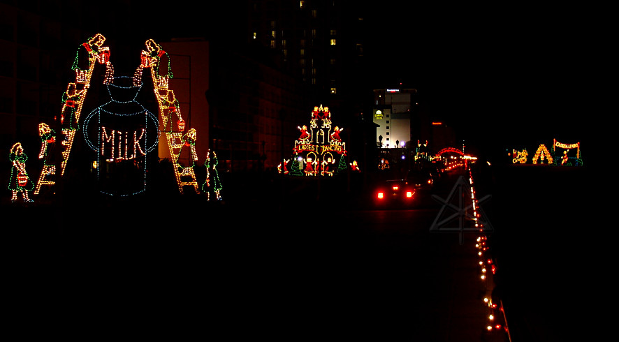
After dinner I didn't want to try doing the whole Delaware bridge/tunnel
run in the dark, so I decided to kill a little time and tuck in for the
night locally.  So I headed out for the shoreline in Virginia Beach proper,
where I found that elaborate xmas-lights displays had been set up all along
the waterfront.  Cars could cruise slowly along the seawall road, usually
with no headlights, to see the whole line of them.  Some appear to have only
a tenuous relationship to the holiday season...
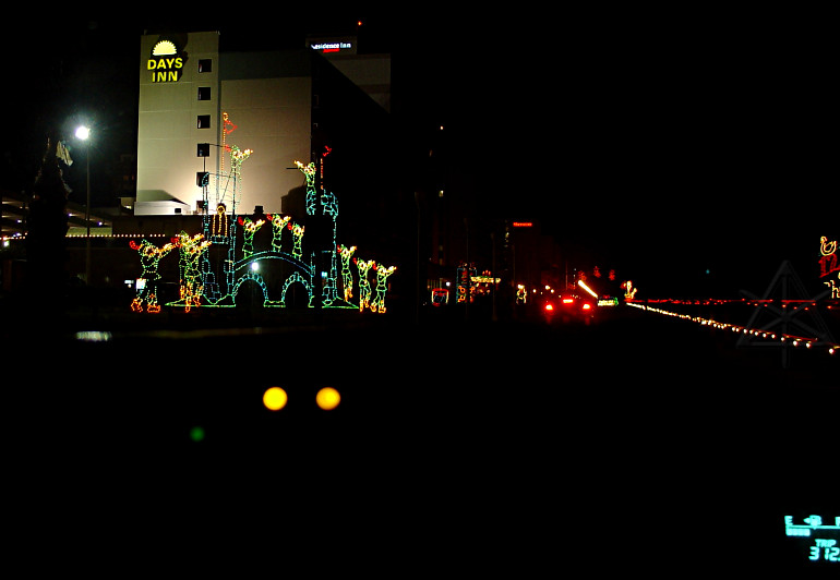
I jumped into the middle of this slow procession from a nearby hotel parking
lot, and followed the last half of the route.  The car in front came to a
complete stop fairly frequently, which was okay since there was almost no
traffic behind us.  Here I too came to a dead stop to balance the camera
on the wheel and take this one; the two large yellow lights below are the
brake-pressure indicators lit up while I held the car still.
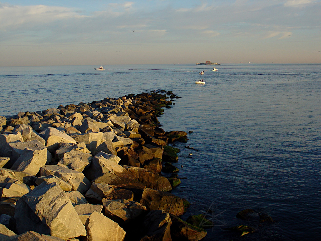
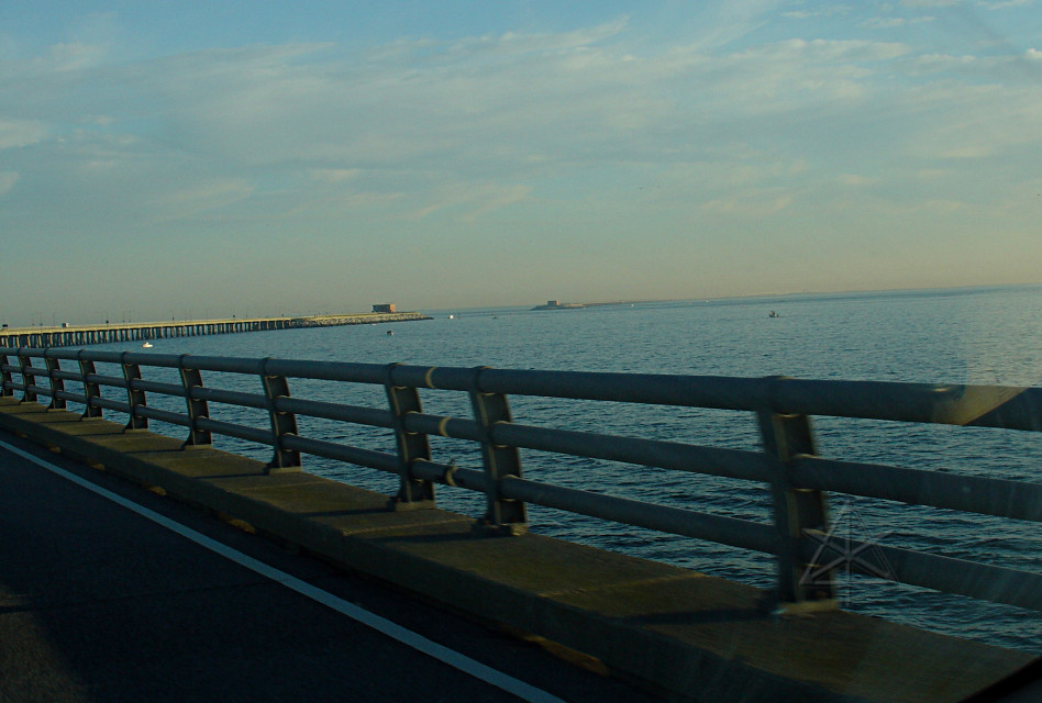
Next morning, off to Delaware.  The bridge/tunnel complex is about 15
miles long over mostly water.  The toll was only $12, not the $16 or $18
that others had told me it cost.

Just before the first tunnel there's a rest-stop pulloff, which I took and
from the end of it I could see out over where the first tunnel actually goes.
It pops back up where that next brick blockhouse is and becomes a bridge again.
This is evidently done so that ships can get in and out of Chesapeake Bay
without worrying about drawbridges and the like.  The tunnels go very deep,
sufficient to let the midpoint channel clear the largest hulls going over.
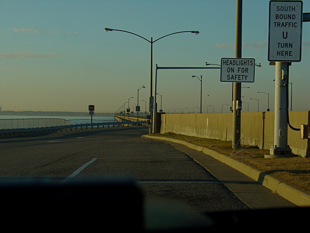
While going back along the service road, I was aimed south toward where I
had just come from.  Anyone wanting to go back southward, however, is told
to drive all the way back around the blockhouse at the end of the pier and
enter from the actual southbound side, to avoid cutting across two directions
of traffic.
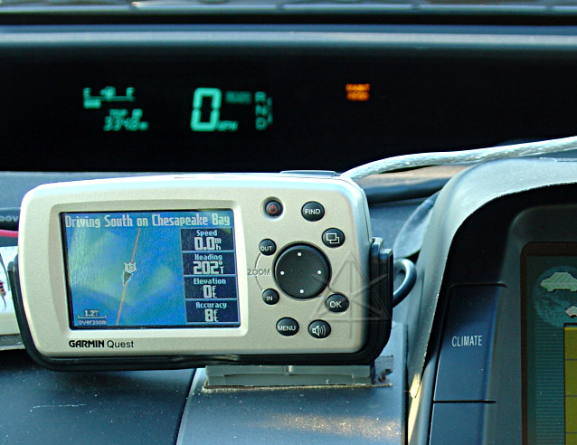
While stopped here I noticed something amusing.  The GPS evidently thinks
I have an amphibious Prius.

I stopped because I wanted to lean over the wall and get this shot of the
actual tunnel entrance.
Rolling again; coming up on the next tunnel segment.
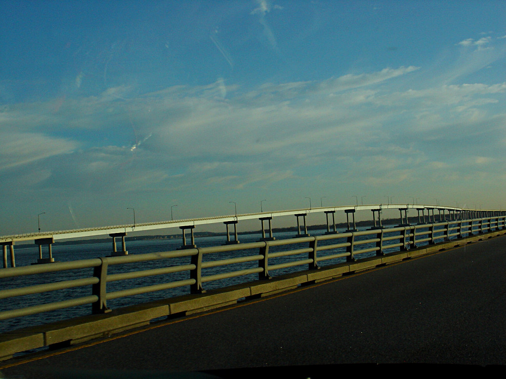
Finally, the last feature is a rather high bridge.  Large boats could
probably go under this, too; maybe it was easier to do a bridge here
instead of a tunnel?  Dunno.
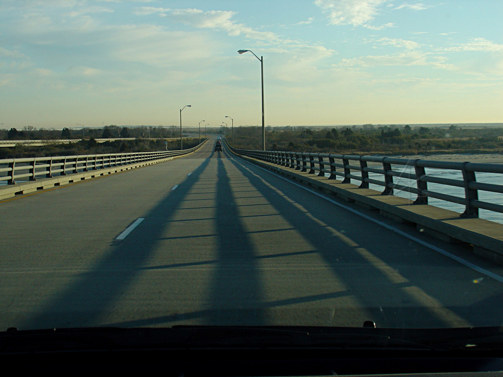
On the backside of the bridge, "land ho" at last!

This put me in that little southern tail of Delaware on US 13, which is
dead flat and straight and went on for very long time.  On a whim I saw the
road out to Chincoteague coming up on the GPS, and decided to take the 20
mile or so side trip.

This went past the Wallops installation, which seems to include a mile-long
antenna farm.  This is probably not where one wants to stop and get *out*
of the car for pictures, lest one be immediately be branded as a terrorist.
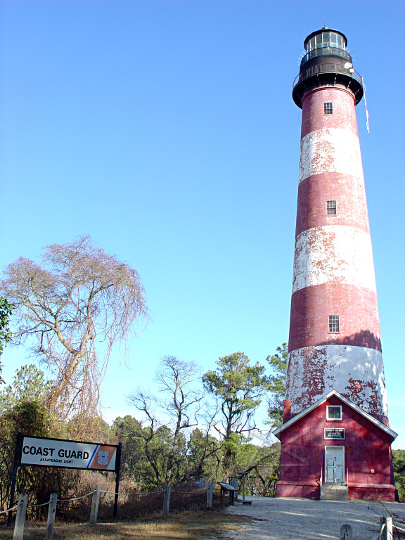
The long causeway over the swamps eventually landed me in Chincoteague, where
I stopped to tank up.  From there I could do a little pulse-n-glide stretch
over another causeway farther out to Assateague and head into the park out
there.  A short walk up a sandy path brought me to the Assateague lighthouse.

Another view of the light while returning on the causeway; it just barely
peeks up above the trees but is visible enough across the flats from the
ocean that it does the job.

I didn't see any horses, except a brass statue in the middle of town.  I did,
however, spot another Prius parked alongside the road and popped into the
little art shop to flyer its owner.  My parents were surprised to hear that
Chincoteague has become a bit of a tourist trap, when they remembered it as
almost entirely desolate back in the day.

Several hours later, finally getting back to the mainland via the Bay Bridge
that carries route 50 high over the water.  No toll here; I was mildly
surprised.

The sun headed down as I was burning eastward through Pennsylvania; for a
while it was directly behind me and very orange.  The rest of the run was
over the usual familiar northeastern and fairly uneventful except for various
MPG observations, and I got back around 11:30 that night after 17+ hours
on the road.